Your bike in front of a col sign

Page may contain affiliate links. Please see terms for details.

Shut Up Legs

Down Under Member
2 cols in 1 today! :laugh:
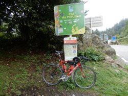
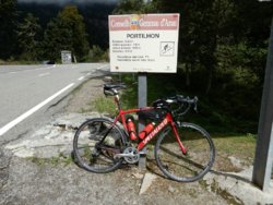
I rode up to the Col du Portillon (1293m), where there is a French col sign facing towards France, and a Spanish col sign facing towards Spain. This col is right on the border.
After riding up to the col, I rode down the other side to the town of Bossost in Spain, then back up to the col.
Each photo was taken after the climb.

DSCN1142-1036x777.JPG

DSCN1221-1036x777.JPG
 
Last edited:

Shut Up Legs

Down Under Member
No new cols yesterday: I rode up Col de Menté again.
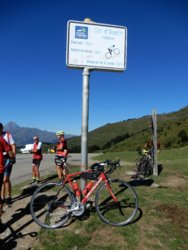
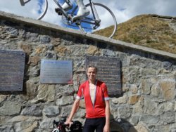
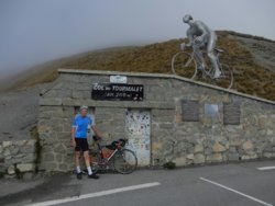
Today, however, I braved high 20s heat to ride up the east sides of both Col d'Aspin (1490m) and Col du Tourmalet (2115m), making it a 101km ride with 2470m climbing (shut up, legs! :angry:). My bike GPS computer's thermometer kept going up to about 31-32 degrees, so on reaching Col du Tourmalet, my legs were very tired. :sweat:
I even saw numerous llamas up near Col du Tourmalet, which I hadn't seen the last 2 times I rode up there.

DSCN1407-777x1036.JPG

DSCN1480-1036x777.JPG
 

Shut Up Legs

Down Under Member
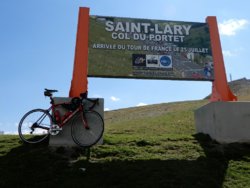
Today's col was higher than Col du Tourmalet from yesterday, and it was hard work, with a combination of temperature in the range 28-32 and high grades making it a tough sweatfest. I present to you the Col du Portet at 2215m the (as of July this year) highest sealed col in the Pyrénées :notworthy:

(technicality: it's still not the highest sealed pass: that's still the Tourmalet. When you reach the Col du Portet, the sealed road ends)

DSCN1598-1036x777.JPG
 
Last edited:
Doh! I’m officially embarrased. The thread title of “col sign” was mistakenly interpreted by me (I’m American) as a mispelling of “cool sign” and I posted what I thought was a cool sign!

Let’s face it...internet forum mispellings happen (as do internet forum misinterpretations) and please forgive my lack of an actual “col” sign (what is it anyway?)

I’m happy to delete my non-col, but kinda cool sign picture, otherwise my sincere apologies for ruining the intended theme of this thread.

EDIT: I googled COL signs. “Mountain Pass”.

Admin, feel free to delete my misplaced post....
 
Last edited:

Donger

Convoi Exceptionnel
Location
Quedgeley, Glos.
Doh! I’m officially embarrased. The thread title of “col sign” was mistakenly interpreted by me (I’m American) as a mispelling of “cool sign” and I posted what I thought was a cool sign!

Let’s face it...internet forum mispellings happen (as do internet forum misinterpretations) and please forgive my lack of an actual “col” sign (what is it anyway?)

I’m happy to delete my non-col, but kinda cool sign picture, otherwise my sincere apologies for ruining the intended theme of this thread.

EDIT: I googled COL signs. “Mountain Pass”.

Admin, feel free to delete my misplaced post....
FYI, "col bagging" is an activity carried out by masochistic cyclists who feel the need to demonstrate the extent of their epic suffering by seeking out the perfect photo op as proof of passage - whereas your photo demonstrates a mad, masochistic need to cycle for miles into the middle of nowhere in blistering heat to take a picture of a cool sign. .......... Actually that sort of counts. And it is quite a cool picture.
 

Shut Up Legs

Down Under Member
FYI, "col bagging" is an activity carried out by masochistic cyclists who feel the need to demonstrate the extent of their epic suffering by seeking out the perfect photo op as proof of passage - whereas your photo demonstrates a mad, masochistic need to cycle for miles into the middle of nowhere in blistering heat to take a picture of a cool sign. .......... Actually that sort of counts. And it is quite a cool picture.
Speaking of masochism... :whistle:

I rode up both sides of Col de Val Louron-Azet today, for a total of 101.8km and 1790m climbing. The bike + col photos (higher resolution than usual, so you can see more detail) are below.

The first one is the side of the sign facing east, which I saw on climbing from Génos (to the east of the col).
This photo shows Pla d'Adet ski resort (just below the right hand side of the lower col sign with all the stickers on it), and the backbreaking road up to it (to its right), and (if you look really hard) parts of the road up to Col de Portet.

The second photo is the side of the sign facing west, which I saw on climbing from Sailhan (to the west of the col). This photo shows Col de Peyresourde (in the background, mid left).
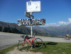
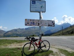
DSCN1881-2073x1555.JPG

DSCN1912-2073x1555.JPG

I posted no col signs for yesterday, because there were no cols, but lakes instead: Lac de Cap de Long and 3 of its neighbouring lakes, all 4 of these with elevations between 1850m and 2190m. Although they're all formed by dams for hydroelectric power, they're still spectacular, and worth a visit, even on a bicycle if your legs can handle it. :okay:
 
Last edited:

Donger

Convoi Exceptionnel
Location
Quedgeley, Glos.
Speaking of masochism... :whistle:

I posted no col signs for yesterday, because there were no cols, but lakes instead: Lac de Cap de Long and 3 of its neighbouring lakes, all 4 of these with elevations between 1850m and 2190m. Although they're all formed by dams for hydroelectric power, they're still spectacular, and worth a visit, even on a bicycle if your legs can handle it. :okay:

I've always liked roads up to dams, too. You only have to see the swarms of motorcyclists heading off up the side roads to know there's definitely going to be something worth seeing. My recent trip to the Vosges proved once again that it is worth taking a detour up any road that you see a group of motorbikes coming out of.
 

Shut Up Legs

Down Under Member
My hire bike at La Hourquette d'Ancizan. Of course the donkeys had to photobomb it. :rolleyes: One donkey kept trying to eat my camera, thinking it was a treat of some kind. Add to that the swarms of flies and other insects, and I couldn't exit the place quickly enough. I did ride up both sides of it, though.
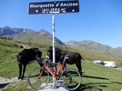
DSCN1950-1036x777.JPG
 

Shut Up Legs

Down Under Member
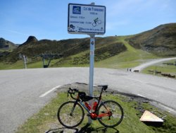
No cols yesterday: just a 54km recovery ride with 885m climbing. Today, I moved to another cyclists' B&B about 55km west (straight line) of the other, and started exploring the west end of the Hautes Pyrénées (and a bit of the Pyrénées Atlantiques). I rode up to Col de Tramassel (just above Hautacam ski resort), for another 40km with 1575m climbing.

DSCN2049-1036x777.JPG
 
Last edited:
Top Bottom