Advice on how to plan a suitable route from Birmingham to Eskdalemuir for a complete novice

Page may contain affiliate links. Please see terms for details.
I ride every day commuting and using my bike for shopping etc, my bike is a Thorn Club Tour. In the summer I go out on Sustrans routes following the maps which you can purchase.

Around May time early June I am thinking about cycling from my home in North west Birmingham to Samye Ling Tibetan Buddhist Centre at Eskdalemuir in Scotland. The problem is I have no idea how to plan a cycle friendly route to that destination. So any advice on how to go about planning this route would be truly welcome.I have no idea how long to give myself to get there and any other issues I need to take into account would be great. I would like to keep the costs down so would be carrying my tent and be looking to camp over night.
 
Go for it! Sounds brilliant - I have very happy memories of the Samye Ling.

How to go about planning it ..... hmmm, maybe I'm less useful there. Fwiw, I cycle much as you do, but did do (a few years ago, with my then 14 year old son and a bunch of others) Leeds to Edinburgh.

Our planning?
  • an AA road map (so we could tear the relevant pages out instead of carrying the whole thing :smile: )
  • I have a Dawes Discovery 201 hybrid - we didn't carry a tent, but I carried sleeping bags for two, my stuff, and pretty well most of my son's as well; so about the same weight and volume as travelling solo with tent.
  • I knew I/we could do 50-60 miles with reasonable comfort with an average of 12mph laden - so that kinda set the time at 4 days.
  • and it was just a case of working out a reasonably direct route, using quiet roads. And choosing our hills - one big hill is worse than 3 or 4 medium hills!
It helped that I knew most of the area we were going to cover reasonably well.

The bit between Birmungham and the Lakes - sorry, haven't a clue!

Our route - the bits in bold might be useful. Briefly we went Leeds-Otley-Ilkley-Bolton Abbey-Grassington-Hawes. Next day Hawes-Kirkby Stephen-Appleby-Langwathby-Kirk Oswald-Brampton. Then Brampton-Newtown-Hethersgill-Bolton Fell End-Langholm-Eskdalemuir-Samye Ling (for coffee and cake)-Ettrick. And last Ettrick to Edinburgh - no interest to you :smile:

Brilliant ride - hills not too taxing (except on the last day, when we hit the never-ending ups and downs between Ettrick and Edinburgh - now that DID take it out of me).


Aye - but the bit between Brum and the Lakes; sorry - haven't a clue.
 

vernon

Harder than Ronnie Pickering
Location
Meanwood, Leeds
Plan out a rough route using a Philips road atlas. The maps have camp site locations marked on them an more often than not they are easy to find. If not ask a local. If you want the quieter roads and it isn't always obvious from the maps then use www.viamichelin.co.uk and the cycle option to help with route selection bearing in mind that it can't cope with journeys of more than 200km at a time. If you want a gradient profile then use something like www.bikehike.co.uk or www.mapmyride.com to plot the route and get a profile.

Hope that helps.
 

rualexander

Legendary Member
Most of your route wil be very similar to the routes taken by people doing Land's End to John o Groats so you could start by researching those. We went through Eskdalemuir on the way to Edinburgh on our lejog ride.
 

Paladin - York

New Member
Location
York
Around May time early June I am thinking about cycling from my home in North west Birmingham to Samye Ling Tibetan Buddhist Centre at Eskdalemuir in Scotland. The problem is I have no idea how to plan a cycle friendly route to that destination. So any advice on how to go about planning this route would be truly welcome.I have no idea how long to give myself to get there and any other issues I need to take into account would be great. I would like to keep the costs down so would be carrying my tent and be looking to camp over night.

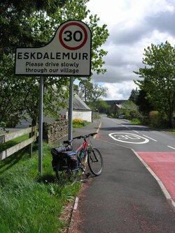
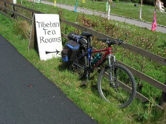
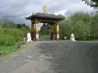
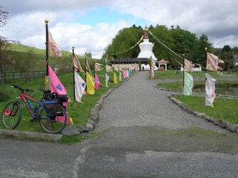
If it's of any help I cycled the Kirkby Stephen to Eskdalemuir route last year.

Kirkby Stephen - Appleby-in-Westmoreland - Penrith - Carlisle - Longtown - Langholm - Eskdalemuir. Apart from the B709 between Langholm & Eskdalemuir, which was very quiet last May, I avoided the busy main roads using the back roads of my own choice and those suggested by Sustrans.

70.JPG 68.JPG DSCN7472.JPG 69.JPG
 
Use the experience you have built from Sustrans routes (both good and bad). YOu would be surprsed just how much experience and knowledge you have.

You also know from your present experience just how far you can travel comfortably. Just remember that cycling with a full load day after day is more tiring.

For planning there is an interesting map (Open cycle map) that shows all cycle routes and is free!

This is available hrough a planning site called Bike Route Toaster simply selectthe "Cycle option on the course creator. This allows you to completely control the route.

The other site worthwhile using is Cycle Streets which is more like a route planner in that it does all the work for you and allows you to choose "fast, balanced or quiet" . These are however only guides and you can either stick to them religiously or use them as a basis for planning.

If you have time what can be educational is to plan your own route and see how it compares with these!


Apart from that it is up to you, although it may be worthwhile having a shakedown ride in May. When my wife did her first tour, we planned a route out from home with a circular route and overnight stop. This means that you realise what you are missing, just how much stuf you don't actually need and above all are confident in your abilities and timings.

Finally campsites can be a problem. Unfortunately wild camping or just putting your tent up in a field are no longer easy, so detouring significant distances for a site is not unknown, but is a part of the planning process.

Don't forget also that some places like Travelodge can be cheap (£15 per night if booked n advance) which for some popular sites is similar to camping fees.
 
OP
OP
U

User16390

Guest
Thanks some great advice. I will take a look at the lejog route and see the nearest point to Birmingham and plan a quiet route towards it ( if there is such a thing as a quiet route our of Brum lol). I will check out the various websites with regards route planning, they sound relly helpful. I definately need to plan Campsites, hopefully the maps on the websites will show some.

Looking at Paladin's photo's has really wet my appetite. A friend has told me definately make sure wet weather gear is up to scratch, apparently Eskdalemuir is one of the wettest parts of the UK..!!
 

Paladin - York

New Member
Location
York
I definately need to plan Campsites, hopefully the maps on the websites will show some.

Sorry forgot to mention that I camped at Longtown & Kirkby Stephen.

Enjoy your planning.
 

Pigo

Well-Known Member
Location
Suffolk
I think the planning is just as rewarding as the ride itself - take plenty of time over it & it should make the whole trip easier & more memorable. Last summer I done a trip around the Welsh coast - I researched each day & B&B ....mainly to find those that would offer a safe shelter for my bike & wash my gear so I could carry the least amount possible!
Think carefully about what you require from a campsite so that you can find the most suitable.
I used mapmyride.com, road atlas & sustrans info to help with finding the best quiet roads, bridleways & cyclepaths.
I planned for around 50 miles a day but the weather & the hills were shocking at times !
Most of all - Enjoy It!
 

Glow worm

Legendary Member
Location
Near Newmarket
I guess just west of Telford (Walcot) is the closest to Brum I'm planning on my LEJOG. If you have a road atlas, you might be able to follow my proposed route which I have carefully designed to avoid A roads as much as possible and to use car free Sustrans routes whererver I can.

1. Walcot to Shawbury (C roads)
2. Shawbury to Darliston via Marchamly (C roads)
3. Marchamley to Aston via Ightfied (C roads)
4. Aston to Nantwich (C roads)
5. Nantwich to Winsford via Wettenhall (C roads)
6. Winsford to Northwhich (C roads)
7. Northwhich to Aston then Runcorn Bridge (largely car free Systrans route 5 & you can cycle over Runcorn Bridge on the pavement and nip behind the bus shelter in a gap in the wall at the far end (east side of bridge) to join local streets then the sustrans route under the bridge to whisk you north through Liverpool)
8. Runcorn Bridge & up through East Liverpool to nr Gt Altcar - all along car free Sustrans route 62 - old rail line)
9. B5195 then C roads to Pinfold then Ecclestone (mainly C roads)
10. Ecclestone to Leyland hooking up with car free Sustrans route 55 to C. Preston.
11. C. Preston to Woodplumpton (car free sustrans route then B roads)
12 Woodplumpton to Street (C roads adjacent to M6)
13. Street to Caton on Sustrans route 6 (C roads)
14. Caton to Grassingham Sustrans route 69 its a longer way round but less hilly (C roads)
15. Grassingham to Kirby Lonsdale (B road)
16. Kirby Lonsdale to Greenholm via Ingmire Hall (mostly C roads)
17. Greenholm to Crosby Ravensworth via Orton (C and B roads)
18. Crosby Ravensworth to Langwathby via Temple Sewerby (C and B roads west of river Lune)
19. Langwathby to Wetherall via Armanthwaite and Lazonby (mainly C roads -short bit of A and B roads)
20. Wetherall to Boltonfellend via Irthington (C roads)
21. Boltonfellend to Langholm (join B6318 just a mile or so before border)
22. Langholm to Eskdalemuir on B709.

I won't be in a rush so will be happy to pootle along the lanes, so if you are in a hurry, you may want a few busier roads. I've mapped the whole route now and it still looks pretty direct even with all the minor roads.
 

Crashtel

New Member
I'm sure the advice above is better as people have actually cycled it but if you want a starter for a new route have you tried viamichelin you can select the cycle option, although having said that it seems to have trouble with long routes I normally have to break them down into 100-150mile sections, then you have to study the map to make sure there really are no alternatives to the A roads sections it suggests. But good as a starting point.
 
Top Bottom