
JohnE
Well-Known Member
- Location
- Stockport, UK
I recently cycled The Bay Cycle Way which follows NCN 700 from Walney Island (near Barrow in Furness) to Glasson Dock (near Lancaster), a total of 81 miles around Morecambe Bay.
I retired a few years ago and did my first ever tour not long ago. I'd had this one in mind for a while. So with a fine weather forecast, I decided, on the spur of the moment, to go for it. Many of you would do this in a day, but with the travelling, I decided to do it over two days. I booked accommodation at approximately half way, prepared my gear and was ready for an early start next day. I'd decided to drive up to Lancaster, leave the car, catch the train to Barrow, cycle the Bay Way, and then cycle back to Lancaster for the drive home.
Day 1
It didn't go to plan ! The M6 was closed – a police incident apparently. Managed to get onto the A6 and eventually got to Lancaster much later than expected. I just missed the train I was hoping to get and had to wait over an hour for the next one. Still, the sun was shining ! The train arrived and two other cyclists appeared from nowhere and were in the cycle carriage before me. B*gger ! they only take two bikes. Went on anyway, and we managed to arrange the three bikes so that it didn't affect the passage way through the compartment (much !). Phew !
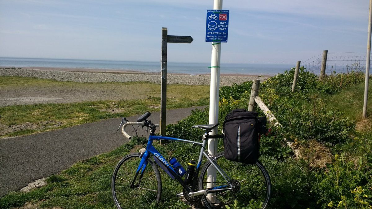
I cycled the few miles over to the official start point on Walney Island. I was using the Bike Tracker app on my phone for voice guidance on the route and had already downloaded the route files. Loaded up the route, and my phone locked up. What's going on ? Switch it off and on, load up the route, and my phone locked up again. B*gger … again ! Downloaded the route file from the cloud and it's all working fine. Phew … again !
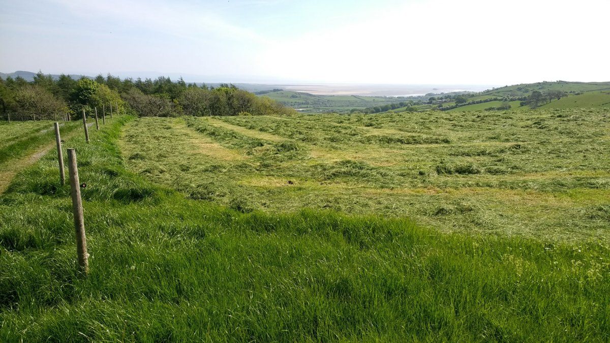
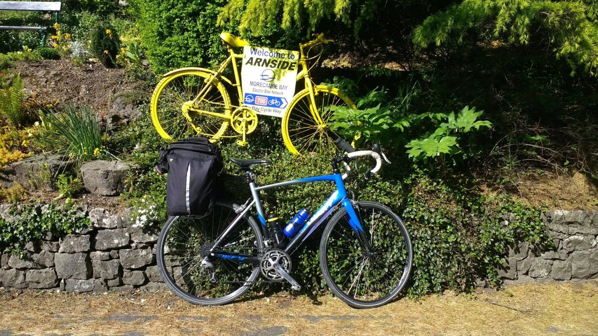
Finally, I'm off. The route was really interesting. The start had very stark coastal scenery, followed by Barrow and its industrial heritage, then coastal scenery without being near the sea (if that makes sense), then inland through rolling hills and farmland (ahh, the smell of new mown hay, and ohh, other rural smells),
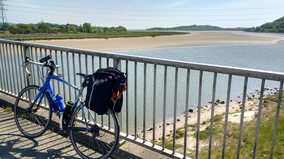
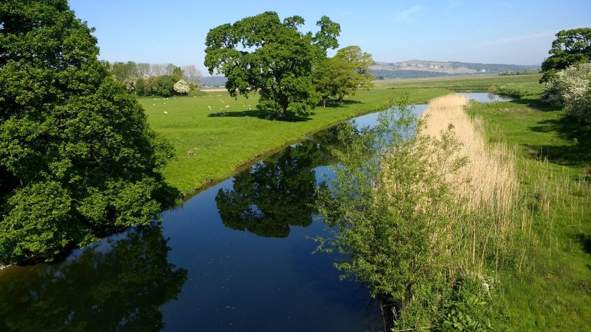
a bit of woodland, rivers and estuaries,
and through some lovely little villages (Cartmel being my favourite). I had said I would be arriving at my overnight stop about 5pm, and arrived at the nearby Derby Arms with time to spare, so quenched my thirst there. The food menu looked OK, so I decided I would pop back later for my evening meal.
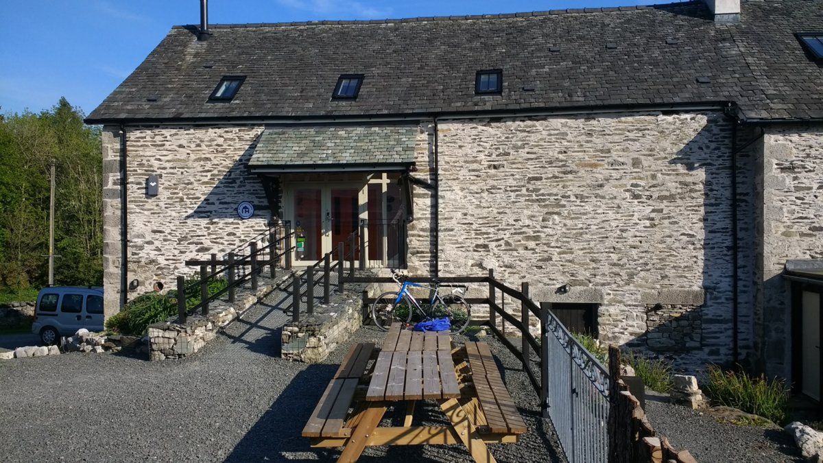
I stayed at Witherslack Cycle Barn,
which is run by fellow cyclists, and is very convenient, as it's less than a mile off the route. It was spot on. It has safe bike storage, modern clean rooms, a comfortable lounge and a well equipped kitchen if you want to cater for yourself (there is a community shop nearby, next to the Derby Arms). Strava said I had done 48 miles and 2830' climbing.
Day 2
After a hearty breakfast, I was off again. Not quite as interesting as the first day, but once again a bit of everything - a mixture of rural farmland,
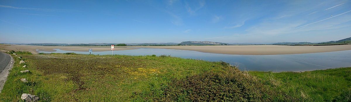
coastal scenery,
canal towpath, converted railway line, and riverside, all through some nice villages.
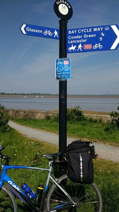
I arrived at Glasson Dock for lunch.
This is the official end of the Bay Cycle Way
A short ride back into Lancaster and off back home. Strava said I'd done 42 miles and 1390' climbing. Once again, my luck was out. On the drive home, the motorway was closed again – another police incident. It didn't matter – I'd had a good couple of days.
Summary
It had been a good ride which I'd thoroughly enjoyed. I had ideal weather – clear blue skies, but quite cool – the scenery looked grand. The ride has a bit of everything. Overall, the route was very quiet and I encountered very little traffic. I can thoroughly recommend it to anyone looking for a short tour (perfect for a weekend). I can also thoroughly recommend my overnight accommodation at Witherslack Cycle Barn – I intend to return there later this year with my wife, who is a walker, not a cyclist, and explore the nearby area some more.
I retired a few years ago and did my first ever tour not long ago. I'd had this one in mind for a while. So with a fine weather forecast, I decided, on the spur of the moment, to go for it. Many of you would do this in a day, but with the travelling, I decided to do it over two days. I booked accommodation at approximately half way, prepared my gear and was ready for an early start next day. I'd decided to drive up to Lancaster, leave the car, catch the train to Barrow, cycle the Bay Way, and then cycle back to Lancaster for the drive home.
Day 1
It didn't go to plan ! The M6 was closed – a police incident apparently. Managed to get onto the A6 and eventually got to Lancaster much later than expected. I just missed the train I was hoping to get and had to wait over an hour for the next one. Still, the sun was shining ! The train arrived and two other cyclists appeared from nowhere and were in the cycle carriage before me. B*gger ! they only take two bikes. Went on anyway, and we managed to arrange the three bikes so that it didn't affect the passage way through the compartment (much !). Phew !
I cycled the few miles over to the official start point on Walney Island. I was using the Bike Tracker app on my phone for voice guidance on the route and had already downloaded the route files. Loaded up the route, and my phone locked up. What's going on ? Switch it off and on, load up the route, and my phone locked up again. B*gger … again ! Downloaded the route file from the cloud and it's all working fine. Phew … again !
Finally, I'm off. The route was really interesting. The start had very stark coastal scenery, followed by Barrow and its industrial heritage, then coastal scenery without being near the sea (if that makes sense), then inland through rolling hills and farmland (ahh, the smell of new mown hay, and ohh, other rural smells),
a bit of woodland, rivers and estuaries,
and through some lovely little villages (Cartmel being my favourite). I had said I would be arriving at my overnight stop about 5pm, and arrived at the nearby Derby Arms with time to spare, so quenched my thirst there. The food menu looked OK, so I decided I would pop back later for my evening meal.
I stayed at Witherslack Cycle Barn,
which is run by fellow cyclists, and is very convenient, as it's less than a mile off the route. It was spot on. It has safe bike storage, modern clean rooms, a comfortable lounge and a well equipped kitchen if you want to cater for yourself (there is a community shop nearby, next to the Derby Arms). Strava said I had done 48 miles and 2830' climbing.
Day 2
After a hearty breakfast, I was off again. Not quite as interesting as the first day, but once again a bit of everything - a mixture of rural farmland,
coastal scenery,
canal towpath, converted railway line, and riverside, all through some nice villages.
I arrived at Glasson Dock for lunch.
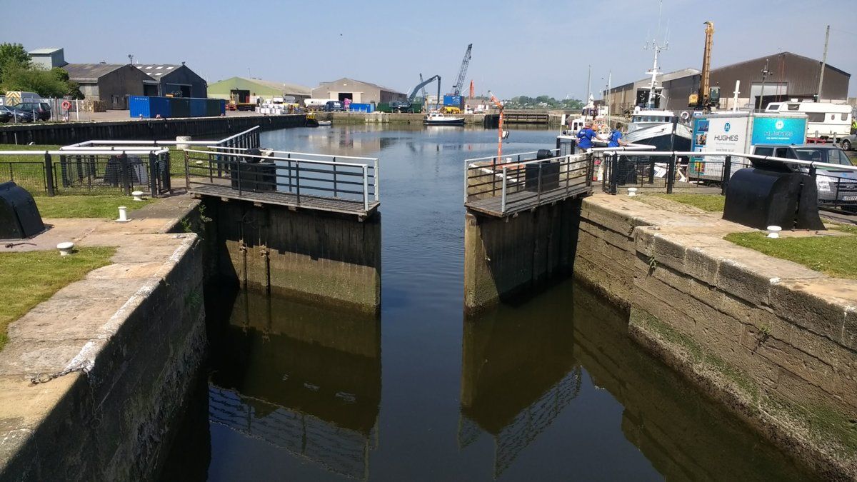
This is the official end of the Bay Cycle Way
A short ride back into Lancaster and off back home. Strava said I'd done 42 miles and 1390' climbing. Once again, my luck was out. On the drive home, the motorway was closed again – another police incident. It didn't matter – I'd had a good couple of days.
Summary
It had been a good ride which I'd thoroughly enjoyed. I had ideal weather – clear blue skies, but quite cool – the scenery looked grand. The ride has a bit of everything. Overall, the route was very quiet and I encountered very little traffic. I can thoroughly recommend it to anyone looking for a short tour (perfect for a weekend). I can also thoroughly recommend my overnight accommodation at Witherslack Cycle Barn – I intend to return there later this year with my wife, who is a walker, not a cyclist, and explore the nearby area some more.


