Cycling abroad virgin seeks advice

Page may contain affiliate links. Please see terms for details.

delport

Guest
It is certainly not what I would buy to tour Europe by bicycle with - having said that I have no doubt that using it I would be able to find most of the French Ferry Ports without too much trouble - I not quite sure what is unacceptable about it - was it touted as being suitable for touring cyclists?

My choice is as I have said before is about 1:200k - this is 1:150k -and is not difficult to obtain in book stores

Mich%20150k%20-%20Calais.jpg


more detail maybe but not so much that I would be able to follow the map without resorting to looking for signs showing me where to go.


And yes - "a Michelin is more than good enough" - but not all Michelin are equal - a degree of common sense in picking a map is necessary

Would you say i have now proved my point that if you want a map for getting out of a city it isn't any use?

What you should say if recommending michelin is what would not be a suitable scale, not suitable is the ones i have pictured, there are examples like that throughout the book, i just selected one i was relying on a year ago when i was cycling.

If you travel from england you end up in the port, no maps are needed for that part, it is the travelling from the port that is the issue.

I travel very long distances, more so on the train than cycling and wouldn't buy a map for every single area i go to.

My next trip is over 1000 miles in length and i won't be buying multiple maps just to do that journey, i'll take a netbook and gps, i might take the michelin, but not rely on it for city travel.

To explain why i bought the michelin in the first place, they were thought of as the best, i didn't have time to study every page but the detail looked fine in the shop.
I'm not a maths person, therefore scale means nothing to me, this means nothing to me for example
1:1 000 000

this doesn't not mean i am uneducated or far from bright.

Your example map is barely any better than the three i pictured.
Great if you are off to Sangatte 20 km down the road but what actual use is it for getting out of a port?

Possibly i am just looking for something no mass market map can provide, and i'd need to keep on spending to get what i need, that is the way it is looking.There is no real point in me buying individual maps for every city in Europe that i have visited or will visit.

I can navigate with a compass just about, if i couldn't i may have had a lot more difficulty getting from a port.
 

asterix

Comrade Member
Location
Limoges or York
WRT cities, may I suggest you take a basic compass?

If you are in a city and trying to find the way out to somewhere, road-signs will try to get you onto the biggest main road going (it's no different in other countries). As a cyclist you probably won't want that. When you are on a bike it's much easier to head in a certain direction than it is in a car and you can ignore the road signs until you get to the smaller roads.
 

delport

Guest
WRT cities, may I suggest you take a basic compass?

If you are in a city and trying to find the way out to somewhere, road-signs will try to get you onto the biggest main road going (it's no different in other countries). As a cyclist you probably won't want that. When you are on a bike it's much easier to head in a certain direction than it is in a car and you can ignore the road signs until you get to the smaller roads.

Overall these maps aren't for cyclists, they are for drivers.
All i require is a map that shows towns on the way out of a port 2km,4km,6 km along the way etc.But the way the maps are made they are for drivers on the fast route out of a city that is why the first place on the map is 20 kms away.No use at all for a cyclist.Cyclists aren't allowed on these roads in the 1st place.

I've also got another michelin map, it's even worse on detail than the one i photocopied.

It's like dropping someone in central london and saying, i won't give you any directions, but bromley is 20 miles down the road and it's on the map.

I bought a map to have information, not to put the map aside and rely on a compass to guide me out of a city.
 

StuartG

slower but no further
Location
SE London
If you are landing in Dieppe in the day - make the tourist office your first point of call. They recently moved so don't despair when you see an empty office by the bridge. They have a superb set of biking literature and very friendly almost English speaking staff. The Avenue Verte map is cute.

I swear by my Michelin Normandie 1cm/2km map (number 513). Just right and double sided so its all you need if you stay in Normandie. Buy it over there in a supermarket or petrol station. My 2009 edition was 6.65 euro (but I think they were discounted).

Normandie is great cycling country. Not flat but not too hilly unless you decide to ride along the coast which has countless small rivers cutting through the limestone cliffs. and then there is the cheese, the cidre ....
 

andym

Über Member
To explain why i bought the michelin in the first place, they were thought of as the best, i didn't have time to study every page but the detail looked fine in the shop.
I'm not a maths person, therefore scale means nothing to me, this means nothing to me for example
1:1 000 000

this doesn't not mean i am uneducated or far from bright.


Erm. If you don't understand the difference between a 1:1,000,000 map and a 1:200,000 then it does sound lilke you have a major gap in your education. It might be worth spending a bit of time doing some research.

I have a Michelin map in front of me. It says on the cover 1:200,000 1cm=2 km the second bit is probably the most useful/understandable. A 1:1,000,000 map would presumably say 1cm=10 km.

A map with a 1:1,000,000 scale is covering an area 25 times greater than a map the same size that's at 1:200,000 scale - so inevitably it means there is less detail. Zoom in and out on the map on you laptop - as you zoom oit the map gets more detailed and as you zoom in you get more.

There's no argument that a GPs can carry a lot more detailled info tham a medium- scale map. But paper maps have their advantages as well. Personally i would always carry a decent paper map as well as a GPS.

There's always a trade-off to be made between the amount of detail and the weight of the maps: but a netbook is also pretty heavy (I say that as someone who is travelling with a netbook digital mapping and GPS).

BTW the two Michelin 200k maps I have with me both include basic street plans for the centres of towns - not brilliant but better than nothing. (i'd also highly recommend the iPid/iPhone app cityMaps2go which enables youbto diwnload and save OpenStreetMap maps for hundreds if towns and cites - ther's probably an Android version as well).
 
OP
OP
Polite

Polite

Über Member
Well people I did it and thanks for all your help.

As I've just got in, am tired and have the world's slowest computer, I'll upload a few photos to say thanks later.
 

ComedyPilot

Secret Lemonade Drinker
You can insert photos here on CC, just use the insert image option in the reply menu, or write a blog on crazyguyonabike.com and post a link.
 
OP
OP
Polite

Polite

Über Member
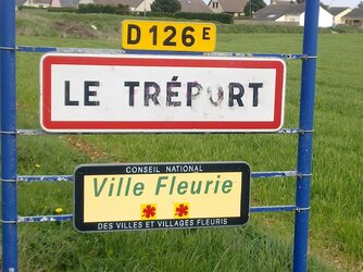
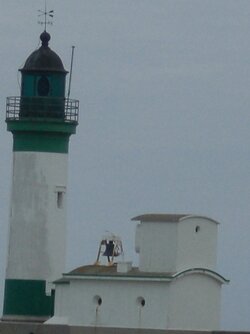
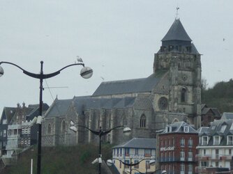
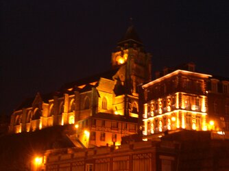
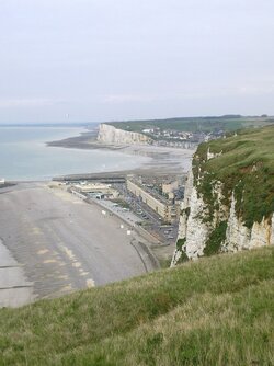
[font="'Comic Sans MS"]Here's a few snaps.[/font]
 

Attachments

  • Tréport.jpg
    Tréport.jpg
    350.5 KB · Views: 39
  • CIMG1728.JPG
    CIMG1728.JPG
    247.4 KB · Views: 39
  • CIMG1725.JPG
    CIMG1725.JPG
    562.7 KB · Views: 39
  • CIMG1729.JPG
    CIMG1729.JPG
    515.3 KB · Views: 36
  • CIMG1744.JPG
    CIMG1744.JPG
    325 KB · Views: 36
  • CIMG1752.JPG
    CIMG1752.JPG
    490.7 KB · Views: 31
  • CIMG1778.JPG
    CIMG1778.JPG
    794.7 KB · Views: 36
  • View.jpg
    View.jpg
    280.2 KB · Views: 43
  • CIMG1791.JPG
    CIMG1791.JPG
    283.9 KB · Views: 39
Top Bottom