French Alps 2019

Page may contain affiliate links. Please see terms for details.

gavroche

Getting old but not past it
Location
North Wales
What a trip you are on. Plenty of memories to take back home. By the way, Canicule is the French word for Heatwave. Enjoy the rest of your trip. I look forward to more beautiful scenery photos.
 
OP
OP
Shut Up Legs

Shut Up Legs

Down Under Member
What a trip you are on. Plenty of memories to take back home. By the way, Canicule is the French word for Heatwave. Enjoy the rest of your trip. I look forward to more beautiful scenery photos.
Thanks. By the way, I cycled past a 'Gavroche' café in Saint-Jean-de-Maurienne a few hours ago. Who or what does 'gavroche' refer to ?
 
OP
OP
Shut Up Legs

Shut Up Legs

Down Under Member
Today I did my first proper bike ride since moving to Chalet La Tuvière yesterday: 62.5km with 2100m climbing, and got back up to the chalet in low 30s heat in the early afternoon.
Right now, at nearly 7pm, a large thunderstorm is filling the Vallée de la Maurienne below the chalet.

The 2 album photos show the valley earlier, during the heat of the late morning, as I rode up to Col du Chaussy via the Lacets de Montvernier.

Regards,

--- Victor.


OP
OP
Shut Up Legs

Shut Up Legs

Down Under Member
Today I rode up to Col de la Madeleine from the south, and it's obvious the European heatwave is still with us: it was 30 degrees at the col, and it's (not quite) 2000m altitude.

After riding back down from the col and back to Saint-Jean-de-Maurienne it was mid 30s again, and stayed there for over half my 10km ride (with 800m climbing) from there back up to Chalet La Tuvière: a sweatfest. Because of the chalet's location, all my rides are ending that way. The chalet does offer a pickup in Saint-Jean-de-Maurienne if sufficient notice is given, but I haven't used it yet.

Obviously I'm losing lots of excess weight :smile:

Regards,

--- Victor.

 
OP
OP
Shut Up Legs

Shut Up Legs

Down Under Member
Yesterday's ride was a big one, with 120km and 3100m climbing. I left at 0750, and after the usual descent from Chalet La Tuvière to Saint-Jean-de-Maurienne, I rode up La Vallée de la Maurienne to Saint-Michel-de-Maurienne, up to Col du Télégraphe, down to Valloire, up to Col du Galibier, then back the same way.

Well, almost! As the European heatwave continues, it was 37 degrees when I got to start of the (mostly unshaded) road that heads back up to the chalet from Saint-Jean-de-Maurienne, and at that point, heat exhaustion set in. I rode about halfway up the 10km (8%) climb to the chalet, stopping every few minutes, with my cycling slowing to about walking speed. At that point, Fabrice (one half of the married couple who own the chalet: Fabrice is French and Jane English) was driving down to Saint-Jean-de-Maurienne for shopping, saw me in my distressed state at about 1650, and loaded me and bike in the car.

Back up at the chalet, I knew I'd overheated, because I couldn't keep any liquids down, and felt so nauseous I skipped the chalet's dinner, and these are quite nice. I'm alright now, though. I've done no riding today, and am sitting here in the comfort of the chalet checking my photos from yesterday (over 200 of them, because I like to take photos during my cycling), and watching the Tour de France live on TV.

It was quite warm even at Col du Galibier, too: about 25 degrees, not bad for a location at 2642m altitude.

One photo shows me standing near the Col du Galibier, with the view to the southwest of the col behind me, and the other the view back down the valley to the north of the col (that I rode up to get to the col).

Yes, I do regard this as recreation, by the way, and I wouldn't have swapped yesterday for anything :smile: I enjoyed every minute of it (until that last aborted climb to the chalet).

Regards,

--- Victor.


Last edited:
OP
OP
Shut Up Legs

Shut Up Legs

Down Under Member
I'm pretty idle again, today. I rode down to Saint-Jean-de-Maurienne to visit the bike shop from where I'm hiring my bike, and got one of the staff there to adjust the front spokes to correct a lateral wobble. I then visited a pharmacy and supermarché.

Another reason for my being there was to find something to drink on my rides that my stomach wouldn't reject. xx( On recent rides, especially when returning from the very hot Col du Galibier ride, my stomach just didn't like my electrolyte drink of choice, High5 Zero, and after forcing that down, even water tasted off. This is possibly because I've been using it for the last few weeks. I found a nice enough tasting replacement at the store (called D'Vélos Maurienne), and tried it on the scenic ride back up to the chalet.

I did a nice ride yesterday. It was supposed to be an easy one, but there's no such thing around here. It was 72km with 2200m climbing, and was up to the Col d'Albanne (1650m). This is a quiet place in the middle of some grassy fields, with no sign marking the col (or none I could find). Partway up the climb, there are panoramic views of Saint-Jean-de-Maurienne and also the mountainside containing La Tuvière and this chalet. One of the photos shows its rough location: behind Saint-Jean and to its left.

Regards,

--- Victor.


Last edited:
OP
OP
Shut Up Legs

Shut Up Legs

Down Under Member
I'm a bit behind on my ride reports, so here's 3 days worth of life in the French Alps :smile: :

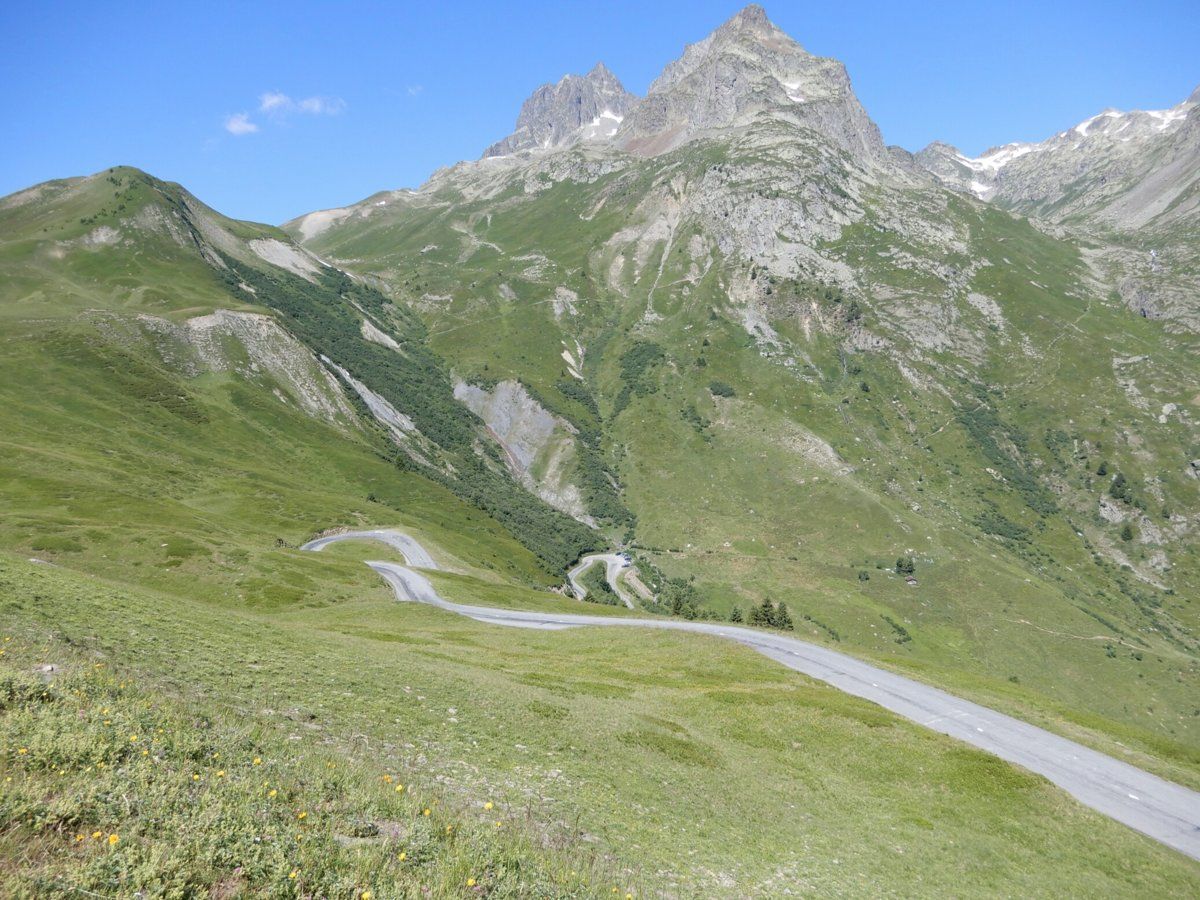
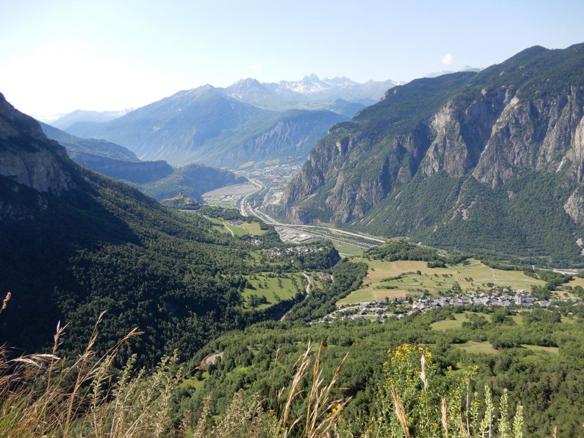
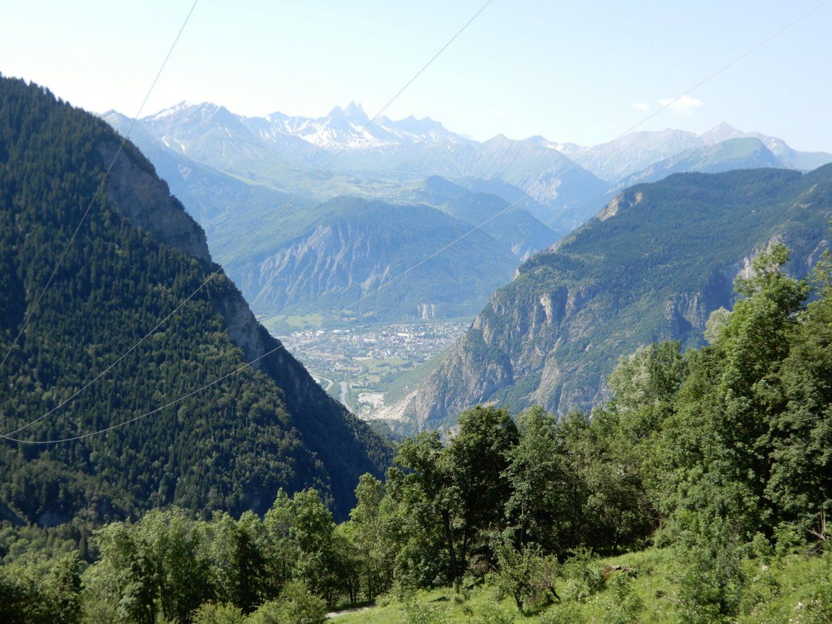
2 days ago (71.5km, 2070m climbing): Col du Mollard (1630m), via the Villargondran hairpin bends, an astonishing 40 (I think) bends in total. Mollard is one of those family friendly cols, with a farm animal petting enclosure, swimming lake and restaurant all nearby.

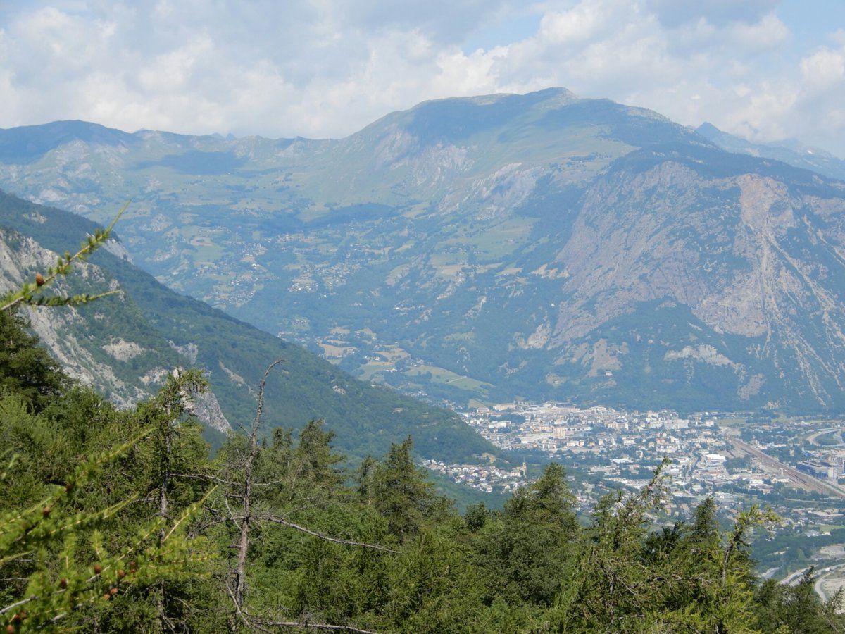
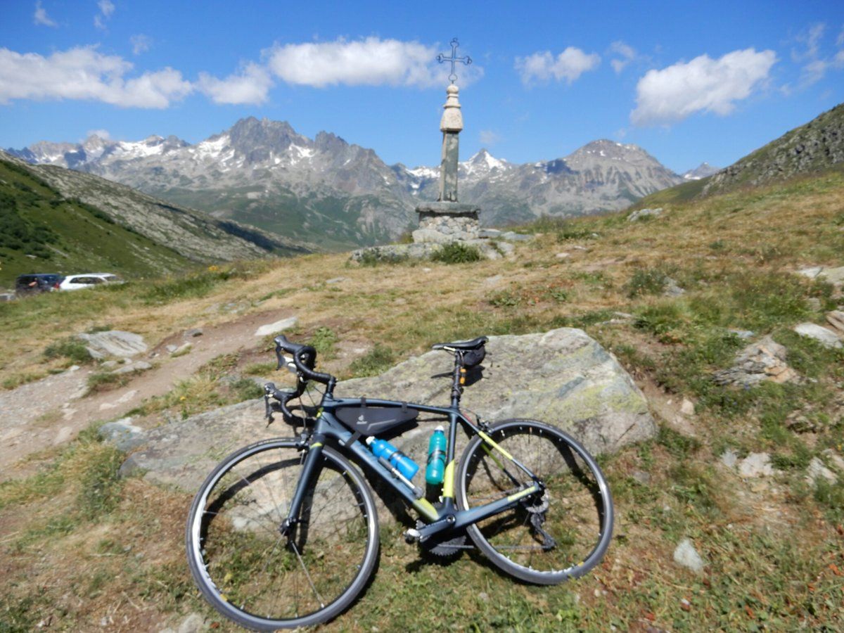
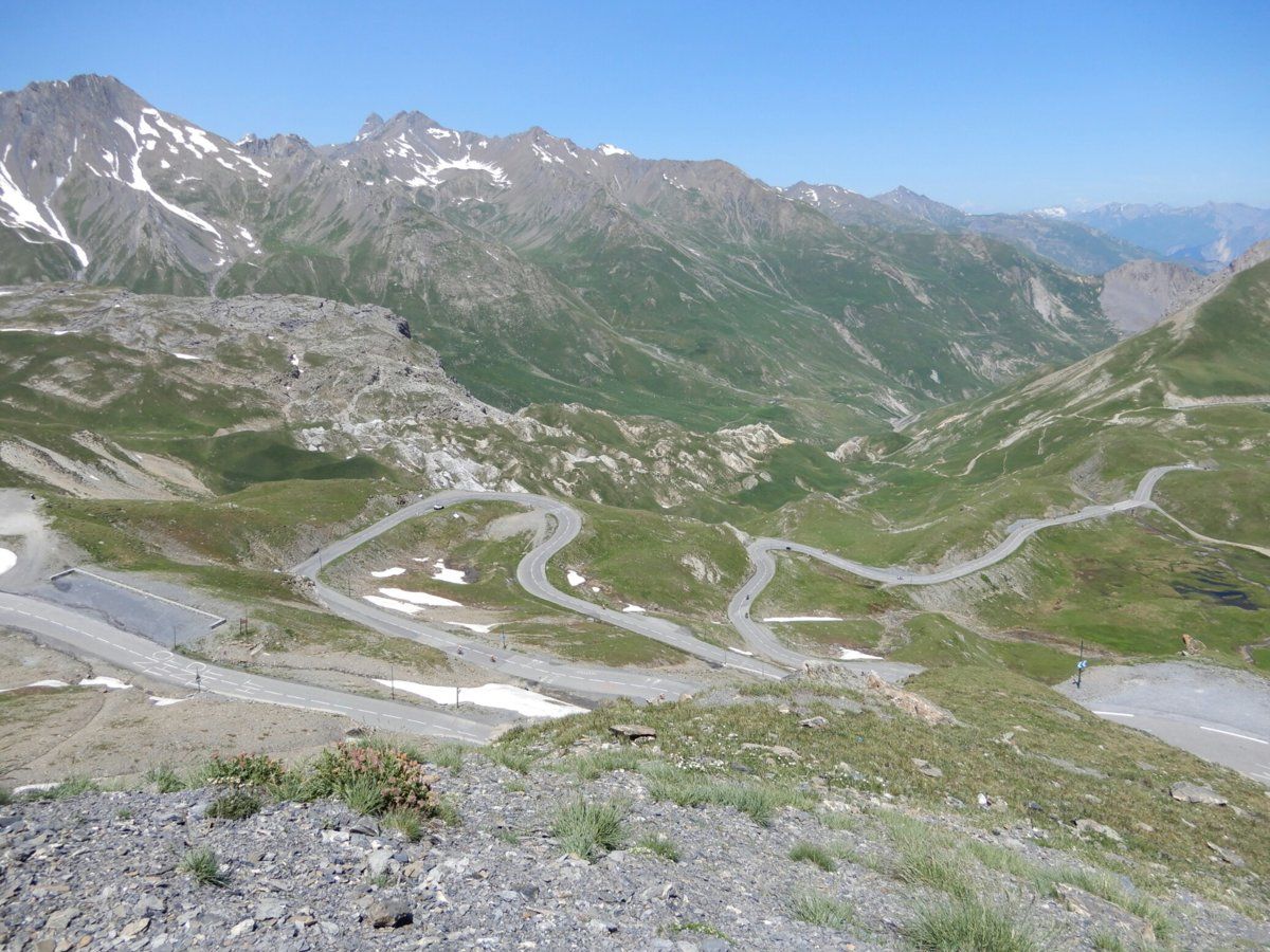
Yesterday (80.5km, 2040m climbing)): a Col de la Croix de Fer (2065m) loop via the main road up from Saint-Jean-de-Maurienne and passing through the ski resort town of Saint-Sorlin-d'Arves to the Col de la Croix de Fer, then past Col du Glandon and down to Saint-Etienne-de-Cuines, from which we (I was in a group for this one), rode back to Saint-Jean-de-Maurienne. I've now ridden up to Col de la Croix de Fer by the west side twice and east side once, and they're both beautiful climbs. I plan to ride up to it via the north before I leave here.

Today (92.5km, 2215m climbing): Col de la Madeleine (1994m) again, but via the quieter D76 route which passes through Montgellafrey. I also took a side trip up to the Lac de la Grand Lechère (1600m), which added 13km (half up, half down, and it's about 400m above the D76). The D76 route is tougher than the main D213 route, due to being steeper, narrower, and bumpier. It's also quieter, however when cars approached, I had to be careful, because there's only just enough room for 1 car to pass 1 bike on the D76.

My legs are feeling great and used to the Alps, and my cough is almost gone :smile:
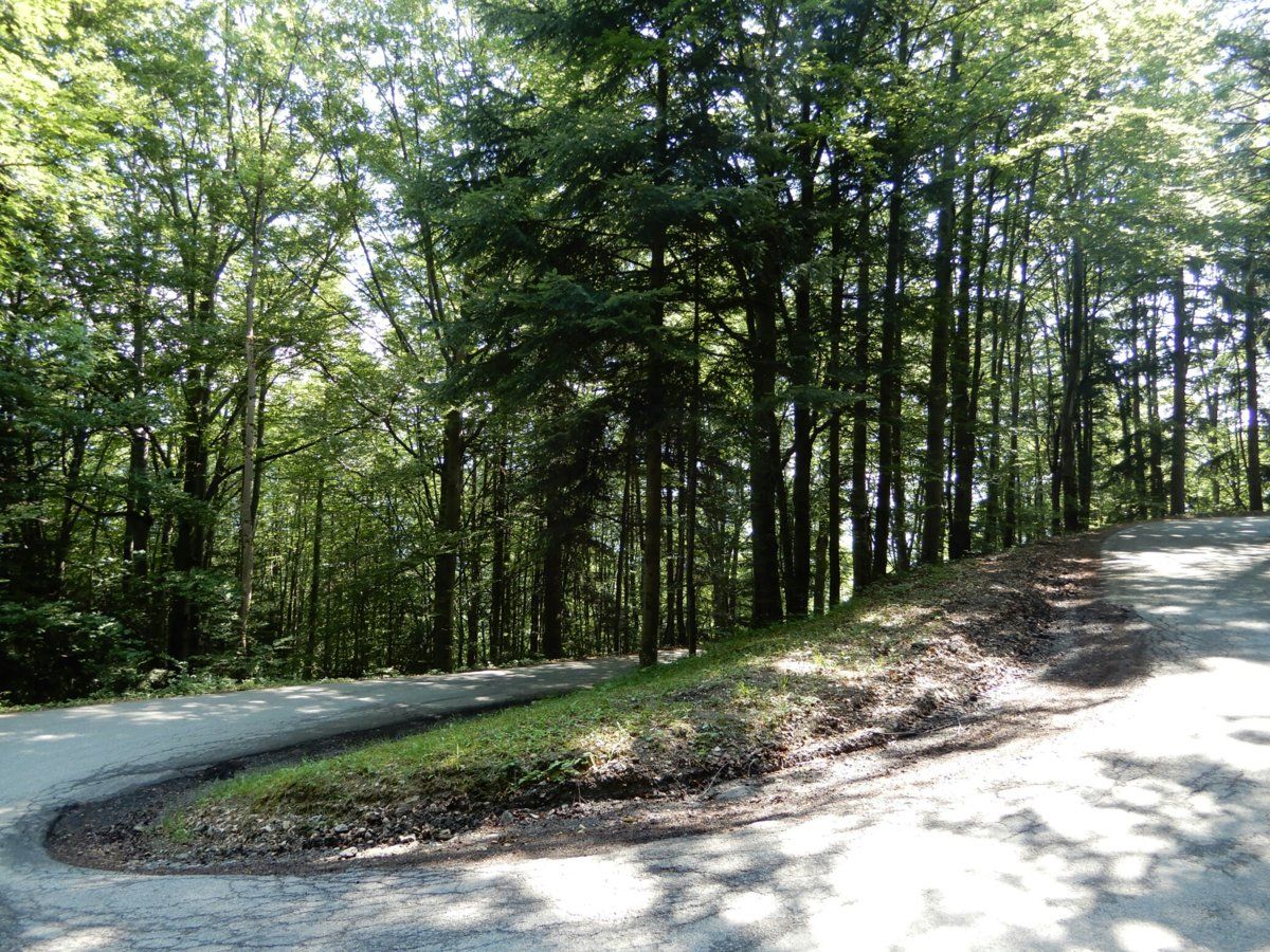
Now for some photos: the one below is of one of the 40 or so hairpin bends climbing up from Villargondran. Most of them go through forest like in the photo.


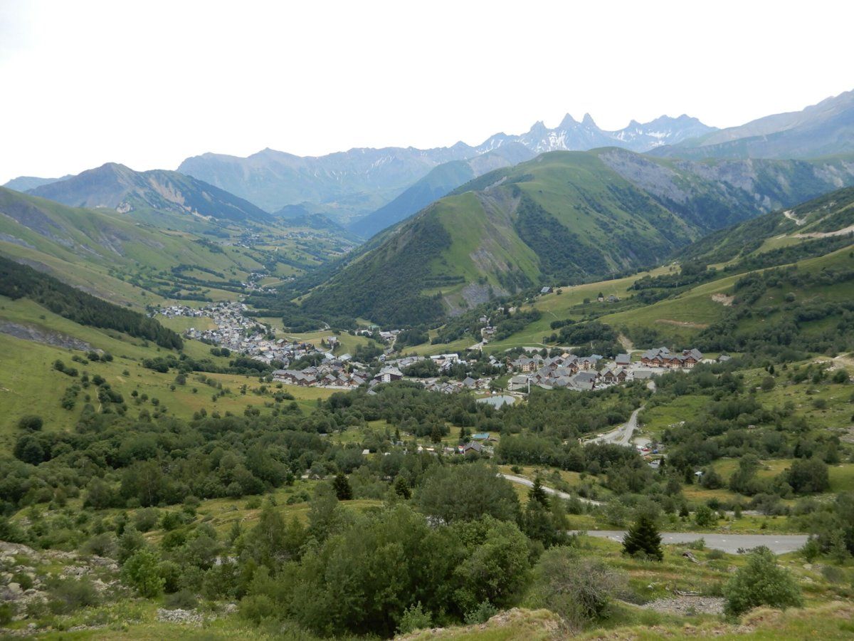
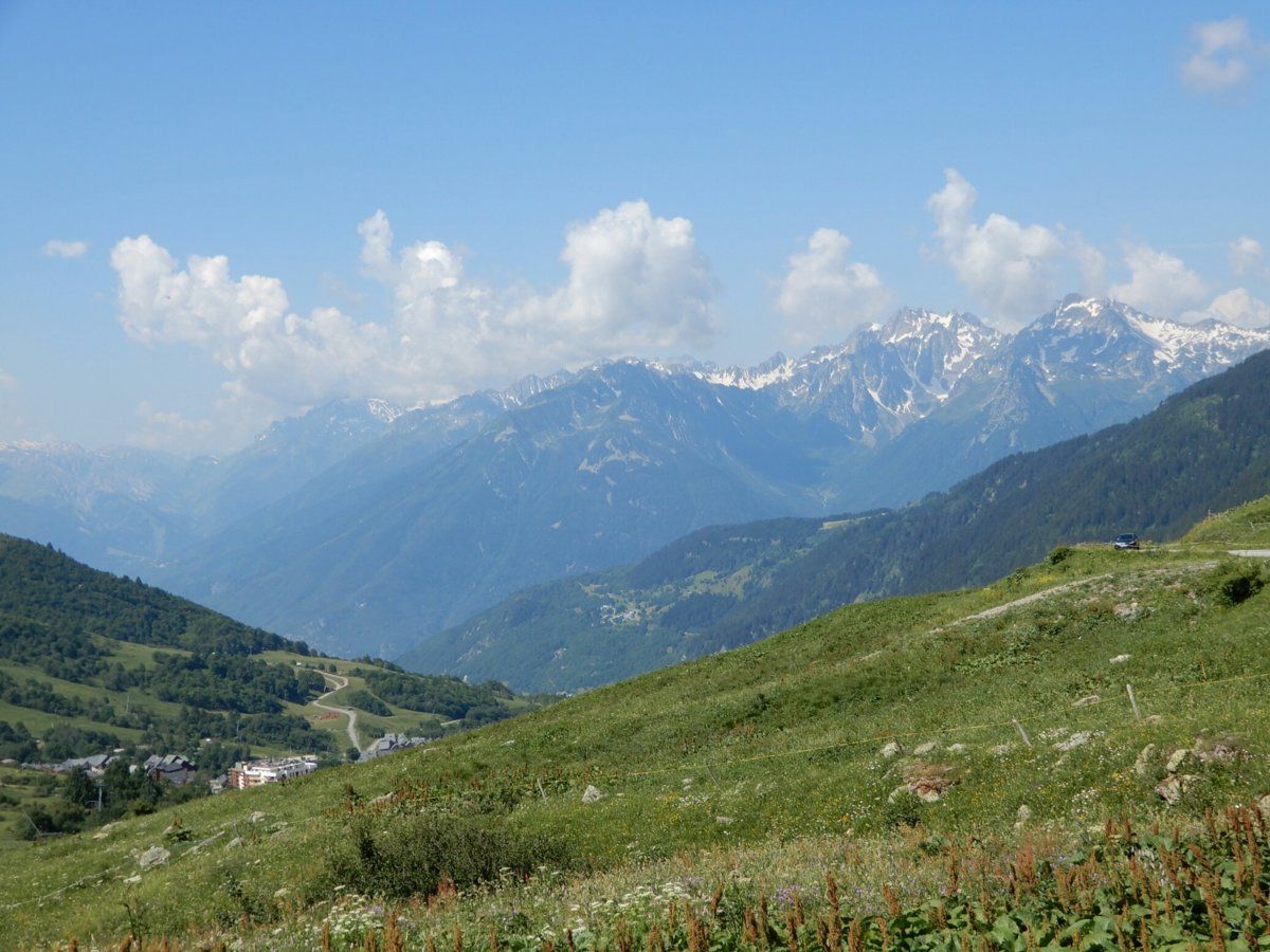
Below is the view from just east of Col de la Croix de Fer and looking down at the ski resort town of Saint-Sorlin-d'Arves, with Alpine mountains in the distance.


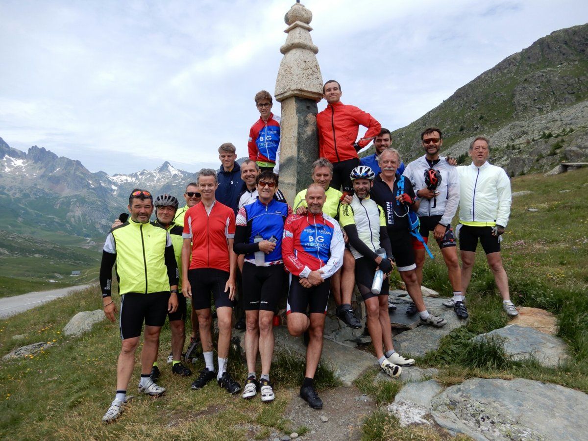
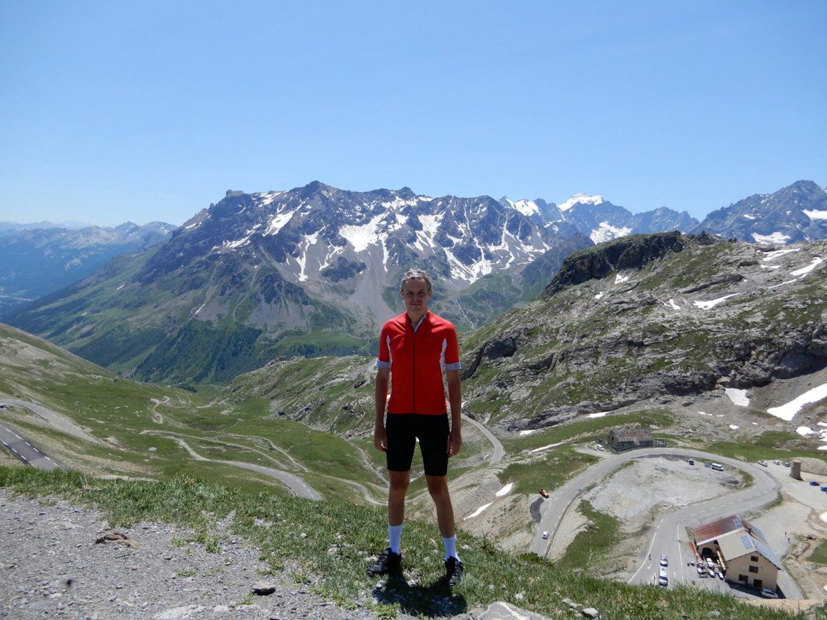
At the Col de la Croix de Fer, the group of French cyclists staying at the same chalet as I posed in front of the iron cross for which the col is named. The cross is not quite visible, being just off the top of the photo. I'm 4th from left in the plain red jersey.


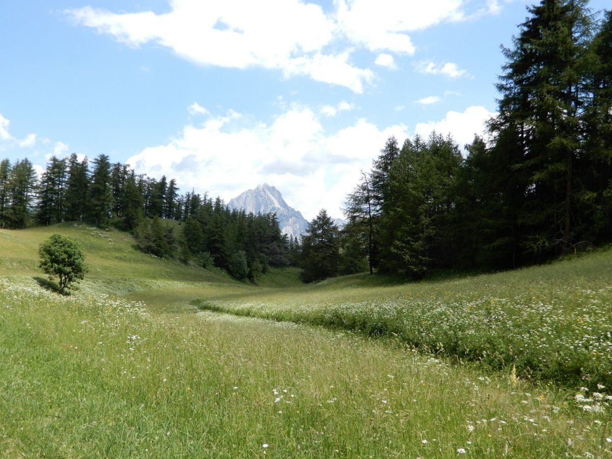
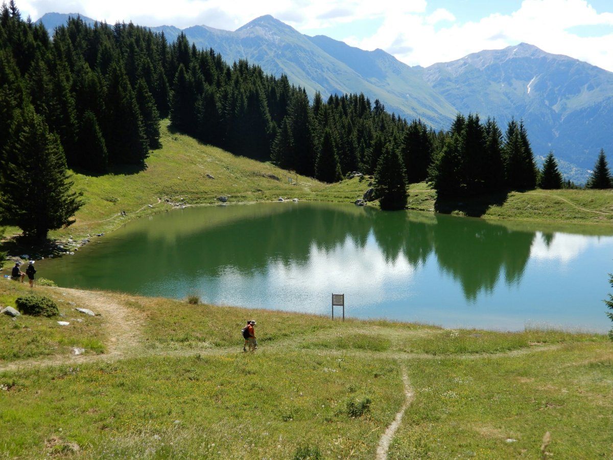
The Lac de la Grand Lechère is only 100m across so not quite 'grand' but it's nice enough, and surrounded by grassy fields, pine trees, and lots of silence :smile:


Regards,

--- Victor.
 
OP
OP
Shut Up Legs

Shut Up Legs

Down Under Member
I had a rest day today, but even though I rode only 61km, I still climbed 1940m. C'est la vie dans Les Alpes! :smile:

I rode up to Mont-Denis, which is at about 1500m, and is directly opposite La Vallée de la Maurienne from Villargondran and its hairpins. One of the photos shows Villargondran as viewed from partway up the climb to Mont-Denis. If you look carefully, you can see the lower hairpins going through the town, zigzagging up and to the right of the town, then continuing up the mountain but more to the left. The other photo shows Saint-Jean-de-Maurienne from about the same point in the Mont-Denis climb.

Regards,

--- Victor.


Last edited:
OP
OP
Shut Up Legs

Shut Up Legs

Down Under Member
Another longer one today, with 84km and 2600m climbing. I've now completed the Trois Croix de Fer (yes, I made that up).

I rode up to the Col de la Croix de Fer via the D927 up from Saint-Etienne-de-Cuines, riding over the Col du Glandon about 3km downhill from the Col de la Croix de Fer. The last 3km of the climb from Saint-Etienne-de-Cuines to Col du Glandon averages 10% grade, but I barely noticed it today. Woohoo, my Alpine legs have arrived! Thanks, Father Cyclemas :smile:

I then rode down from the Col de la Croix de Fer via the D926, passing through the ski resort town of Saint-Sorlin-d'Arves, down to near Saint-Jean-de-Maurienne, then up to the chalet again, a final climb of about 820m over about 12km.

As for the abovementioned 'trois', today's ride up to the Col de la Croix de Fer from the north means that I've now cycled up to this col from the west (27th June in my stay here in France, and 3 years ago), the east (3 days ago), and now the north also.

The 2 photos show some of the bends I rode up to Col du Glandon, and my bike having a little nap in front of the Croix de Fer (it's tough being sat on for hours).

Regards,

--- Victor.


Excellent pics - I had a very brief cycling holiday in the Alps - two days in Morzine and two in Le Bourg d`Oisans. Mainly to do Alpe d`Huez which I did and then I attempted the Croix de Fer. However, i`m not built to cycle in 37 degree heat and had the call off the Croix de Fer 11km from the top, I thought I was melting. Next year..........
 
OP
OP
Shut Up Legs

Shut Up Legs

Down Under Member
I rode 75km with 2020m climbing today, riding from Saint-Michel-de-Maurienne up to the relatively unknown Col de Beau Plan (at 1440m), then taking a road near the col up to a location called La Perousaz (at 1600m). What it's for I have no clue, because there is nothing here: no farms, buildings, or anything but forest. It's very quiet and peaceful.

The climb from Saint-Michel-de-Maurienne up to La Perousaz is similar to Saint-Michel-de-Maurienne up to Col du Télégraphe (which is directly across the valley from La Perousaz): the former ascends 850m over 13km and the latter 850m over 11.8km.

Due to the day being quite misty, I have no photos of the Col du Télégraphe from across the valley, so here's something different: partway up today's climb, I heard the loud sound of falling water, and saw a cascade on both sides of the road, and running under it, so the 2 photos are of the upper and lower parts of it.

Regards,

--- Victor.


Ming the Merciless

There is no mercy
Location
Inside my skull
Some lovely roads you've been on there. One of the great things about the alpine villages are the water troughs to refill and cool down at. As for electrolytes I like to keep them separate from the water. So tablet form. I just have flavourings in my water.
 
OP
OP
Shut Up Legs

Shut Up Legs

Down Under Member
Some lovely roads you've been on there. One of the great things about the alpine villages are the water troughs to refill and cool down at. As for electrolytes I like to keep them separate from the water. So tablet form. I just have flavourings in my water.
Yes, I use the tablets also, and occasionally switch to plain water when I feel like it. The 'eau potable' in every village is rather nice, isn't it?
 
Top Bottom