The CC Trig Point bagger thread, now incorporating other interesting geographs

Page may contain affiliate links. Please see terms for details.
OP
OP
Drago

Drago

Legendary Member
There is one about a mile to the NW which I will one day be visiting.
 

classic33

Leg End Member
Mixenden Road, just before the junction with Hollins Lane
CAM01046.jpg

Hope Hall, South annexe. Clare Road/Hope Hall Street.
CAM01047.jpg

Top line is over 7 inches long.
 
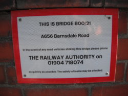
Barnsdale Road (A656)
Allerton Bywater

North Eastern Railway
Leeds & Castleford Branch


It's the road from Castleford, via 'Peckfield Bar' (where A63 crosses it), to HookMoor, where it rejoins the A1...…… having left it, following the old Roman Road, at Barnsdale Bar (south of Pontefract)

I use this road a lot, but have never seen the mark before, as usually I'm in traffic, but today the Sun was catching it, & it was a relatively traffic-free time of day (circa 12:50 - 13:00)

DSCF7168.JPG


Looking west off the bridge, to the previous site of the station
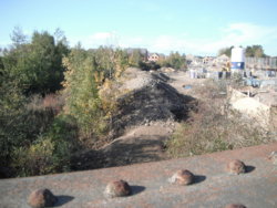
DSCF7170.JPG

DSCF7169.JPG


Looking up 'Barnsdale' towards Mary Pannnal Hill
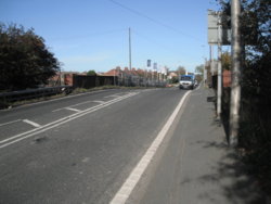
DSCF7171.JPG


The site of Ledston Station, seen if you scroll down to the correct section here (3rd photograph. below maps); http://www.lostrailwayswestyorkshire.co.uk/Castleford Garforth.htm


The bridge forms the crest of the hill; http://www.geograph.org.uk/photo/258895
Looking east, towards the Aire flood-plain; http://www.geograph.org.uk/photo/121899

Which was crossed on this bridge, now extremely rickety (& not used); http://www.geograph.org.uk/photo/2869303


EDIT @ 17:23
What is interesting, is that the 1905 (25" - mile) OS map shows the mark on the opposite parapet
 
Last edited:
MilePost
Barnsdale Road (A656)

Top of 'Mary Pannall Hill'
(to the Ledston Luck side of the cross-roads)
'HookMoor Branch' refers to this being a continuation of Barnsdale Road, which left the A1 at Barnsdale Bar

It follows the route of the Roman road, passing through Pontefract, meeting up again at Castleford, before rejoining the A1 at Aberford (HookMoor)

DSCF7165.JPG


https://britishlistedbuildings.co.uk/101264130-milepost-at-se-428-299-kippax#.W9DOmPZFzIU

It's practically in the blue circle; http://www.geograph.org.uk/photo/1113585
 
OP
OP
Drago

Drago

Legendary Member
Planning this weekends big loop (I'm hoping to bag a dozen in one ride) and I noticed the route takes me past and old water tower. I googled it, and found a website that might interest my fellow explorers...

http://bwtas.blogspot.com/2012/06/castlethorpe-troughs-water-tower.html
 

PeteXXX

Cake or ice cream? The choice is endless ...
Location
Hamtun
Top Bottom