Badger_Boom
Veteran
- Location
- York
I took a walk round part of York that I normally drive and came back with some interesting snaps:
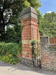
Here‘s Fulford Cross (or what’s left of it) :

a couple of cracking War Department datum stones from two corners of Imphal Barracks:


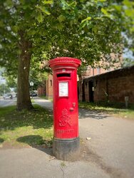
a nice George VI pillar box:

and an OS benchmark on the entrance to the former cavalry barracks that I would never have noticed if the light hadn’t been right:

Here‘s Fulford Cross (or what’s left of it) :
a couple of cracking War Department datum stones from two corners of Imphal Barracks:
a nice George VI pillar box:
and an OS benchmark on the entrance to the former cavalry barracks that I would never have noticed if the light hadn’t been right: