Richard A Thackeray
Legendary Member
During todays 'allowed exercise'
Locals, or those simply familiar with the area, may be able to roughly trace where I rode
6.
'Kingfisher Bridge' (aka 'Burnhill Bridge')
Ackworth Bridge Road (parish boundary?, where it becomes Burnhill Lane)
(off Rigg Lane)
Situated in a triangle between Low Ackworth, East Hardwick & Thorpe Audlin


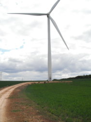
https://www.geograph.org.uk/photo/5030374
Locals, or those simply familiar with the area, may be able to roughly trace where I rode
6.
'Kingfisher Bridge' (aka 'Burnhill Bridge')
Ackworth Bridge Road (parish boundary?, where it becomes Burnhill Lane)
(off Rigg Lane)
Situated in a triangle between Low Ackworth, East Hardwick & Thorpe Audlin
https://www.geograph.org.uk/photo/5030374