The CC Trig Point bagger thread, now incorporating other interesting geographs

Page may contain affiliate links. Please see terms for details.
Monday 12th
3.

Normanton - Wakefield KirkGate railway
'Half-Moon' lake to the east (an 'Ox-Bow' created by the building of anembankment for the railway, circa 1840, & cutting off a meander of the River Calder)

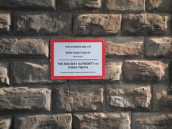
To the other side of the bridge is the River Calder, & 'the Bljue Bridge'
Now a footbridge/TPT route, but constructed to carry ash-pipes (see #2)

583609

583610


https://www.geograph.org.uk/photo/4907896
 
Monday 12th
4.

'
Blue Bridge'
Spanning the River Calder, just upstream of Kirkthorpe Weir


Broad Reach Lock, can just been seen through the guard-mesh
583611


583612


In summer, some of the local Darwin Award applicants jump off the bridge into the Calder
In severe flood, the water can reach the lowest platform of the stairs!
583613


https://www.geograph.org.uk/photo/1920455
https://www.geograph.org.uk/photo/6095549
 
Last edited:
Monday 12th
5.

Broad Reach Lock
River Calder - Aire & Calder Navigation Canal
Eastmoor
(just east of Wakefield City-centre)

It's primarily a 'flood lock' to protect the 'Cut'
Normal river levels see the gate open. to maintain a good water level in the Canal

High/flood conditions see them closed
There are three weirs before the Canal rejoins the Calder;
Kirkthorpe (the largest/most impressive), Stanley Ferry (where the Grade 1 Aquaduct takes the A&CNC over the Calder) & Penbank (east of the M62, between jcts 30 & 31)

583617


https://britishlistedbuildings.co.u...adreach-lock-wakefield-east-ward#.YHSWMKySnIU
https://www.geograph.org.uk/photo/6493049
https://www.geograph.org.uk/photo/6095652
 
Tuesday 13th
3.

Lofthouse Colliery Reclamation Park
Close to the Leeds - Wakefield WestGate - Doncaster - Kings Cross railway

Best known for its 1973 disaster

583778


583779


Re; the public railway mentioned
583780


I certainly remember the spoil-heaps like this

583781


All named after seams
DSCF6879.JPG


I know 2 of the Mines Rescue team that went down, Bill (Cave, mentioned in this text) & Colin, who died a few years ago
https://www.nmrs.org.uk/mines-map/a...e/lofthouse-colliery-disaster-wakefield-1973/

http://www.bbc.co.uk/bradford/sense_of_place/lofthouse_colliery_disaster.shtml


https://www.geograph.org.uk/photo/5971562
https://www.geograph.org.uk/photo/3767615
 
Last edited:
Last edited:
Tuesday 13th
5. Out of sequence, as I missed this one...., it ought to be number 1

Site of the 'Capping' of the St Johns Colliery shaft
NewLands cum Woodhouse Moor
Normanton

From here, I could see both Emley Moor transmitter masts (not visible on this photograph)

583812


The 'triangle' appears to mark the site of a shaft (as there's also one shown at Lofthouse Colliery

There's no picture on Geograph, but it's roughly on the blue-circle at the 14:00 position
https://www.geograph.org.uk/photo/366384

https://maps.nls.uk/geo/explore/#zoom=16&lat=53.69464&lon=-1.43495&layers=10&b=1
 

Spartak

Powered by M&M's
Location
Bristolian
584281


Minehead end of the South West Coast path.
 
Top Bottom