You are using an out of date browser. It may not display this or other websites correctly.
You should upgrade or use an alternative browser.
You should upgrade or use an alternative browser.
Your bike on a bridge pics
- Thread starter User
- Start date
Page may contain affiliate links. Please see terms for details.
Richard A Thackeray
Legendary Member
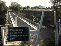
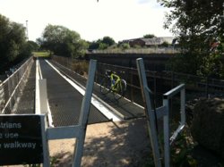
Trash Screen Bridge
'Stanley Ferry'
(off) Ferry Lane/Birkwood Hill
Stanley
It crosses the River Calder, to provide both a footpath/cycleway & prevent some of the detritus reaching the aquaducts (one of which is Grade 1 listed)


http://www.geograph.org.uk/photo/4740035
EDIT @ 19:45
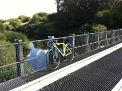
This was how it looked on Saturday 26th December 2016
The same day that Tadcaster Bridge collapsed
In my pic (above) the Calder is about 15 foot below the bridge and about 50-60 foot wide at this point
'Stanley Ferry'
(off) Ferry Lane/Birkwood Hill
Stanley
It crosses the River Calder, to provide both a footpath/cycleway & prevent some of the detritus reaching the aquaducts (one of which is Grade 1 listed)


http://www.geograph.org.uk/photo/4740035
EDIT @ 19:45
This was how it looked on Saturday 26th December 2016
The same day that Tadcaster Bridge collapsed
In my pic (above) the Calder is about 15 foot below the bridge and about 50-60 foot wide at this point
Last edited:
Richard A Thackeray
Legendary Member
Inside a Bridge???
This is an enclosed footbridge, over the River Calder, & 'hanging' from an operational railway bridge
It is between Broad Cut Road (Calder Grove) by the Navigation Inn (on the Calder & Hebble Navigation Canal) & Charles Street, at Horbury Junction
The last time I crossed this (15 years ago??), there was no lighting, & the planking that formed the floor was rotten/vandalised/missing
Sunday 12th March 2017

Location/internal/external images;
http://www.geograph.org.uk/photo/732745
http://www.geograph.org.uk/photo/732741 (steps can be seen by l/h abutment)
This is an enclosed footbridge, over the River Calder, & 'hanging' from an operational railway bridge
It is between Broad Cut Road (Calder Grove) by the Navigation Inn (on the Calder & Hebble Navigation Canal) & Charles Street, at Horbury Junction
The last time I crossed this (15 years ago??), there was no lighting, & the planking that formed the floor was rotten/vandalised/missing
Sunday 12th March 2017
Location/internal/external images;
http://www.geograph.org.uk/photo/732745
http://www.geograph.org.uk/photo/732741 (steps can be seen by l/h abutment)
tincaman
Guru
- Location
- Chudleigh, South Devon
Bridge over the A38 at Splatford Split, Devon

Last edited:
thats an awesome set-up....what size are those G Ones?
tincaman
Guru
- Location
- Chudleigh, South Devon
40mm running at 40psi tubeless
Richard A Thackeray
Legendary Member
PackHorse Bridge, over an infant River Dearne
Clayton West
Adjacent to the (A636) Wakefield - Denby Dale TurnPike Road
Sunday 21st January 2018


http://www.geograph.org.uk/photo/38977
https://www.britishlistedbuildings.co.uk/101135303-packhorse-bridge-denby-dale#.W2SUS_ZFzIU
Clayton West
Adjacent to the (A636) Wakefield - Denby Dale TurnPike Road
Sunday 21st January 2018
http://www.geograph.org.uk/photo/38977
https://www.britishlistedbuildings.co.uk/101135303-packhorse-bridge-denby-dale#.W2SUS_ZFzIU
Last edited:
Richard A Thackeray
Legendary Member
This could be viable for the 'Something Different' & the 'In Front Of A Church' threads, as well as this one!!
'Chantry Chapel'
Wakefield Bridge
Circa 1350 century bridge chapel, one of only 4 left in the Country
It forms part of the piers

https://www.britishlistedbuildings....-side-of-wakefield-bridge-wakefield-east-ward
https://www.britishlistedbuildings.co.uk/101273508-wakefield-bridge-wakefield-east-ward#.W2SXLvZFzIU
http://www.geograph.org.uk/photo/5824389
http://www.geograph.org.uk/photo/281857
'Chantry Chapel'
Wakefield Bridge
Circa 1350 century bridge chapel, one of only 4 left in the Country
It forms part of the piers
https://www.britishlistedbuildings....-side-of-wakefield-bridge-wakefield-east-ward
https://www.britishlistedbuildings.co.uk/101273508-wakefield-bridge-wakefield-east-ward#.W2SXLvZFzIU
http://www.geograph.org.uk/photo/5824389
http://www.geograph.org.uk/photo/281857
Richard A Thackeray
Legendary Member
Cawood Swing-Bridge
Cawood
River Ouse
Carrying the B1222, towards Kelfield & Stillingfleet
Earlier today, circa 13:00

When the Ouse is in flood!!
http://www.geograph.org.uk/photo/3243319
Cawood
River Ouse
Carrying the B1222, towards Kelfield & Stillingfleet
Earlier today, circa 13:00
When the Ouse is in flood!!
http://www.geograph.org.uk/photo/3243319
Julia9054
Legendary Member
- Location
- Knaresborough
Will in front of a bridge do? The Millau Viaduct

Richard A Thackeray
Legendary Member
The road from Stutton, I take it?A couple of old pics of the Road Comp, at Boston Spa and over the A64 near Tadcaster
View attachment 414736
Richard A Thackeray
Legendary Member
A combination shot
The towpath of the Aire & Calder Navigation Canal (between 'Stanley Ferry' & Birkwood Lock) and the parapet of a culvert carrying a field-drain/stream under the Canal

http://www.geograph.org.uk/photo/1843521
http://www.geograph.org.uk/photo/1843528
The towpath of the Aire & Calder Navigation Canal (between 'Stanley Ferry' & Birkwood Lock) and the parapet of a culvert carrying a field-drain/stream under the Canal
http://www.geograph.org.uk/photo/1843521
http://www.geograph.org.uk/photo/1843528
NorthernDave
Never used Über Member
- Location
- The real Northern Powerhouse
Richard A Thackeray
Legendary Member
Springhead Park
Rothwell
I'd ridden down to meet up with one of my old buddies, who I worked with, till she left to join YAS (Yorkshire Ambulance Service)
So, as I was there early, I had a pootle around the Park
This rather substantial bridge (for a park) allows machinery to cross to either side of the River Dolphin
Oddly it's simply Oulton Beck a mile downstream, & the part that it flows through there is definitely a lot posher than Rothwell!, as seen by the photos, in this thread

http://www.geograph.org.uk/photo/1386712
Rothwell
I'd ridden down to meet up with one of my old buddies, who I worked with, till she left to join YAS (Yorkshire Ambulance Service)
So, as I was there early, I had a pootle around the Park
This rather substantial bridge (for a park) allows machinery to cross to either side of the River Dolphin
Oddly it's simply Oulton Beck a mile downstream, & the part that it flows through there is definitely a lot posher than Rothwell!, as seen by the photos, in this thread
http://www.geograph.org.uk/photo/1386712
Elybazza61
Guru
From Sundays' Wicken fen pootle


