Durness to Dover - 17th June to 25th June

Page may contain affiliate links. Please see terms for details.
A friend of mine, Mike, had decided to do something vaguely heroic for his 40th birthday this June, but wanted to do something different from a usual coast to coast. Seeing as everyone else seems to be doing a charity ride, I foolishly agreed to do this, and we came up an 800 mile route from the most northerly village in the UK, Durness, down to Dover.

We're doing this for the East Anglian Air Ambulance charity, and aim to raise at least £1,000, seeing as the Air Ambulances don't receive any State funding at all, and need £4 million a year to keep their 2 helicopters in the year.

We've set up a website at www.durnesstodover.co.uk which has a link for donating,and over the next few months the web site will be filled in with more details about the route and our training.
 
OP
OP
Flying Dodo

Flying Dodo

It'll soon be summer
Well, the final days are now ticking away.

The route planning and places to stay were all sorted in February, although I have recently made some minor tweaks to the route to avoid some A roads. I've got my checklists of everything to take printed off, GPX routes loaded into the GPS, maps printed off just in case, and the bikes are all sorted.

Just got to suffer 8 hours on the train up to Inverness on Thursday, then we're getting a lift up to Durness (via a distillery for educational purposes) on Friday, before setting off on Saturday (I've realised the description of this thread is wrong as it's 18th June - 25th June).

And of course the weather looks like rain...........

I should have internet access, so hopefully I'll be updating this with our progress, and some pictures.
 
A friend of mine, Mike, had decided to do something vaguely heroic for his 40th birthday this June, but wanted to do something different from a usual coast to coast. Seeing as everyone else seems to be doing a charity ride, I foolishly agreed to do this, and we came up an 800 mile route from the most northerly village in the UK, Durness, down to Dover.

We're doing this for the East Anglian Air Ambulance charity, and aim to raise at least £1,000, seeing as the Air Ambulances don't receive any State funding at all, and need £4 million a year to keep their 2 helicopters in the year.

We've set up a website at www.durnesstodover.co.uk which has a link for donating,and over the next few months the web site will be filled in with more details about the route and our training.

Hope it is all going well for you both. Durness made me a bit nostalgic so I dug out two photos (non digital so rather grainy) of scenery as it was in 1980 between Kinlochbervie and Durness - the route may not have changed a great deal! Good luck to you both for the rest of your trip.

M
 

Attachments

  • Kinlochbervie to Durness 1980.jpg
    Kinlochbervie to Durness 1980.jpg
    38.6 KB · Views: 76
  • The Main road to Durness from Kinlochbervie in 1980.jpg
    The Main road to Durness from Kinlochbervie in 1980.jpg
    33 KB · Views: 93
OP
OP
Flying Dodo

Flying Dodo

It'll soon be summer
Thanks Miranda!

Well, Day 1 is done.

We set off from Durness at 08.40 with sunshine and a tailwind for the first 20 miles,which nicely pushed us up some of the hills. It really is quite desolate and stunningly beautiful at them same time. The route took us along lochs, then up over passes and down to the next loch. We stooped for a quick lunch break in Lairg and then faced a monster hill after Bonar Bridge, before a long downhill to we're we've stopped in Dingwall.

4,356 ft climbing, 94.3 miles with a total rolling time of 7:01. My max speed was 35.8, but Mike, being younger and more reckless, went faster!

Photos will follow later, although if you look at the web site (www.durnesstodover.co.uk) then Mike's uploaded a few, and he is regularly tweeting updates.

The Tweets and updates are great. Sorry to see the P*etc Fairy found you - hopefully she will leave you alone now. You are cycling through scenery that was so stunning the first time I saw it that it has stayed with me as it was so magical. It made me rummage through my photo album again!

As you head down the A9 - although hopefully not on it as it is on a par with the A303 - and the old A9 is a bit of a rat run if I remember - about a mile north of Dunkeld is the Hermitage which - although perfect for MTBs not exactly the terrain you are looking for, is a very pretty spot. As you can see - this part of the world is full of memories for me and its fantastic that new ones are being created for you - especially as you are doing this mammoth trip to raise funds for East Anglian Air Ambulance. Donation on its way.

Absolutely brilliant indeed - every day a winner.

All the very best to you both.

M


Attachments

  • The top of Schehallion in 1990.jpg
    The top of Schehallion in 1990.jpg
    34.8 KB · Views: 78
  • Proof I walked to the top of Schehallion in 1990.jpg
    Proof I walked to the top of Schehallion in 1990.jpg
    32.9 KB · Views: 84
  • The Hermitage in 1990.jpg
    The Hermitage in 1990.jpg
    52 KB · Views: 77
OP
OP
Flying Dodo

Flying Dodo

It'll soon be summer
Day2 – Sunday 19[sup]th[/sup] June – Dingwall to Blair Atholl - 96.7 miles 5,380 ft climbed


Sunday morning saw us rolling out of Dingwall at 8.30. Not many people around at that time! After heading south of the town, we then started climbing south eastwards, before basically following the A9 towards Inverness, on a minor B road.

Crossing over the Kessock Bridge to Inverness was fun, as you could feel the bridge swaying when big lorries went past. Once over, we then had a bit of climbing towards Moy, to then basically follow the A9. This was either on a cycle path, or bits of the old A9. When it was the old road, it was lovely, as in places there's miles of 2 lane road just for bikes. In other places though, there's a really grotty cycle path. The bridges over viaducts all seemed to have had their concretew remps removed, so you ended up having to pull up over a bump.

We stopped off in Aviemore for lunch which seems a really nice Alpine type town. Mike commented that he couldn't believe the quantity of food we were getting to eat. On this trip, the more calories, the better! By now the wind had turned to be more in our faces, and heading past Newtonmore, we were steadily climbing. The cycle path ended due to road works, so we ended up first cycling on new, unused road, then on the A9 itself until the cycle path started up again. On the section to Dalwhinnie, the wind was starting to get really strong, so we were pleased that the road started to head east. However, as a combination of the rubbish surface of the cycle path, and the bumps on the bridges, I got a pinch puncture. However, that was swiftly dealt with, and then the final 10 miles were downhill all the way to Blair Atholl.

The weather here in Scotland has been lovely with loads of sun, so we've been very lucky.

I've noticed when we've stopped, little midges trying to have a nibble, but they haven't managed to bite.

Overall, we're both not suffering too much and we're now 25% done.
 

srw

It's a bit more complicated than that...
Overall, we're both not suffering too much and we're now 25% done.

That really brings home the size of these islands, and how much is essentially uninhabited. You're a quarter of the way to Dover and you're still in a place that feels to a southerner like the far North of Scotland.
 
OP
OP
Flying Dodo

Flying Dodo

It'll soon be summer
Day 3 – Monday 20[sup]th[/sup] June Blair Atholl to Edinburgh

Another nice day in Scotland, with no wind and sunny spells. Our route took us parallel to the A9, on nice quiet B roads. Now we're out of the Highlands, the contrast in the countryside is striking, as it's very agricultural, with loads of sheep and cattle. I've noticed as we go past, that the animals often turn to watch us and follow where we're going. Down in the south of England, they completely ignore you. Another thing I've spotted is that the Scottish certainly believe in supporting their local industry. For every 1 Coke can or bottle discarded in the verge, there's probably 10-15 Irn Bru bottles.

We made rapid progress to the west of Perth, and then had some big climbs. I've only had to use the granny gear once so far, which I'm pleased about. The day seemed to pass quite quickly and easily, although Mike was suffering a bit at times. We then tracked next to the M90, to go across the Forth Bridge, which is a very impressive structure, before our stop in Edinburgh. Overall, we did just under 5,000 ft of climbing with a moving average speed of 12.9 mph.
 
OP
OP
Flying Dodo

Flying Dodo

It'll soon be summer
Day 4 – Tuesday 21[sup]st[/sup] June – Edinburgh to Hexham – 104 miles

For a change, the day didn't start bright & sunny. I think the correct Scottish term is “dreich”. Damp, overcast and starting to rain. We headed off early just after 7 am and skirted around the by-pass. Judging by the sheer volumes of cars heading into Edinburgh, I can see why a tram system might have seemed to have a good idea!

Due to the weather, we decided to stick to the main roads and headed south-east on the A7. The surface on this, is the type of tarmac with bits sticking out which really started to act as a drain on our speed. We got to Galashiels just before 11 and decided to sit down out of the rain, for something to eat. The Tesco there is built above the car park, so you have to up escalators to get into the store. We were too early for lunch, so we made do with another cooked breakfast, some sandwiches and a pudding, after first selecting the items with the most calories.

Heading off again in the rain, we then turned onto the A68. Just before Jedburgh was a place called Bonjedward, and Mike commented that “bon” would not be the word you'd normally put in front of Jedward. The closer we got to the border, the brighter the weather got, so we were able to ditch the wet weather gear. At the border itself we stopped for some photos and then headed off downhill. The wind was now getting stronger and blowing across the road, which made for some interesting handling whenever a large lorry went past.

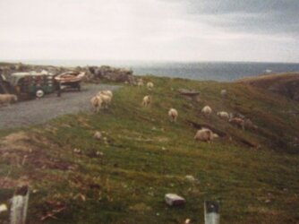
Going past Kielder Forest, there was an MoD firing range, with strict warning notices not to enter and live ordnance. However, I thought it was a little unfair to allow sheep to go grazing there. By now the sun was out again, and we were zooming along at 18 mph. Both our bikes have developed little sqeaks but nothing major. The final stretch of the A68 was a bit of a drag with a headwind, although it's one of those roads where it's a continual rolling road up to a summit, then swooping down again, and zooming up again. Mike's got a time lapse camera running on his bike, so when it's all compiled into a video, it'll look very impressive. However, it got a bit tiring by the time we turned off for our night stop in Hexham. The tops of my legs are definitely aching.


The GPS shows 11,847 ft of climbing although I don't believe that, as the original track before we decided to stay on the A roads, was just under 7,000 ft. However, our average rolling speed is slightly higher at 14 mph. Either way, I'm relieved it's a shorter leg to Thirsk tomorrow.
 
Good going Adam and Mike - I can just about imagine how some of the bony, jointy bits are feeling. :smile: Remember, nothing lasts forever - not even your troubles!
Thirsk I always remember as browny stone house land - nice nevertheless, with beautiful scenery. Davy is thinking of riding shotgun on part of your journey (Have you got a portaloo? - it would save time :rolleyes:
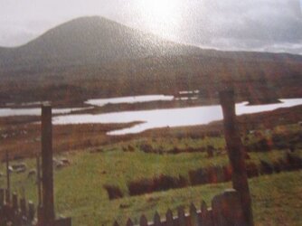
) is there a meet up point for your last leg?
Continued good luck both.
 
Top Bottom