Inputting GPS coordinates to find on a map.

Page may contain affiliate links. Please see terms for details.

Tail End Charlie

Well, write it down boy ......
If you have some GPS coordinates, how do you find where they are on a map? By that I mean I have some coords e.g. SJ 79854 67142 from my GPS but don't know how to get back to that place from elsewhere. Hope that makes sense.
 

Alex321

Veteran
Location
South Wales
Those coordinates look like OS map coordinates.

You can find it on the OS maps site - that comes out between Holmes Chapel and Congleton - is that correct?
https://explore.osmaps.com/location...rdinates=-2.303035185970667,53.20097175266028
 
OP
OP
Tail End Charlie

Tail End Charlie

Well, write it down boy ......
@Alex321 , @numbnuts @Ian H that helps tremendously thankyou very much. It does mark Swettenham, in fact it's a particular tree in the arboretum there (a catalpa bungei if you're interested). I presume I need to get the OS app now? I manage that arboretum and have those GPS coords/ OS refs for all the trees and what I'd like to do is find a tree from the coords and given there are 2500 trees, whatever method needs to be a very low scale.
 

GuyBoden

Guru
Location
Warrington
Interesting,I been cycling near to Sir Bernard Lovell's Quinta Arboretum for many years.

His house was called Quinta.

He was famous for something else too, but I'm not telling................:whistle:
 

GuyBoden

Guru
Location
Warrington
cQuxdxQuXnUfE1BcqIIQyGOzL_NOjdXHk6j=s680-w680-h510.jpg
 

annedonnelly

Girl from the North Country
There's also Grab a Grid which shows satellite & map images side-by-side. The co-ordinates you have are accurate to a 10m square.
 

Ajax Bay

Guru
Location
East Devon
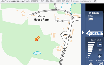
Here's a screenshot from (1:25,000) Streetmap.co.uk with that OS Grid 'searched for' [ SJ 79854 67142 ]
There will be other clever people along, but you will have a paper plot of where all your special trees are (metasequoia glyptostoboides anyone) and can move the arrow around to get a read out.
Consider what the best coordinate system is for your use (see options below so maybe WGS84 or OSGB36 (OS maps) and Lat/Long but this GR is a 1m x 1m square defined by its SW corner). There may also be a recommended worldwide standard in the forestry/arboretum 'space'.
Also if this output is derived from a hand held GPS it'd be worth taking more than one reading (eg beside the east and west sides of each tree and averaging (satellite visibility and other minor errors)).
Ask yourself what the purpose is, who might use the information (and how) and how are they going to access it.
Pub front door: SJ8000167176
1701878974467.png

OS X (Eastings) 379854
OS Y (Northings) 367142
Nat Grid SJ798671 / SJ7985467142
Nearest Post Code CW12 2LF
Lat (WGS84) N53:12:03 (53.2009672159965)
Long (WGS84) W2:18:11 (-2.3030426812624953)
Lat,Long (WGS84) 53.2009672159965,-2.3030426812624953
Lat (OSGB36) N53:12:02 (53.20068702105658)
Long (OSGB36) W2:18:06 (-2.3016218047231267)
Lat,Long (OSGB36) 53.20068702105658,-2.3016218047231267
what3words finally.unscathed.amuse
Open Loc/Plus code 9C5V6M2W+9QP
 

Attachments

  • 1701877492875.png
    1701877492875.png
    54.6 KB · Views: 8
Last edited:
OP
OP
Tail End Charlie

Tail End Charlie

Well, write it down boy ......
Here's a screenshot from (1:25,000) Streetmap.co.uk with that OS Grid 'searched for' [ SJ 79854 67142 ]
There will be other clever people along, but you will have a paper plot of where all your special trees are (metasequoia glyptostoboides anyone) and can move the arrow around to get a read out.
Consider what the best coordinate system is for your use (see options below so maybe WGS84 or OSGB36 (OS maps) and Lat/Long but this GR is a 1m x 1m square defined by its SW corner). There may also be a recommended worldwide standard in the forestry/arboretum 'space'.
Also if this output is derived from a hand held GPS it'd be worth taking more than one reading (eg beside the east and west sides of each tree and averaging (satellite visibility and other minor errors)).
Ask yourself what the purpose is, who might use the information (and how) and how are they going to access it.
Pub front door: SJ8000167176
View attachment 715523
OS X (Eastings) 379777
OS Y (Northings) 367207
Nat Grid SJ797672 / SJ7977767207
Nearest Post Code CW12 2LH
Lat (WGS84) N53:12:06 (53.201548544084524)
Long (WGS84) W2:18:15 (-2.3041994945026976)
Lat,Long (WGS84) 53.201548544084524,-2.3041994945026976
Lat (OSGB36) N53:12:05 (53.20126843374148)
Long (OSGB36) W2:18:10 (-2.3027787333742404)
Lat,Long (OSGB36) 53.20126843374148,-2.3027787333742404
what3words bristle.quail.lush
Open Loc/Plus code 9C5V6M2W+J87

I suspect you're correct in that using the 10 digit coords is an arboretum "industry" standard, so I'm probably stuck with it. But I'll have to ask as that level of knowledge is above my pay grade!!
 
OP
OP
Tail End Charlie

Tail End Charlie

Well, write it down boy ......
Would What Three Words work? The grid system on there is 3x3 metres.
A five/five digit OS grid reference is 1x1m.

What3Words would give enough location detail, but as above it's probably a standard in the arboretum sphere. The other problem is I already have the 10 digit coords for the trees and redoing this for 2500 of them would take some time!
 
Top Bottom