My picture of the day-Where's yours?

Page may contain affiliate links. Please see terms for details.

Spartak

Powered by M&M's
Location
Bristolian
IMG_20180305_122303.jpg
 

Thorn Sherpa

Über Member
Location
Doncaster
Day with the kids yesterday no cycling so decided on a walk round Sprotborough Falls
 

Datum2

Über Member
Location
Huntingdonshire
Mid afternoon bike ride included part of the perimeter of RAF/USAF Molesworth via a hard surface bridleway. Home to a high security nature reserve by the look of it. I believe they may also be reading Kims il Jongs post here. Anyway its all probably moving to RAF Croughton soon.
The track on the inside is much better but for some reason they wont let you ride on it!

2018_0305_16133500.jpg


edit- all a bit tangled up
 
Last edited:
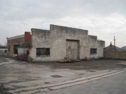
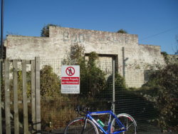
A newly cleared off (all foliage removed) 'Boot & Shoe Garage', opposite the old pub of the same name
Peckfield. Boot & Shoe.  Garage. 2.JPG
There looks to be a newly located caravan storage/sales/repair business starting there

This is on the 'old' A1, just by the point where the A63 joins from 'Peckfield Bar'/Leeds
Locals (or A1 travellers) may remember that there was a flyover here, to join the A1-south

How it looked 4 years ago
Peckfield. Boot & Shoe.  Garage. 1.JPG


Surprisingly. Geograph has none of the 'B & S', but this is the location, as it is now (map below picture)
The photographed garage is between the Motel, & the B1222 (on the south-bound side)
http://www.geograph.org.uk/photo/1910345


EDIT @ 20:05


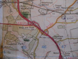
1988 map of the area, note flyover marked
Map 1.JPG

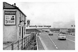
An old photograph??
(mid-late 60's?)
28576099_750148695181745_6381550433271481546_n.jpg
 
Last edited:
20180302_115823.jpg
Another work-orientated picture..........
 
Mid afternoon bike ride included part of the perimeter of RAF/USAF Molesworth via a hard surface bridleway. Home to a high security nature reserve by the look of it. I believe they may also be reading Kims il Jongs post here. Anyway its all probably moving to RAF Croughton soon.
The track on the inside is much better but for some reason they wont let you ride on it!

I've done the southern fence reached by going up through Molesworth village, there was a sign pointing to the right, the track was very narrow and lots of overgrowing brambles and rose briars and it came out near the main entrance. When I got home and checked the map that section didn't seem to be bridleway.................... at least I didn't get shot :smile:
 
Pontefract
Tuesday (sorry!!)
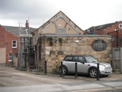
The rear gable of the neglected, ruinous Swales Yard Merchants House:cursing:
CornMarket
It was the 'Counting House' pub for a few years
Suspected to date back to the 1400's in parts (& oldest building in Pontefract, after the Church & the Castle)

Liquorice Way end of the building (Swales Yard, to the right)

DSCF4412.JPG Pontefract. The Counting House. 4.JPG

Seen here in better days; http://www.geograph.org.uk/photo/234676


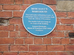
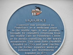
Liquorice Way plaque
Pontefract

On the side of what is now a Tattoo parlour

DSCF4415.JPG
 
I had a ride over to see my buddy/work-collegue Chris, who's been off work for a while with medical problems

During the visit I took a few pictures in his town

Hillman Avenger, at a garage on ClunterGate
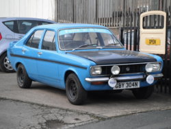
DSCF4444.JPG

The left-hand shop was a photographers/photography show
It's certainly been closed a while, as the (painted) phone number is '0924'
The '01...' numbers came into being in 1995 (I checked)
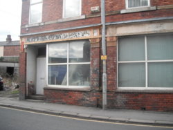
DSCF4449.JPG


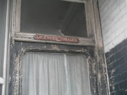
The right-hand show was a Tobacconists
It seems as though it's used for something now (storage?), as that window/blind look quite recent, & the door left that way for effect, or to make it look as though there's nothing work breaking in for?
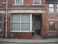
DSCF4450.JPG DSCF4455.JPG
 
Top Bottom