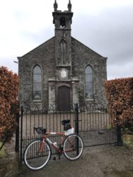
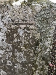
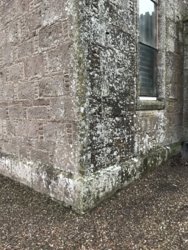
Nice offer, but sadly not. I’ve got nowhere to keep it. It would be a shame if it got broken up though.If I can get it, would you take it?
Post Office will not be removing it and those doing the work plan on just breaking it up.
You are using an out of date browser. It may not display this or other websites correctly.
You should upgrade or use an alternative browser.
You should upgrade or use an alternative browser.
The CC Trig Point bagger thread, now incorporating other interesting geographs
- Thread starter Drago
- Start date
Page may contain affiliate links. Please see terms for details.
Richard A Thackeray
Legendary Member
'Pack-Horse Bridge' (aka Little Bridge)
off Wakefield Bridge (aka Chantry Bridge)
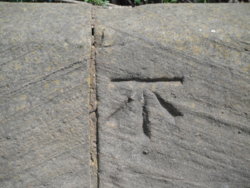
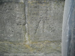
Masons mark is just to the right
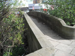
As seen from the riverwards side
The stream has long since silted up/re-routed/been culverted
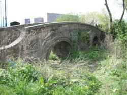
Location;
https://www.britishlistedbuildings.co.uk/101273509-packhorse-bridge-wakefield-east-ward#.WuX0uUxFzIU
http://www.geograph.org.uk/photo/281857
http://www.geograph.org.uk/photo/2761553
http://www.geograph.org.uk/photo/283977
On Wakefield Bridge itself, but well-weathered
Twice widened, hence the round arches; http://www.geograph.org.uk/photo/2761598
The original 14th C arches; http://www.geograph.org.uk/photo/281864
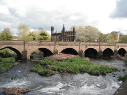
off Wakefield Bridge (aka Chantry Bridge)

Masons mark is just to the right

As seen from the riverwards side
The stream has long since silted up/re-routed/been culverted

Location;
https://www.britishlistedbuildings.co.uk/101273509-packhorse-bridge-wakefield-east-ward#.WuX0uUxFzIU
http://www.geograph.org.uk/photo/281857
http://www.geograph.org.uk/photo/2761553
http://www.geograph.org.uk/photo/283977
On Wakefield Bridge itself, but well-weathered
Twice widened, hence the round arches; http://www.geograph.org.uk/photo/2761598
The original 14th C arches; http://www.geograph.org.uk/photo/281864


fatjel
Guru
- Location
- West Wales
Went past this one today atop Llanllwni mountain.

Drago
Legendary Member
- Location
- Suburban Poshshire
If I can get it, would you take it?
Post Office will not be removing it and those doing the work plan on just breaking it up.
What post box are we talking about?
classic33
Leg End Member
This Edward VII, free standing at approx 6 foot high.What post box are we talking about?
Two, soon to disappear as they widen the road.
View attachment 371000
Over the railway on the A629
View attachment 371001
View attachment 371002
Free standing Edward VII Post Box
View attachment 371003
At the Punch Bowl, Huddersfield Road - Exley Bank junction.
View attachment 371004
Two marks on this pub recorded as visited earlier this year and recorded as Very Good.
View attachment 371005
Registered mark, Stainland Road(B6112). Not convinced
View attachment 371006
Appears this water pump was both a belt driven & geared directly to an engine.
View attachment 371007
View attachment 371008
One! from Huddersfield.
Upperhead Row, junction with an un-named delivery road for Sainsburys
Appears to have been recut, with a second going over the lower
View attachment 371009
classic33
Leg End Member
What's the number on the Bench Mark plate?Went past this one today atop Llanllwni mountain.
View attachment 406616
Drago
Legendary Member
- Location
- Suburban Poshshire
@classic33 If it weren't so big I'd have that. Hope its rescued and preserved.
fatjel
Guru
- Location
- West Wales
82858 is the only number i can see is below a strange sign
@classic33
@classic33
classic33
Leg End Member
Scrap at present is the plan.@classic33 If it weren't so big I'd have that. Hope its rescued and preserved.
Now about that plate?
Drago
Legendary Member
- Location
- Suburban Poshshire
Yes, yes please indeed!
fatjel
Guru
- Location
- West Wales
Seems what I've for years thought was the top of Llanllwni mountain is actually Mynydd Llanfihangel-rhos-y-corn -- 51.998642, -4.179163
Mynydd Llanllwni is about half a mile to the North and does not have a road running over it
What I and most locals think of as Llanllwni mountain is actually more than one mountain
In my defence I'm from that London what do I know
Mynydd Llanllwni is about half a mile to the North and does not have a road running over it
What I and most locals think of as Llanllwni mountain is actually more than one mountain
In my defence I'm from that London what do I know
Bobby Mhor
Legendary Member
- Location
- Behind You
Sadly, it is well known for being a deleted TuMPSeems what I've for years thought was the top of Llanllwni mountain is actually Mynydd Llanfihangel-rhos-y-corn -- 51.998642, -4.179163
Mynydd Llanllwni is about half a mile to the North and does not have a road running over it
What I and most locals think of as Llanllwni mountain is actually more than one mountain
In my defence I'm from that London what do I know

Bobby Mhor
Legendary Member
- Location
- Behind You
Out exploring yesterday
5 found,
here's three
Isle of Bute, Port Bannatyne

Isle of Bute, Ardbeg

Cowal, B836, Bridge

and a milestone

5 found,
here's three
Isle of Bute, Port Bannatyne
Isle of Bute, Ardbeg
Cowal, B836, Bridge
and a milestone
Richard A Thackeray
Legendary Member
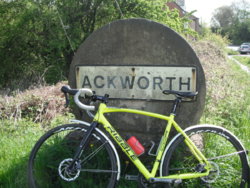
All within the boundaries of Ackworth
Today
On the A638 Wakefield - Doncaster road, about 8 miles south-east of Wakefield
Brackenhill
This part of the village was where there were long established quarries, & abandoned equipment still exists there
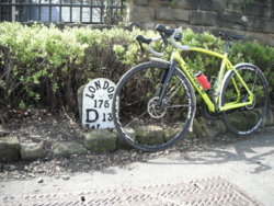
Wakefield Road, at the junction with Dicky Sykes Lane
At the right-hand end of this hedge; http://www.geograph.org.uk/photo/4099649
D = Doncaster
W = Wakefield
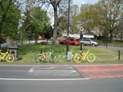
High Ackworth
The Market Cross, in the background, drinking fountain (dated 1870), & 'West Riding' signpost
Today
On the A638 Wakefield - Doncaster road, about 8 miles south-east of Wakefield
Brackenhill
This part of the village was where there were long established quarries, & abandoned equipment still exists there

Wakefield Road, at the junction with Dicky Sykes Lane
At the right-hand end of this hedge; http://www.geograph.org.uk/photo/4099649
D = Doncaster
W = Wakefield

High Ackworth
The Market Cross, in the background, drinking fountain (dated 1870), & 'West Riding' signpost

uphillstruggler
Legendary Member
- Location
- Half way there

