The CC Trig Point bagger thread, now incorporating other interesting geographs

Page may contain affiliate links. Please see terms for details.

Bobby Mhor

Wasn't born to follow
Location
Behind You
Visited nearby Greenock..
three found (two intentionally)
First a plaque to a famous son of the area..
bowers.jpg

Also a local connection to the Shackleton (great escape) expedition, ships carpenter 'Chippy' McNeish was born a mile away from where I write..
Chippy was the man who worked and prepared the boat on which they sailed from Elephant Island to South Georgia..he had earlier disagreed with Shackleton and his name wasn't put forward for the Polar medal, that kinda took the shine off my admiration for Shackleton.
Still a story worth reading about..
YouTube has lots of interesting stuff on the expedition.

Greenock
NS 2680 7722 Greenock, Union St, Wall.jpg
NS 3073 7485 Greenock, Shankland Rd, Wall.jpg
NS 3085 7478 Greenock, Shankland Rd, Wall.jpg
 

classic33

Leg End Member
View attachment 464195

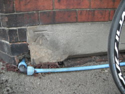
Possibly a 'listening' disc for those water board folk listening for leaks etc you see using the same technology of these chaps above?
The sticks were placed on the ground, not onto any markers placed into the surface. This from an ex local waterboard worker. Leaks could occur in any part of the pipe network.
 

PeteXXX

Cake or ice cream? The choice is endless ...
Location
Hamtun
A new to me benchmark I have ridden past loads of time and never noticed it before .

Not sure if @PeteXXX has seen it ?

View attachment 465019

It's hidden by a telegraph pole on Boughton green farm house just as you go into Boughton on the left .
I can't remember if I've done that one, or not
 
Hartleys Bridge
(over River Aire)
Lock Lane (A656)
Castleford


I've included it before, but it's a nice bridge

I've just got a different view now, & looking over it upstream, on the Aire

DSCF9049.JPG

DSCF9050.JPG

DSCF9051.JPG


It's on the 'crest of the bridge' on the side nearest the camera; https://www.geograph.org.uk/photo/1734909

https://britishlistedbuildings.co.u...d-central-and-glasshoughton-ward#.XM8ivHdFzIU


Lock Lane, becomes Barnsdale Road, after crossing the Aire & Calder Navigation Canal (see little map, in the Geograph link, above)
This is part of the Roman Road, which left the line of the Great North Road, at Barnsdale Bar
It disappears in modern Pontefract, passes the Garrison at Castleford (aka Lagentivm) & forded the River Aire, just upstream of the bridge, & is marked by a rather nice piece of ceramics


View: https://www.facebook.com/photo.php?fbid=10210813651529639&set=a.10208206049781225&type=3&theater
 
The Victoria Hotel
Main Street
Allerton Bywater

Spotted after a trundle alongside the River Aire, from the bend, which signifies the meeting of Lock Lane & Barnsdale Road
I don't mind riding up B R, in fact I enjoy that road, but I wanted to have a look along the riverside path

DSCF9055.JPG
DSCF9057.JPG


The path is marked, following the Aire, on the map below the Geograph picture (officially now also a bike-route)
https://www.geograph.org.uk/photo/4974723

http://victoriaallertonbywater.co.uk/index.html

The path, I actually followed; https://www.geograph.org.uk/photo/667527

The date-stone can't be seen in this picture, but its '1898', only a year older than my house
 
Last edited:
Top Bottom