The CC Trig Point bagger thread, now incorporating other interesting geographs

Page may contain affiliate links. Please see terms for details.
Thursday 20th
14.

Ballaugh Bridge
A3

This is the famous leap, by The Raven pub

IMG_6769.jpeg


IMG_6766.jpeg


https://www.geograph.org.uk/photo/32123


View: https://www.youtube.com/watch?v=sJ_9cASjZ4I
 
Thursday 20th
15.

Joey Dunlop Memorial
By 'Bungalow'
Mountain Road/A18

IMG_6780.jpeg


IMG_6781.jpeg


https://www.geograph.org.uk/photo/5770908
 
Last edited:
Friday 21st
16.
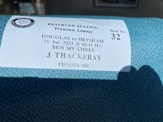
Our ferry arriving, about 05:30 (Ben My Chree)

IMG_6795.jpeg


We paid extra, once on board going to IoM, but walked to the Steam Packet offices, & pre-booked for the return crossing
It was £22/person, but all tea/coffee/biscuits/cake, was included
IMG_6802.jpeg

From our lounge, clearing Douglas harbour
IMG_6800.jpeg


IMG_6801.jpeg


IMG_6804.jpeg


Heysham approaching, Nuclear Power Station, in sight
IMG_6805.jpeg
 
Last edited:
Tuesday 1st
1.

Wharfe Bridge
Wetherby

This carried The Great North Road, until the very early 60's
Built in the 13th Century, widened in 1773 & again in 1826
Mentions are made of contributions towards the construction in 1233, & rights of passage/tolls, in 1286

Seen from 'The WIlderness' car-park
IMG_6881.jpeg


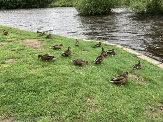
It's the fastest, I've seen it flowing for a while, seemingly too fast even for most of the Ducks!
IMG_6882.jpeg

The rebuilds/widenings, are very visible from underneath

IMG_6883.jpeg


IMG_6884.jpeg


'

IMG_6885.jpeg


IMG_6886.jpeg


The upstream side
IMG_6887.jpeg


https://britishlistedbuildings.co.u...er-wharfe-with-attached-war-memorial-wetherby
https://www.geograph.org.uk/photo/7083628
https://www.geograph.org.uk/photo/4542040
 
Last edited:
Tuesday 1st
2.

Wharfe Bridge
Wetherby

This carried The Great North Road, until the very early 60's
Built in the 13th Century, widened in 1773 & again in 1826

Looking south ('downstream' to the left)
IMG_6889.jpeg


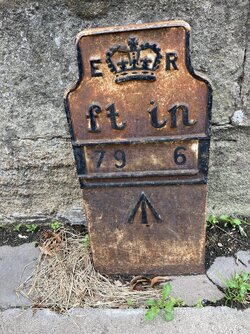
This plate is adjaecent to the green telecoms cabinet
IMG_6890.jpeg

On the same side
IMG_6891.jpeg


Looking north, the 'GNR' went straight ahead, missing the Market Place
IMG_6892.jpeg


https://britishlistedbuildings.co.u...er-wharfe-with-attached-war-memorial-wetherby
https://www.geograph.org.uk/photo/7364241
https://www.geograph.org.uk/photo/6042381
 
Last edited:
Tuesday 22nd
1.

Hay
NewLands Lane
Normanton

IMG_7159.jpeg


In the OS map, l’m within the blue circle, looking south-west
The pond is at my ‘2 o’clock position’/where the small trees are to the right
https://www.geograph.org.uk/photo/2040381
 
Last edited:
Top Bottom