The Rail Enthusiast thread

Page may contain affiliate links. Please see terms for details.
I may have added previously. but I'm not searching 1,100+ pages

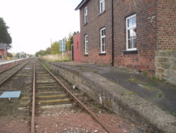
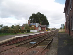
Battersby Junction

The terminus (now) of the Esk Valley Branch Line
Previously it was a through Station, via Stokesley, joining the Middlesbrough - Northallerton line
Now it's the end of the line, & the switch for trains from Middlesbrough & Whitby

http://www.disused-stations.org.uk/b/battersby/
http://www.geograph.org.uk/photo/3273067


Thursday 22nd October 2015
PA221543.JPG PA221544.JPG


The sleepers have certainly seen better days, & plenty of bad winters!!
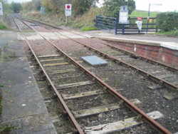
PA221546.JPG
 
I may have added previously. but I'm not searching 1,100+ pages

Eshald Lane
(off Fleet Lane)
Oulton

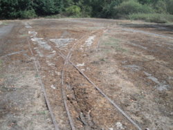
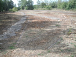
Remnants of the tracks from Oulton Brick-Works (beyond my Octavia, & the hedge)
They lead to Water Haigh Colliery that had been located behind me
Monday 6th April 2015


Oulton. Esholt Lane. 1.JPG


They are the lines crossing the road between the OO of Woodlesford
https://newwoodlesford.xyz/water-haigh-colliery/


More information, on the wonderful 'Secret Leeds'
http://secretleeds.com/viewtopic.php?t=3171
 

NorthernDave

Never used Über Member
The embankment that forms the horizon is the former Leeds - Wetherby railway line, now destined to vanish forever taking with it any hopes of it reopening, under the East Leeds Orbital Road (ELOR) - a super Outer Outer Ring Road dual carriageway that will solve all the cities traffic woes in one fell swoop*
IMG_20180811_120453886r.jpg

* - this is almost complete nonsense and no-one outside the council and their partners think the ELOR will do anything other than attracting more to the residential, business, commercial and entertainment developments that will be built alongside the new road.
 

mybike

Grumblin at Garmin on the Granny Gear
The embankment that forms the horizon is the former Leeds - Wetherby railway line, now destined to vanish forever taking with it any hopes of it reopening, under the East Leeds Orbital Road (ELOR) - a super Outer Outer Ring Road dual carriageway that will solve all the cities traffic woes in one fell swoop*
View attachment 423936
* - this is almost complete nonsense and no-one outside the council and their partners think the ELOR will do anything other than attracting more to the residential, business, commercial and entertainment developments that will be built alongside the new road.

They haven't learned from the M25.
 
They haven't learned from the M25.

Or indeed pretty well any major motorway development.

There's a science to this called induced demand, which has been around for many decades and shows that if you build roads there will be more traffic, but if you restrict road building and instead invest in railways or cycleways people will change their transport choices, but hey, who needs facts when you can get votes by offering simplistic solutions to problems?
 
I'll add this here, as it's on rails

Out this morning, but not for long
As part of the route when in Stanley, I decided to ride up part of what locally are known as 'the Nagger Lines'
This was a horse-drawn 'wagon-way' (one of two in the area - the other is purported to be the Worlds first public railway, where private wagons could be ran)

Nowadays, it's a public footpath/bridleway, part of the 'Trans-Pennine Trail', part of the 'Wakefield Wheel' (70-odd mile cycle route), & one of the sections of the 'Leeds Country Way' that cross the boundaries onto 'WF' soil

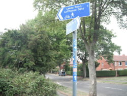
Looking uphill, towards Canal Lane & Lofthouse Gate
It's an inclined plane, once it's crossed Rooks Nest Road

Follow it here, 1908, at the top, where it heads west towards Lofhouse Colliery, the northwards embankment is still there, I used to walk my Collies along it, when we lived in Stanley
https://maps.nls.uk/geo/explore/#zoom=16&lat=53.7138&lon=-1.4883&layers=168&b=1

DSCF6122.JPG DSCF6125.JPG DSCF6127.JPG
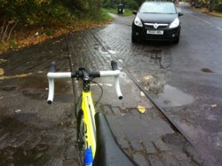
The rails are still embedded in Lime Pit Lane, & this section is close to 'Deep Drop Cottage', which is such named in mermory of a small pit here & its calamity
21 died!!
https://www.stanleyhistoryonline.com/Deep-Drop-Colliery-Explosion.html

Ribble. CGR. 18.jpg

It ran from collieries in the Lofthouse/Outwood area, to the Aire & Calder Navigation Canal. at Stanley Ferry
That was taken the day that my 'Mint Sauce' top-tube decal arrived, it was waiting when I got home

http://www.geograph.org.uk/photo/978693
http://www.geograph.org.uk/photo/2941702

http://www.cycling-wakefield.org.uk/downloads/CycleLeaflet13StanleyFerryCarrGate.pdf


At one point it passes under the Lofthouse Junction (Methley to Lofthouse & Outwood) line which ran through the middle of Stanley
 
Last edited:

classic33

Leg End Member
Not the best of images, sorry, as it was a bright day, & I only had iPhone with me at that point
Yesterday
View attachment 425305


It's the track of the old Savilles Garden Centre (10" gauge) railway, at the top of 'Garforth Cliff', on the A63 between Garforth & 'Peckfield Bar'


View: https://www.youtube.com/watch?v=6oYBbOE7szE


The tunnels entrances are still there, or were in April 2017


Stolen, after it closed, so it appears; https://www.yorkshireeveningpost.co...-leeds-garden-centre-seen-on-the-m6-1-7538813

Is the BM in the right thread?
 
Top Bottom