
You are using an out of date browser. It may not display this or other websites correctly.
You should upgrade or use an alternative browser.
You should upgrade or use an alternative browser.
The CC Trig Point bagger thread, now incorporating other interesting geographs
- Thread starter Drago
- Start date
Page may contain affiliate links. Please see terms for details.
classic33
Leg End Member
A few from around what has been the local airfield(100 years ago), infectious disease hospital, local zoo, race course, WWII auxillary airfield, and now mainly used by a golf course/club.
Note the holes.

East Wall

HCWW marker, cast iron so seldom just thrown away.

Mile Stone at a junction. Caused a slight hold up. One driver was so engrossed watching me, that he missed a change of lights.


Note the holes.
East Wall
HCWW marker, cast iron so seldom just thrown away.
Mile Stone at a junction. Caused a slight hold up. One driver was so engrossed watching me, that he missed a change of lights.
Attachments
Last edited:
D
Deleted member 23692
Guest
Without knowing it's location it's most likely a pylon for an aerial ropeway serving the mining/quarrying industry of oldAnyone any idea what this could be, there was another one about 1/4 mile away, it's up on the Teesdale Moors
View attachment 452249
biggs682
Itching to get back on my bike's
- Location
- Northamptonshire
Sure i have seen similar marking on another local church but can't remember which and where
D
Deleted member 26715
Guest
https://www.google.co.uk/maps/@54.5...4!1sgNCzVCJD_7U6-lYGJv-ycQ!2e0!7i13312!8i6656Without knowing it's location it's most likely a pylon for an aerial ropeway serving the mining/quarrying industry of old
D
Deleted member 23692
Guest
Cheers for that. I wasn't even close

It's an 'observatory' (also referred to as a pillar) for the Grassholme Tunnel - an aqueduct which links Grassholme Reservoir to Hury Reservoir, built by the Tees Valley Water board between 1901 and 1914.
All the above derived from beautiful old maps , and the power of the internet
 -https://maps.nls.uk/geo/explore/#zoom=17&lat=54.5811&lon=-2.1043&layers=168&b=1
Now I've posted that link, I can guess what what most of you will be doing tonight
Happy exploring

D
Deleted member 26715
Guest
There are days when just 1 'like' is not enoughIt's an 'observatory' (also referred to as a pillar) for the Grassholme Tunnel - an aqueduct which links Grassholme Reservoir to Hury Reservoir, built by the Tees Valley Water board between 1901 and 1914.
D
Deleted member 23692
Guest
CheersThere are days when just 1 'like' is not enough
I use that site most days at work and it's superb - especially the 25" to the mile sheets. the downside is that it only covers one epoch
https://www.old-maps.co.uk covers many epochs, but the available scales and coverage are sometimes limited.
Between the two and the web I can I can get answers whilst getting paid
classic33
Leg End Member
Cheers for that. I wasn't even close
It's an 'observatory' (also referred to as a pillar) for the Grassholme Tunnel - an aqueduct which links Grassholme Reservoir to Hury Reservoir, built by the Tees Valley Water board between 1901 and 1914.
All the above derived from beautiful old maps , and the power of the internet
Now I've posted that link, I can guess what what most of you will be doing tonight
Happy exploring
And a LIDAR image of part of that
D
Deleted member 23692
Guest
I get to play with LIDAR too, which is great for finding things in woodland ")
OP
OP
Drago
Legendary Member
- Location
- Suburban Poshshire
You find all sorts of strange things in the woods...

classic33
Leg End Member
One from the Copper Kettle

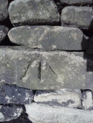
Any ideas on these two?

Numbers are regular on these, placement isn't. No railway or canal nearby.

Unable to get in for this one

Whereas this has two uses. BM bottom right.

Has the end been reached?

Saint John's Church, Warley.
Bench mark has been covered.
Marked as a trig point as well

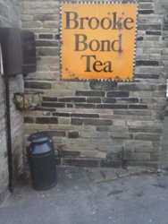
Just up the(Burnley) road.

Mark partially hidden

By these

Any ideas on these two?
Numbers are regular on these, placement isn't. No railway or canal nearby.
Unable to get in for this one
Whereas this has two uses. BM bottom right.
Has the end been reached?
Saint John's Church, Warley.
Bench mark has been covered.
Marked as a trig point as well
Just up the(Burnley) road.
Mark partially hidden
By these
Last edited: