classic33
Leg End Member
Just up the road from the second picture in this post, opposite side of the road.

How many schools have a guard house like this?

The one this replaced was simply broken up and thrown.

Gibbet Street, near the high level railway.

Further down

Willing to trust a name like this?

And how the name came about.

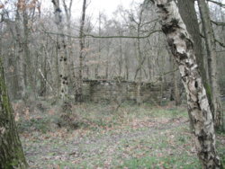
It's origional location was further East, around where the block of flats stand in the background.
How many schools have a guard house like this?
The one this replaced was simply broken up and thrown.
Gibbet Street, near the high level railway.
Further down
Willing to trust a name like this?
And how the name came about.
It's origional location was further East, around where the block of flats stand in the background.
Last edited: