Your ride today
1/5/24
What is it With This Bloke and Towpaths, Anyway?
A spur of the moment decision to do a ride which I’d previously planned following my enjoyable Chester towpath/Greenway/Deeside path one. I should have started earlier (it will be on my tombstone) but as it was persistently not-raining, and who knew what tomorrow might bring, I thought I’d better grab the chance. Another opportunity to stretch the mileage on the allegedly urban-recumbent Spirit.
From Home to Waverton
So, with my just-in-case rain jacket in with my usual stuff I set off in the direction of Darnhall bridge. No problems here, the traffic lights were obliging today and I steamed up the other side of the dip. I was soon turning off on to Hickhurst lane, following it to Eaton, then to the junction with the A49 at Four Lane ends. Near the end of a long downhill I turned right to the lane to Tiverton, to be confronted with a Road Closed sign. Taking the gamble that it was nothing that an enterprising cyclist wouldn’t be able to get through, I wriggled through the cones. A pleasant village with no sign of roadworks.
However, once through the village more Road Closed signs loomed, and some contractors’ vehicles blocked the road. A fortunate coincidence had provided a footpath alongside the road, separated from it by a strip of grass, so I followed that. It came back to the road beyond the closure. I trundled on in the direction of Huxley, stopping in a field gateway to take a photo of the bike with Beeston castle in the distant background, brooding on its crag.
Steady pedalling brought me to Huxley, where I passed through on the road to Waverton. It took longer than expected to get to Waverton, where I took a break on a bench by the Shropshire Union Canal at Egg Bridge.
It was 3:30 by now, so I didn’t want to hang around too long. The plan was to follow the towpath through Chester and on to the end at Ellesmere Port, where it meets the Manchester Ship Canal. Bridge 119 to beyond bridge 147.
Waverton to Bridge 136
I set off not intending to dally, other towpath traffic notwithstanding. The average speed would be pretty low, what with stopping to let oncomers pass, slowing down where the towpath narrowed under bridges, etc. Soon after I started off, a jogger appeared in my mirror then fell behind until I negotiated a bridge outside Christleton when he got closer again. I stopped to photograph some canalside cottages and let him past.
I followed him for a while and he was managing an impressive 7.4 mph. Beyond Christleton more people were about, and as I got into Chester progress became very slow. Although most of the canalside cafes were closed, there were many schoolkids about as it was that time of day. I can’t help thinking that the quality of life must be pretty good if you grow up in Chester.
I followed a couple at walking speed through the deep and narrow canyon where the canal runs far below the city walls before passing them at the entrance to Northgate Locks.
As I reached Northgate locks it became really bonkers. I saw a mountain biker cross a narrow lock gate bridge then hang on to the gate with a 6ft drop to the path, obviously intending to meet it where it sloped upwards to meet the ledge he was on. “that looks pretty precarious”, I said, then from behind came “Cyclists coming through” and a bunch of mountain bikers, male and female, passed me and the pedestrians on either side before rattling downhill to the bottom of the locks. I rattled down more sedately. The slope has raised strips of brick placed horizontally at intervals, obviously intended to give horses and boatmen grip for pulling boats. For anything on wheels it gives a rough ride. They are also found under bridges. At the bottom of the locks I followed the towpath sharp right under a bridge to Tower Wharf. I climbed a steep ramp, crossed over then down a spiral ramp and eventually got on the towpath again. Up to this point it had been on the left hand side heading for Ellesmere Port: now it was on the right hand side. It was still fairly smooth tarmac in a good state of repair here and reasonably wide, too.
As I passed a bridge I noticed that the access had steps and a masonry trough so you could wheel your bike up. I nipped up and took a photo.
There were many well signposted access points and at one of them was a familiar figure: a marker post for NCN 45, Mercian Way, in the form of a helmeted Saxon warrior.
He has a twin at Whitchurch where NCN45 uses a disused railway line. That one is in a natural metallic colour, this one has been painted black. There could be many more dotted around the countryside as the Mercian Way runs between Chester and Salisbury. Maybe the only way to find out is to travel its whole length. Another project for my old age (which is actually, now).
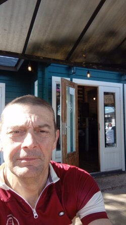
As I was taking a picture a woman with a pushchair came up and offered to take a picture with me in it. I took her up on her kind offer and thanked her. I have to conclude, though, that the marker is in better nick than I am. She went on her way, and just as I was about to set off a chap on a mountain bike arrived. “How do you balance on that thing with those tiny wheels?” he said. “Well, somehow I do. I’ve done 24 miles today and hope to make it about 55 by the time I get home” I said. “Well, good luck”, he said, and turned off at the access point.
Blimey, all this socialising. Time was getting on, and even with the good condition of the towpath, it’s slower than on the road.
I pressed on, tinging my bell at the helpful pushchair lady, and she moved over to let me pass. Apart from the occasional jogger and cyclist there were less people about. The surface changed after passing a bridge, whose number I didn’t recall, from tarmac to a whitish fairly coarse gravel which was still decent enough, though not so comfortable. Although time was slipping by faster than I’d liked, I expected to get home not too much later than I’d planned.
A girl in jogging gear appeared from a side entrance and waited for me to go past. As she slowly disappeared behind in my mirror I wondered if she was wearing shorts. It wasn’t a bad day, but maybe a bit chilly for those.
I plodded on. Although having left Chester behind, with the scenery becoming more rural, the distant sound of traffic was always present. I stopped to look at my map and could see that the M53 wasn’t far away to the East, and not far ahead its interchange with the M56 straddles the canal near the village of Stoak, then it stays close to the canal, crossing it twice before the canal’s terminus at Ellesmere Port.
The female jogger passed me while I was considering all this. The mystery was solved. At first I thought she’d forgotten her trousers. Had she escaped from somewhere? Were there teams of anxious carers even now scouring the countryside fearful for her safety? None of the above. Pale pink leggings was the answer. Behind me, in the distance, a male jogger was visible. I got going hoping to make up some time. The first jogger turned off at the next bridge, and the surface changed to a fine sandy coloured gravel, easier to ride on than the whitish stuff. In my mirror, I saw the male jogger distantly turn off at the bridge too.
The old bridges on this stretch had a noticeably narrower towpath under them than previous ones, mostly with the aforementioned brick ridges which made for bumpy going.
I reached Bridge 136. I’d made a point of remembering this bridge in the absence of an easy road route back from Ellesmere Port to Mickle Trafford, so would have to return along the towpath to this point before rejoining the road. Still, I believed that the towpath would be at least as good as it had been so far. According to Pearsons Canal Companion, “the towpath is metalled throughout and popular with walkers and cyclists alike”. In the short time since my edition was published the surface has deteriorated somewhat beyond Bridge 136. An interesting contrast between Bridge 136 which is the original, and the adjacent 136A which is a newer concrete one which now carries the road to Stoak. The towpath under 136 is smooth but narrow, and then widens as you go under 136A. The newer bridges on this stretch are more roomy underneath for towpath users but the originals remain narrow and with the brick ridges underfoot.
Bridge 136 to the Waterways Museum
I was heartened at first to come out from under Bridge 136A to see a black tarmac surface again on the towpath but my joy was short lived when it narrowed and began to show potholes. It is definitely narrower than the towpath nearer to Chester. My expected quick progress never materialised, and even with the suspension it was a rather uncomfortable ride. I would recommend anyone riding this stretch to give themselves extra time to do it.
Looking back. The taller you are, the closer to the water you have to go to avoid bumping the brickwork, same with a wide bar bike. It looks wider than it is, due to the wide angle lens. It's actually pretty narrow.
Anyhow, I trundled doggedly on. At one point there is a long line of moorings on the other side, with an appearance of permanence, sheds, gardens etc. Some of the boats looked rather neglected with fading paint, weeds growing out of the hessian bumpers. One in particular with the name “Ghost” looked particularly abandoned though someone must be attending to it as it was still afloat.
I stopped to let a man preceded by two dogs, with a can of beer in his hand, come under a bridge. “Would you like a hand with that?” he asked. “No, I’m fine, thanks” I replied. I carried on.
The surroundings as the town encroached were rather oppressive, and it looked rather neglected. Despite this I passed a couple of blokes fishing in the canal. Approaching the bridge where the M53 crosses over at an acute angle was like coming to a long gloomy concrete tunnel. Fortunately there was a railing between the towpath and the water. At the end of the bridge was an A frame barrier standing in splendid isolation next to a muddy path.
After passing through this bridge things opened out and the final bridge, 147, provided a frame for the vista that opened beyond.
I’d expected to be too late to visit the museum when I started out. It closed at 4pm, but I’ve been there before. It’s worth a visit. Even the car park is interesting, being next to the Manchester Ship Canal.
Some years ago I was in the car park when I was surprised by the sound of a ship’s horn, before a largeish coastal vessel swept majestically by en route to Salford. I could hear the rumble and thump of slow turning machinery inside its cliff like sides. No such luck today.
It was 7:30 pm. I took some photos and felt the relief of having achieved my objective. Another one for the bucket list. Now I would have to get back to Bridge 136 as best I could, and make up time on the road.
Ellesmere Port to Bridge 136
As I wended my way back down the towpath I couldn’t help noticing a large overweight man walking through one of the concrete bridges. He was tottering and was possibly drunk. I held back and gave him plenty of room so I could get past him beyond the bridge. He could have been harmless but I didn’t fancy an early bath. As I went past he said “Hi”, I said “Hi” and I pressed on. The light was noticeably fading but it was a clear evening so I hoped the light would last. It looked like I’d have the chance to try out the Supernova headlight in due course.
A few joggers passed the other way, a mountain biker squeezed past, muttering “Cool bike”.
I trundled on, counting down the bridge numbers. Finally 136A then 136 loomed. I stopped to look at the map. Then I walked back and forth for a bit. All that bumping and vibration was taking its toll. “Towpath bashing” is all very well but I felt that in the last few miles I was the one getting bashed. This bike with its suspension is normally very smooth.
Bridge 136 to Chester Greenway
Out on to the road. Quite some unexpected undulations before I reached Mickle Trafford. Feeling strong, such a relief after the constant level of the towpath where there’s little variation in revolutions or power output, hardly any freewheeling.
Through the village, then I came to the entrance to the Chester Greenway. A group of walkers were on their way in so I gave them room to pass then stopped at a handy picnic table and had a snack. I couldn’t resist going up the slope to where the Greenway itself starts, on the old railway, to have a look. Then I freewheeled back to the entrance.
Chester Greenway to Waverton.
It was still light but I felt time pressing so I was soon on the way to Guilden Sutton, then to the A51. Left for about a quarter mile then right into Cotton Lane. I went on to where it becomes Plough Lane then left to Waverton at the next crossroads.
Waverton to Home
At Waverton I turned left on the road to Duddon and despite it being largely uphill felt I was going well. Across the A51 at Duddon into Willington Lane. This started easily, to lull me into a false sense of security about the climb ahead.
I knew that after the next crossroads there was a quite stiff climb, just as my legs were starting to feel the effects of today’s unaccustomed miles. It was also becoming quite dark, though the dynamo headlight was proving very effective. Just got to keep plugging along. I reached the crossroads, then started climbing. It seemed to go on longer than I remembered it in daylight. I stopped for a breather and a Kit Kat, then pressed on. Finally I reached the next crossroads where the slope eased, a little more climbing then downhill to Utkinton Hall. A short climb and then a glorious cooling downhill, a foretaste of things to come as another steep climb followed. Then the slope eased again and the long downhill to Cotebrook began. Soon I was at the A49, nicely cooled down.
Across the A49 into Oulton Mill Lane, climbing to the next crossroads, into Brownhills Road, right into Rushton Lane with a dip then a climb alongside the red brick wall of Oulton Park. Through Rushton, then left into King’s Lane. Here a breeze sprang up, and after getting up speed I didn’t need to pedal for a mile or so, apart from a few turns to maintain speed after a short dip. It felt quite surreal, bowling along in the dark, speed limited only by what I could see in the narrow blaze of light ahead. I hadn’t seen any traffic, either, since crossing the A51 at Duddon.
Left at a T junction into Hickhurst Lane and the following breeze helped me along here, too though I needed to pedal steadily. I reached the T junction with Hall Lane where I turned left and the wind assistance stopped. I rolled on, stopping in a farm entrance briefly then continuing to Darnhall and the dreaded traffic controlled bridge and short sharp climb afterwards. I took a run at it with the lights on green but came to a stop near the top. Need to do more miles, obviously. If I want to stretch out my mileage, maybe I need to find a less hilly route back. After a short breather I got going again and before long reached my back gate, at about 10:30, put everything away, showered, suppered, and headed for bed where I slept like a log.
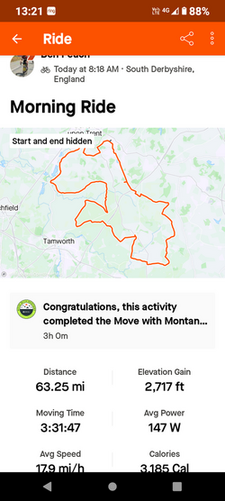
Mileage 54.55. Max speed 24.6 mph. Average 7.1 (much towpathery). According to Garmin.
Ascent 1217 ft. According to Bikehike. Edited to add: second half century this year, none of your metric stuff here! Might even manage an actual century later this year if the fates are kind.


")

 From Plealey I cut across to Arscott for a change then rode to Annscroft and climbed Lyth Hill from that side. On the climb I slowly overtook a runner just before Lyth Bank and was convinced he would come back past me as I strained up the steepest bit - he didn't though. I caught a 4x4 on the descent along the rough track and the driver waved me past as I was going much quicker.