Game: Name that road!

Page may contain affiliate links. Please see terms for details.

roubaixtuesday

self serving virtue signaller
How about this one:


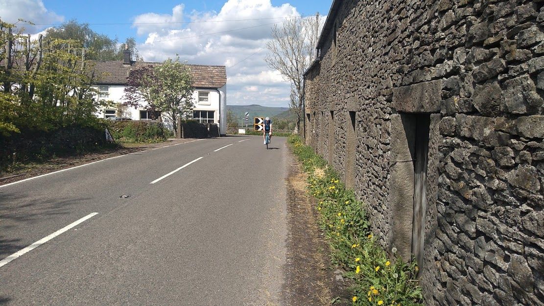
Shadows suggest we're looking East or perhaps SouthEast.

The distinctive peak reminds me of Win Hill, overlooking Edale in the Peak but there's no road I can see that would give that view.

Buildings look North Yorkshire ish to me. Maybe Cumbria or Lancashire?

In other words, I've got no clue, other than Northern England. Will probably turn out to be on the Isle of Wight, on that basis.
 

BrumJim

Forum Stalwart (won't take the hint and leave...)
On the right lines. A bit further South, but certainly not as far as the IoW.
 

Aravis

Putrid Donut
Location
Gloucester
I was certain it had to be the Peak District, and the features on the distant hillside looked right for Win Hill viewed from the south. Spotted it eventually:

573841


On the B6049 a couple of miles south of Bradwell.
 

BrumJim

Forum Stalwart (won't take the hint and leave...)
I was certain it had to be the Peak District, and the features on the distant hillside looked right for Win Hill viewed from the south. Spotted it eventually:

View attachment 573841

On the B6049 a couple of miles south of Bradwell.
Correct. A wonderful day on The Castleton Classic Audax in 2019. Was going to do it again last year, but everything was cancelled.
 

Aravis

Putrid Donut
Location
Gloucester
Right then...

Something very different. This was probably taken around 1965-1967, and it seems some drivers were just as reckless then as they are now. All the features visible are still there. The straight part of the hill in the background was newly built at this time; the line of the old road can be seen curving to the right.

There are signs which suggest the Inn on the right would be well at home in these conditions, but we're a long way from the sea.

573913
 

MontyVeda

a short-tempered ill-controlled small-minded troll
I'm not convinced as so much is different, but the pub itself looks about right, and there is a potential source for the flood behind the google car so...

573950
 

MontyVeda

a short-tempered ill-controlled small-minded troll
I've just been searching the old maps to see if the building beyond the pub is new or not.

I found it searching images for 'the ship, pub, Gloucestershire' and keeping an eye out for the white stripe on the front... it's nowhere near Gloucestershire, but it is very close to (and reminded me of) one of Aravis' previous entries in Kingsclere.

oh bugger
 

Aravis

Putrid Donut
Location
Gloucester
Great work guys, what can I say?

For the avoidance of doubt, @MontyVeda is completely correct. If you were to shunt back a little you'd be able to see the gateway (gate replaced). Quite a substantial hedge to have established itself in 50 years or so. I can't shed any light on the extra buildings I'm afraid.

So I think that's another one for @MontyVeda. Bad luck @Dogtrousers I missed out of the Pwllheli one in similar circumstances. :sad:

Edit: I hadn't realised the pub sign was (almost) decipherable, but I imagine the clue was still helpful.
 

MontyVeda

a short-tempered ill-controlled small-minded troll
Without the clue I'd have been clueless.

[edit] I hate this thread because I get so engrossed in it... I put some spuds on to boil about 90 minutes ago, i won't be eating them :sad:

OK, this is an easy one... fingers on buzzers!

573957
 
Last edited:
Top Bottom