Game: Name that road!

Page may contain affiliate links. Please see terms for details.

Aravis

Putrid Donut
Location
Gloucester
This was the scene a few minutes earlier...

574098


and from Google Maps about 50 years later:

574100
 

shnjmsn

Über Member
Location
Somerset Levels
This was the scene a few minutes earlier...

View attachment 574098

and from Google Maps about 50 years later:

View attachment 574100

Based on the above info and the pic showing what I think looks like a Johnsons cleaners sign above a KFC sign, I've google the Johnsons stores around Bristol and Google mapped but nothing looks anything like it.........:laugh: May of course not be a Johnson's sign at all !
 

Aravis

Putrid Donut
Location
Gloucester
That's very close. Strictly speaking it was then the A34, but you have the right roundabout and you're looking in the right direction (North). The first of my dad's pictures shows the vehicle exiting the roundabout - roughly here:

574127


This event created a lot of excitement but I find no mention of it online. @Dogtrousers' diagram* is illuminating as it shows where all the sections were manufactured. It partly answers the question of when did all the other bits pass by, something I'd been wondering ever since. I have some copies of Newbury Weekly News from around that time. It's possible one of my dad's pictures was used, but if I can find that I will have been seriously lucky.

I see there's a thread on Concorde from about 11 years ago, so I think I might post the fully story there.

* and kudos for finding the link to Southampton.
 

swansonj

Guru
That's very close. Strictly speaking it was then the A34, but you have the right roundabout and you're looking in the right direction (North). The first of my dad's pictures shows the vehicle exiting the roundabout - roughly here:

View attachment 574127

This event created a lot of excitement but I find no mention of it online. @Dogtrousers' diagram* is illuminating as it shows where all the sections were manufactured. It partly answers the question of when did all the other bits pass by, something I'd been wondering ever since. I have some copies of Newbury Weekly News from around that time. It's possible one of my dad's pictures was used, but if I can find that I will have been seriously lucky.

I see there's a thread on Concorde from about 11 years ago, so I think I might post the fully story there.

* and kudos for finding the link to Southampton.
Not sure I can claim this one as I didn't actually get the right road! Had a brain fade about which direction "earlier" was and was looking for the road the load was on before the roundabout not after it. (I found the roundabout by wasting most of an afternoon googling every single KFC in the south of the country^_^
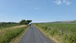
) But as you've given the game away it would be hard for anyone else to claim it either... if that is your wish, I will post another picture tomorrow. Coast, mountain pass, or tree-line, featureless hill?
 

Aravis

Putrid Donut
Location
Gloucester
@swansonj it's definitely over to you. I could hardly just say "you're wrong" without giving any indication how close you were. And with that amount of searching you deserve to get something from it. :laugh:

I was hoping you'd all figure out it must have come from the south coast, headed for Bristol, and think about what roads would have been suitable at that time. It couldn't use the A34 between Whitchurch and Newbury at the time because of tight bends under disused but yet to be demolished railway bridges. So it came through Kingsclere, my village, late at night and stopped presumably at Greenham Common, before continuing through Newbury and onto the A4 in the morning.

But having read the article linked by @Dogtrousers above I'm intrigued to know why this particular piece travelled by road. You can see broken branches in the first picture and I have a feeling it was expected much earlier; it was quite a struggle. A project for a rainy day. OK, let's say tomorrow. :rain:
 

swansonj

Guru
Edit: Damn! I realise on checking that my first attempt wasn't actually a road, it was a cycle trail, which I don't think is in the spirit of this thread. Apologies. Try this instead:
574206
 

Attachments

  • P1090268.JPG
    P1090268.JPG
    117.6 KB · Views: 4
Last edited:
https://tinyurl.com/y6sk95hv
HP.JPG

Hardknott Pass, about a kilometre before the summit on the west side.
Edit: good call, having that scheduled photo stop just there ;-) Did you manage to get going again on that 30% section?!
 
Last edited:

swansonj

Guru
https://tinyurl.com/y6sk95hv

Hardknott Pass, about a kilometre before the summit on the west side.
Edit: good call, having that scheduled photo stop just there ;-) Did you manage to get going again on that 30% section?!
Spot on.

I seem to recall proceeding up the higher stretches of Hardknott at a higher heart rate than is sensible, because, as you suggest, there's a big incentive not to stop for fear of what happens when you try to start again. A year before that picture, I'd done it with my then-skinny nephew on a tandem (he's now a frighteningly strong but very well adjusted adult) and that was easier in some ways - the power-to-weight ratio was worse but there was no danger of lifting the front wheel.
574247 574248

Over to you.
 
Hardknott Pass on a tandem with micro-stoker: impressive stuff !

Matching this to Streetview will be easy since I've run out of photos, hence this is a Streetview capture. It's not a terribly large clue to say ..... Hmmm.... actually, it was still too much of a clue, so no clues at all for the time being :-)

aphotosmall.JPG
 
Top Bottom