Back home having done 102 miles of recce on a really nice day of sunshine and tailwinds
I'll need to make a small change to the route as the seafront at Rhos on Sea is closed for about half a mile. I'll publish the final routes this weekend. I'll also get the ride notes out too
There is also a sandy section immediately after the Bike Hub in Rhyl. It's only about 50m where I had to get off and push so it's not such a big deal
Having done the climb out of Flint it is definitely better than last year's climb. There are some 12% short ramps but generally it was pretty steady
Some photos to whet your appetite
Budworth Mere
Prestatyn
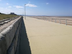
Beautiful Rhyl
Sandy section immediately after Bike Hub
Llandudno in the distance
Post ride recovery food


 and brings back memories I'm trying to bury