Your ride today....

Page may contain affiliate links. Please see terms for details.

roubaixtuesday

self serving virtue signaller
Brilliant forecast, took the chance for a last century of the year.

Dawn obliged by rising just at the first summit, but bloody hell it was cold, -4 by my gizmo.

Feat. Axe Edge, Matlock, Hathersage with a slice of honey pistachio and pea cake(!), Snake Pass.

100.3 miles, 2750m climbing.

1000006406.jpg


1000006507.jpg


1000006508.jpg


1000006512.jpg
 

Mike_P

Guru
Location
Harrogate
My ABC tour of villages etc, which had moved onto the second word second letter, had got stuck after the ride to Leeming Bar on May 20 and the sunny day seemed to be an opportunity to advance it. The Defy headed west along Penny Pot Lane
1697388168239.png

The head/cross head wind was plainly stronger than forecast with all the wind turbines at Knabbs Ridge being entertained by it.
Relief from the wind came in the northwards ride on the B6451 across a deserted A59, it being closed at Kex Gill (aka Cote du Blubberhouses). The head wind returned west and north west bound to Thruscross crossroads. The plan was to take the road over the reservoir dam and then that across the moor beyond to join the A59 beyond the point of closure. A row of cones across the road implied all was not well.
1697388389349.png

On enquiring of the person attending to the cones I was advised the road was only passible as far as the reservoir. Getting to Bolton Abbey is proving somewhat difficult with unfavourable wind directions on days that otherwise seem fine.
I decended away from the wind into a tributory valley leading onto Nidderdale; the valley channelling the wind as a useful tail wind and immediately four PRs.
1697390681037.png

A pheasant flew across straight in front me and then I had to pull out to overtake a cat once a car going the other way had passed! It was walking along the very edge of the road completely oblivious.
Wider roads lead me through Darley and Birstwith. Up the western Clint Bank and down the eastern, over a seemingly intact Hampsthwaite bridge and up Hollins Lane, and thence home.
22.91 miles 1660ft climbed 12.1mph avg
1697391474090.png
 
Last edited:

Jameshow

Veteran
Just short ride up to langbar and then back via cow and calf 3 hills in less than 30mioes ouch!

Cold but bright but I'm not sure it was cold enough for tights though.

Saw another pair of tourers each with one pannier come towards me and Bolton Abbey any one on here.

Was on the race bike which seemed a bit of a odd feeling on such a cold day.

IMG-20231015-WA0002.jpeg


IMG-20231015-WA0004.jpeg
 

geocycle

Legendary Member
Unbelievably the ravages of Storm Babet has left north Lancashire and South Cumbria relative untouched. After three days of very strong winds today dawned dry and bright. I knew the Dales had been drenched so headed out through Arnside and round the Kent estuary and across the flats to Witherslack before climbing the 20% gradients up to High Newton. From there I was into the Leven catchment and I descended down for lunch with the national trust at Fellfoot at the southern edge of Windermere. Other than the company of damp wild swimmers that was very pleasant. Next came the second major climb of the day up Gummer How, not quite as steep but long enough. Had some great views back over the lake. From there it was a steep descent of strawberry bank then some tiny roads through autumn woodland back to Lyth valley and then home. 103 km with 1350 m of climbing.

Pictures of Windermere, the tea room at Fellfoot and bike at the top of Gummer How with Kent estuary in the distance.

IMG_0303.jpeg


IMG_0304.jpeg


IMG_0305.jpeg
 

chriswoody

Legendary Member
Location
Northern Germany
A big ride out yesterday, whilst we haven't had the full brunt of the storms over Britain, it's been pretty wild and wet here these last days, so the forests are drenched. The day was forecast calm and mild with mostly sunshine.

Heading north I ride out through a sodden forest with numerous deep puddles, whilst I try to avoid the worst of them, several are so wide I have no options. Several are so deep, I'm up to the bottom of my disc rotors.

IMG_20231021_134428460.jpg


The sun is playing hide and seek behind the clouds and after last weeks low temperatures, it's over 15 degrees out here today and quite pleasant for this time of year. After 15 kilometers of hard riding I climb up onto the Tiefental as the sun makes an appearance, it's really quiet out here and I take a break to admire the scenery.

IMG_20231021_144311823.jpg


Riding onwards over the heathland I head down to a favourite section of the Tiefental where a lovely path snakes across the top of a ridge, todays lack of folk make it an enjoyable ride today.

IMG_20231021_145121780.jpg


Despite the sunny forecast for today, there's no escaping the unsettled nature of the weather at the moment and looking South I can see the next storm front building, it looks like I'm going to get a good soaking before long.

IMG_20231021_145605982.jpg


Sure enough, a few kilometers further on as I enter a remote section of pine forest the heavens start to open up and the rain comes hammering down. I take shelter in a nearby hunters hut, it's smelly and rough, but crucially dry. 15 minutes later I emerge as the rain dies back and ride on, the paths are running rivers now and it's not long before my lower legs are soaked. This section of forest has some lovely singletrack and has a really remote feel, the trees densely packed and covered in moss. The puddles here are monumental and the bike sinks deep through each one.

IMG_20231021_153109369.jpg


My ride swings south now and onwards through a maze of forest trails, remote and quiet. The last tendrils of the storm are moving away and as I reach Reberllah the sun starts to break through, the late afternoon sun shafting down through the trees.

IMG_20231021_162010418.jpg


It's another 18 kilometers of rough forest trails towards home now and some are a lovely surface, whilst other more remote and wild trails suck the life out of my wheels and my tired legs. On one particularly wet and crated section, the inevitable finally happens and I misjudge my speed into a puddle. An unseen obstacle halts my progress and I tipp over putting my foot straight into the deep water. I'm not far from home though now and it's not long before I'm rolling tired into the garden, soaked and covered in mud after a great Autumn ride.

Overall 59 kilometers with 50 of them being off-road.
 

Donger

Convoi Exceptionnel
Location
Quedgeley, Glos.
Got up early and headed out to Kingsway to ride only my third club ride of the year. Disappointingly, nobody else turned up. Never mind, the published route was one that I fancied anyway, so I headed off out to Cam via Elmore and Frampton before turning for home via Halmore, Slimbridge and Frampton again. Beautiful sunshine and mostly dry roads all the way. Ended up being paced at 15mph by an e-bike for about 3 miles between Saul and the outskirts of Elmore. I think he might have thought I was wheel-sucking, but he was limited to what turned out to be almost exactly my comfortable cruising speed, so I just sat behind him. A lovely ride. Perhaps my last of the year in shorts and short sleeves. 42 miles, (67.6km).
 

Dave 123

Legendary Member
Another mountain bike ride after walking the dogs.

Parts of it were the same as yesterday.

Once over the river Erme i headed uphill and then took the Runaway Lane bridleway to Modbury. Brambles ripped both arms, I looked like I’d been chewed and spat out by a lion!

At the church I decided to go a slightly different way….

I won’t be going there again!

Down a dark steep hill, laurel both sides and overhanging, then the up started at 14%. It stayed like that until it hit 22% for ages. I might have sounded like I was about to die!!!

On to Kingston where I stopped at the Dolphin for a pint of shandy and a bag of crisps.

Home via Orcheton, Flete, Pamflete and Bull and Bear.

23 miles.

https://www.strava.com/activities/10084837713

IMG_6770.jpeg


IMG_6771.jpeg


IMG_6772.jpeg


IMG_6776.jpeg


IMG_6777.jpeg


IMG_6779.jpeg


IMG_6781.jpeg


IMG_6783.jpeg


IMG_6784.jpeg


IMG_6786.jpeg
 
Last edited:

Ian H

Ancient randonneur
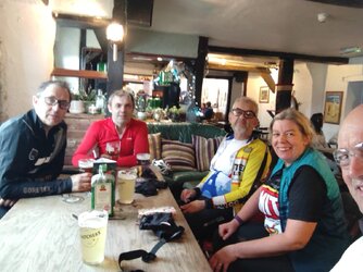
We rode an informal version of the Bampton Breakfast yesterday. I had 20k to ride to the start. Four of us met at Cranbrook, made our way through Exeter and north towards Tiverton. It started raining after a while and the showers came and went during the morning. We got to Bampton and met B, to make five of us. After a good country breakfast in the (new) Old Bakery we came out to to brighter weather. We made a brief detour along the old road at Waterrow, the cast-iron sign-posts hinting at its former importance. The second and final stop was at the Wyndham Arms. Fortified with a couple of pints we headed home, parting ways near Talaton. I clocked 130km for the day, which is reasonable for the time of year, I suppose.
IMG_20231021_123018180_HDR~2.jpg


IMG_20231021_142826750.jpg


IMG_20231021_143342197_HDR.jpg


IMG-20231021-WA0001.jpg

breakfast.JPG
 

cyberknight

As long as I breathe, I attack.
5 of us yesterday headed towards the coffee kabin at twycross which was packed with pesky cyclists with the same idea 😁
Coming back we came closed roads in both directions so we had to detour about 5 miles back on ourselves to get home but not before one brave soul attempted to get through and managed to get about 20 feet before reconsidering
1698085678015.jpeg


1698085711381.png
 

Windle

Über Member
Location
Burnthouses
With almost a whole day free on Sunday and the weather pretty good (we seem to have avoided Storm Babet in the north east) I decided that I needed a bigger than usual trip out. Bike in car and up to Rowley Station picnic area (the station building is now at Beamish) just off the A68 to have a run up the Waskerley Way. I've done this ride before, years ago and it's a cracking route. It was a bit more uphill than I remembered and I had a chilly headwind to start with but soon warmed up, aided by a couple of steep humps where farm access overbridges had been taken out, this one coming in at 15%!.

GOPR0515.JPG
A beautifully scenic, gravely trundle over to Park Head station was duly completed,
GOPR0509.JPG
plus a brief run part way down the other side to where the track of the railway seemed to end, near a house at the top of Crawleyside bank out of Stanhope with an old, faded wooden footpath sign, for I think the Pennine Way.
GOPR0507.JPG
After a brief stop I returned to Park Head station via the road then back onto the Waskerley Way, rolling back down between Waskerley and Smiddy Shaw reservoirs,
GOPR0512.JPG
then past the remaining Waskerley Station building / shed and returned to Rowley.
GOPR0505.JPG
The whole route was busy with cyclists, walkers and a few runners, all seemingly in cheery mood. Heck, even the sheep were grinning (although that could be something more sinister) :ohmy:. I spotted a couple of Red Kites on the way back down too, or possibly the same one following me. After dropping a base layer & unworn full gloves off at the car I set off the other way across Hownsgill viaduct and on into the edge of Consett to get a few more miles in.
GOPR0518.JPG
A chunk of this is properly paved with smooth tarmac, though not exactly well drained, resulting in a slightly wet arse ^_^.
After turning round opposite Morrisons I headed back, taking a brief, muddy single-track detour off into a wood at the side of the path for a pee then headed back to Rowley from the other direction, dodging an errant Stoat that bounded across the path, passing the Terris Novalis sculptures and old iron ore wagon just outside Consett (though not able to get any pictures as they were busy with other folk). A most enjoyable couple of hours and just under 23 miles covered, with nearly a thousand feet of climbing.
 

Windle

Über Member
Location
Burnthouses
Pity they felt the need to provide that extent of fencing - obviously a higher than normal local population of Darwin Award hopefuls

It's anti-suicide fencing, the viaduct being a spot notorious for it in the past. Although the actual cast iron railings were alarmingly low when riding a bike over it. I've ridden it a couple of times before the high fences were put up and it was an arse twitcher :eek:.
 
Top Bottom