Your ride today....

Page may contain affiliate links. Please see terms for details.
Another sunny day, but a bit nippy in the barn this morning (12°C), so a long sleeved jersey is in order. The forecast is for 23°C so a trip to Nieul and straight back - no 'investigating' dead ends today ^_^

Crossed the Vienne at Saint Brice as usual - this is the old Post Office

View attachment 103214

Up the other side of the valley and onto the old Route de Limoges to La Barre where there is this water tower - in French it's a chateau d'eau (as they're usually on top of a hill, it's downhill from here, for a bit at least :rolleyes:)

View attachment 103215

Passed 2 motorcycle Gendarmes parked up having a chat - first time I've seen one for a few weeks :ohmy:

Followed the incredibly straight road from La Barre to Veyrac then Saint Gence. Magically changed into the most curvy road in the area for the last few km to Nieul.

Nieul is a small town with a chateau - which houses a library, an exhibition centre, magistrates court and other bits.

View attachment 103216

There's a very nice park in front with a lake - ideal for a food stop :smile:

View attachment 103217

Took the same road back and found this field of Limousine cows (well, the back half mostly :laugh:)

View attachment 103218

Continued on my reverse route - said 'Bonjour' again to the Gendarmes, who were still there, still chatting :wacko:

Crossed the Vienne again at Saint Brice by the highly originally named 'Pont de Saint Brice-sur-Vienne'

Lots of white bits floating in the river - leaves I suspect.

View attachment 103219

67km in 3 hours :okay:
Stunning photos Alex. Thanks for sharing.
 
Another sunny day, but a bit nippy in the barn this morning (12°C), so a long sleeved jersey is in order. The forecast is for 23°C so a trip to Nieul and straight back - no 'investigating' dead ends today ^_^

Crossed the Vienne at Saint Brice as usual - this is the old Post Office

View attachment 103214

Up the other side of the valley and onto the old Route de Limoges to La Barre where there is this water tower - in French it's a chateau d'eau (as they're usually on top of a hill, it's downhill from here, for a bit at least :rolleyes:)

View attachment 103215

Passed 2 motorcycle Gendarmes parked up having a chat - first time I've seen one for a few weeks :ohmy:

Followed the incredibly straight road from La Barre to Veyrac then Saint Gence. Magically changed into the most curvy road in the area for the last few km to Nieul.

Nieul is a small town with a chateau - which houses a library, an exhibition centre, magistrates court and other bits.

View attachment 103216

There's a very nice park in front with a lake - ideal for a food stop :smile:

View attachment 103217

Took the same road back and found this field of Limousine cows (well, the back half mostly :laugh:)

View attachment 103218

Continued on my reverse route - said 'Bonjour' again to the Gendarmes, who were still there, still chatting :wacko:

Crossed the Vienne again at Saint Brice by the highly originally named 'Pont de Saint Brice-sur-Vienne'

Lots of white bits floating in the river - leaves I suspect.

View attachment 103219

67km in 3 hours :okay:
Great photos!
I miss France *jealous*
 
OP
OP
gbb

gbb

Legendary Member
Location
Peterborough
32 miles, the furthest ive managed I think I two or three years :whistle:.
Pboro, Whittlesea, Coates..off toward March on back roads, decided a road id never used before to..Burnt House ? strange place name, along Cock Bank, a nice looking dyke with all the usual wildlife, to Turves then headed back to Coates then home. The road to Burnt House, mostly single track was actually very good for the fens, very good surface.
1ruth is I feel a bit jiggered tonight, not sure if my fitness is that poor or maybe im coming down with somerhing. Thoroughly nice ride though.
 
Given my new low gear, bicycle winching arrangements (12-36 and a 26T on the front) I thought I'd put them and me to the test.

Took the train to Craven Arms and rode Route 44 to Shrewsbury via Bishops Castle and Minsterley, then up to Wem, and home. Metric Century, or more accurately, 76 miles. Very, very scenic route (apart from the Shrewsbury school run traffic!)

Given that I'm a geologist and know full well that the geological 'grain' of that part of the Blue Remembered Hills runs approximately N-S, a ride 15miles W of Craven Arms was always going to be a bit undulating. The BikeHike profile said it was. And it was.

How is it possible to have 4 mile uphill gradients in Shropshire - or that's what it felt like? My average speed for the first 15 miles was about 9mph!

Once I turned N at Church Stoke I thought all would be well, running along the 'grain'. It was. A bit. But there were still some perverse ups and downs, presumably following 1000 year old tracks and rights of way. And the downs were so narrow, twisty and gravel covered that you could not make up time for fear of an off or meeting a farmer's 4x4 head on. So it was slow going to Pontesbury, where I was able to put away the granny ring until near home and the steep Wych Brook valley.

No caffs at all between Bishops Castle and Shrewsbury (found a sarny in the Co-op in Minsterley) and was dying for tea and cake so stopped at Sleap airfield cafe (I'm a member of the model flying club there). If you have not been, do go. Excellent menu and good value, and you can watch the airplanes come and go.

And now I'm booted and suited and off to the local history society lecture. Not really up for this.....

That's one tough ride from Craven Arms to Shrewsbury. New gearing perfect - never even felt close to a walk. Even on the really steep bits which were 1in5 to 1in7. No photos, sorry - I don't have a camera phone or small camera!
 

mybike

Grumblin at Garmin on the Granny Gear
but I think that one or two of you should perhaps invest in better cameras?

I sometimes use a Canon G15, but the thought of dropping it in the canal means I mostly use a little Vivitar F529
that cost me 99p. And sometimes a grab shot is edited to omit the more boring stuff.
 

Rickshaw Phil

Overconfidentii Vulgaris
Moderator
Given my new low gear, bicycle winching arrangements (12-36 and a 26T on the front) I thought I'd put them and me to the test.

Took the train to Craven Arms and rode Route 44 to Shrewsbury via Bishops Castle and Minsterley, then up to Wem, and home. Metric Century, or more accurately, 76 miles. Very, very scenic route (apart from the Shrewsbury school run traffic!)

Given that I'm a geologist and know full well that the geological 'grain' of that part of the Blue Remembered Hills runs approximately N-S, a ride 15miles W of Craven Arms was always going to be a bit undulating. The BikeHike profile said it was. And it was.

How is it possible to have 4 mile uphill gradients in Shropshire - or that's what it felt like? My average speed for the first 15 miles was about 9mph!

Once I turned N at Church Stoke I thought all would be well, running along the 'grain'. It was. A bit. But there were still some perverse ups and downs, presumably following 1000 year old tracks and rights of way. And the downs were so narrow, twisty and gravel covered that you could not make up time for fear of an off or meeting a farmer's 4x4 head on. So it was slow going to Pontesbury, where I was able to put away the granny ring until near home and the steep Wych Brook valley.

No caffs at all between Bishops Castle and Shrewsbury (found a sarny in the Co-op in Minsterley) and was dying for tea and cake so stopped at Sleap airfield cafe (I'm a member of the model flying club there). If you have not been, do go. Excellent menu and good value, and you can watch the airplanes come and go.

And now I'm booted and suited and off to the local history society lecture. Not really up for this.....

That's one tough ride from Craven Arms to Shrewsbury. New gearing perfect - never even felt close to a walk. Even on the really steep bits which were 1in5 to 1in7. No photos, sorry - I don't have a camera phone or small camera!
Route 44 does seem to take the hilliest possible route without doing any climbs you could actually brag about. It's one I haven't done yet, mainly because of this.:whistle:

As an aside, your useless fact of the day is that Harrison Ford is a member of the Shropshire Aero Club at Sleap: http://www.shropshirestar.com/enter...star-wars-star-harrison-ford-joins-its-ranks/
Harrison would be at an advantage over the other members with him flying the space ship thingy in Star Wars......
 

ColinJ

Puzzle game procrastinator!
S120 is a lovely camera. I wonder though why you didn't go for the Sony RX100? (not meaning to derail the thread).
TBH - it was a bit of an impulse buy. I had a budget of about £200 and just searched for compact cameras which got good reviews and I don't remember reading about the Sony.

I haven't explored its capabilities properly yet. (I'm not a photographer and don't know what I am doing so I leave it on auto most of the time.)
 
Last edited:

Saluki

World class procrastinator
https://www.strava.com/activities/388735049

I didn't get a ride in this morning as feeling fragile but Kenn wanted to go for a ride this evening We got on our bikes, after grabbing lights off the roadies, and away we went. Cake route, up the Marriotts on the CXs. The light was fantastic out there, we watched the setting sun and thought what fun it would be riding back on the trail by bike light.
We got to the cake place at 7.45 and got the last bit of cake in the place, and the last coffee out of the kettle. We were just in time. We are regulars so they said that, if they'd locked up before we finished, to leave the mug in the corner. They'd given us paper plates for the cake.

Once the cake was scoffed and the coffee drunk, we headed off home in the gathering dark. I turned my awesome cateye light on and the Marriotts Way was lit up for all to see. Kenn's light, not so bright but fine to see by. We rode home as fast as we dared, as once under a tree tunnel, it was pitch black. Kenn's light decided that now was a most excellent time to go all dim on him. Fantabulosa! Nevermind, my Cateye was brilliant so we rode, side by side, along the old rail track, chatting as we went. We put Kenn's frog-light (flasher or solid light) on solid for a bit more vision for him and kept a steady 10mph. We got to Ashwellthorpe and noticed that the on/off button of my Cateye had gone red. Thinking that this couldn't be good, we poked it to the 'dip beam' setting to save the battery. We did another mile and it died. USB lights don't go dim. We discovered this tonight. They are bright, bright, bright, turn-off and plunge you in to darkness sort of lights. Joy.
Kenn had a bit of light from his dim battery light, I took his frog and put it on my bike and we put our gears into little ring and pedalled slowly, at about 5mph along the Marriotts. We thought we would head for the Reepham Road at Freelands Corner or turn at Freelands and head to Taverham and then pick up the cyclepaths.
Woodland paths are very dark at night. I just thought that I would mention this. Passing Muntjaks are big and they make you jump when they appear then vanish 3' from your front wheel. Then, this bloke turned up, with proper 2000 lumen Mountain bike lights. We explained our problem with the USB light dying etc and he said, where were we off to, so we told him about the Taverham plan. He was going that way, so we hung on to his tail and rode 3 abreast down the cycleway (I can hear Daily Mail readers hurrumphing from here, even though we were nowhere near a road. Yeah, I know, we don't even pay car tax, blah de blah de blah de blah).

At Freelands, we rode, kind of, two abreast along the road. Kenn tucked up on my back wheel and nice man with mahoosive lights level with my shoulder. At the end of the road, it's cyclepath and pavement all the way home. He went straight on to his hotel (Engineering Contractor) and we headed off towards Drayton on the cycle path. Under the streetlights, our lights were enough to be seen by.

Once at Drayton, we decided to go 'the long way' and not that 2.5 miles up the marriotts in the pitchy pitchness of the tree tunnels. We'd run out of cyclepath mostly, so were naughty and rode on the pavement. We didn't see one single pedestrian at nearly 9pm in the wilds of Drayton/Helleson. Not a one. At Hellesdon, we crossed at the hospital and got back on the pavement and rode all the way down past the ambulance station and to Hellesdon bridge and onto the cyclepaths up the hill to back home.

Only 24 miles but 2 hours 21, which is pretty darned slow. That's what 5mph through the dark does for you. USB light now on charge. Kenn now looking through packed boxes for wherever the heck all those AAA batteries have got too. I think that I'll just buy some tomorrow. Funny thing is, there are spare batteries in the saddlebag on my roadie. I moved over the CO2 but not the batteries. DOH!

Very glad of that sweet and sour quorn thing in the slow cooker, when we got in. We put some rice in the poppety-ping and walked the dogs while it was cooking.

If the engineering contractor from Yorkshire who is working in Norfolk is on here at all, thank you so much for your lights and helping us to the cyclepath. Kenn is on his laptop researching better lights as I type.
 

Lilliburlero

Pro sandbagger
Location
South Derbyshire
I have quite a few holidays to use up so I thought i`d use a few and book the rest of the week off. The plan for today was to get the bus in to town, get my hair cut, have a few beers, come home, eat, nap and do Hicks Lodge (blue mtb trail) later tonight. I waited 30 minutes or more for that bloody bus.... but no show, so I said to myself "sod it, i`m going for a bike ride".

A lovely unplanned 50km http://www.strava.com/activities/388450828
..... with the planned Hicks Lodge night ride thrown in for the heck of it http://www.strava.com/activities/388769145

Today was a good day :highfive:
 

SteveF

Guest
Ventured north out of Buxton today toward New Mills, a 20 mile round trip taking in Whaley Bridge, Furness Vale and Dove Holes... some pretty steep hills in places (for me anyway), a couple of sections hit 16% according to ridewithgps.
Buxton-Furness Vale.png


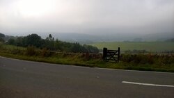
Enjoyed the climb out of town on Long Hill, well until I took the NCR 68 halfway up, which got steeper very quickly and turned into a boulder strewn track... the view back to town before the 68:
WP_20150910_09_13_00_Pro.jpg

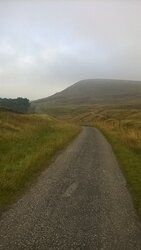
After much up, up, up a chance to do a little down..
WP_20150910_09_22_11_Smart.jpg

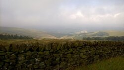
The views opened up even more after a few km and the sun came out, or tried to at least:
WP_20150910_09_24_26_Pro.jpg

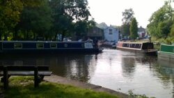
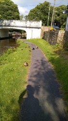
I finally found some flat bits in the Peak District, the canal path along the Goyt Way, the hybrid is a little more nimble and faster that this mode of transport:
WP_20150910_09_44_56_Pro.jpg

Some obstructions on the towpath slowed me a little, damn DUCKS wouldn't give way, no safety equipment and using the tow path when they had a perfectly good canal to use (hmm.. this sounds familiar)
WP_20150910_09_52_34_Pro.jpg

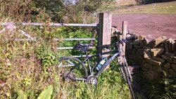
My route planning was perfect, well on cycle.travel and ridewithgps at least, seems that what they think is a road/track actually turns out to be a pretty narrow footpath, still not one to be deterred, obstacles navigated:
WP_20150910_10_04_04_Pro.jpg

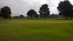
Finally back to Buxton and a little detour on another track that took me through he golf course, quite pleasant:
WP_20150910_11_17_22_Pro.jpg

On the whole very enjoyable, albeit very slow with 747 meters of elevation gain... my poor legs!
 
Top Bottom