EltonFrog
Legendary Member
It’s quite possible that I have got my mojo back, not certain but possible.
This morning, after selling my BSA Tour de France to a nice man from the Vintage Cycle Club, without any procrastination, sodding about, I pumped up my tyres on the Madone , got my gear on and I was on my way.
I set off via Wallingford for the hamlet of Exlade Street to blag a sign for the ABC challenge thread, it was a lovely morning, so I carried on down to Goring (very fast down hill) stopped for coffee and cake and set off home via photo stop at George Michael’s house, the Moulsford, Cholsey for a another photo stop, Aston Clinton , Blewbury then home.
A little over 32 miles and I really enjoyed it.

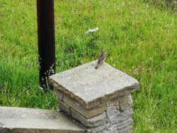
Lovely quiet place this.

Crappy Land Rover spoiling my photo.


Millionaire Shortbread, well you have to really don’t you?

George Micheal’s gaf.


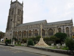
St Mary’s Church Cholsey, Agatha Christie is buried here.

Didcot Cooling Towers in the distance.


This morning, after selling my BSA Tour de France to a nice man from the Vintage Cycle Club, without any procrastination, sodding about, I pumped up my tyres on the Madone , got my gear on and I was on my way.
I set off via Wallingford for the hamlet of Exlade Street to blag a sign for the ABC challenge thread, it was a lovely morning, so I carried on down to Goring (very fast down hill) stopped for coffee and cake and set off home via photo stop at George Michael’s house, the Moulsford, Cholsey for a another photo stop, Aston Clinton , Blewbury then home.
A little over 32 miles and I really enjoyed it.
Lovely quiet place this.
Crappy Land Rover spoiling my photo.
Millionaire Shortbread, well you have to really don’t you?
George Micheal’s gaf.
St Mary’s Church Cholsey, Agatha Christie is buried here.
Didcot Cooling Towers in the distance.


")

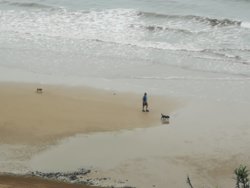
 Kind of unsettling.