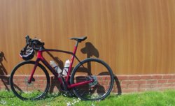
Bike selected; CGR (as I was heading onto 're-cycled' railways)
Weather; sunny, cool, dry, breezy
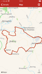
Photographs from today (unless captioned otherwise)
I had decided, I was going to have a ride up to, & along
'The Lines'.... originally built as the
Leeds, Castleford and Pontefract Junction Railway
It essentially runs from Castleford, over the River Aire, under Barnsdale Road (where Ledston Station was), Allerton-Bywater, Kippax, & onto Garforth (I joined it at Allerton-Bywater)
http://www.lostrailwayswestyorkshire.co.uk/Castleford Garforth.htm
The ride down was on the road, down Castleford Road, under the M62 (at jct 31), past the architecturally glorious '
Voysey Row' (
1) & '
Rising Sun', at Whitwood Common
http://www.voysey.gotik-romanik.de/Whitwood Thumbnails/Thumbnails.html
https://www.geograph.org.uk/photo/241087 (part of the Row can be seen in the background)
https://www.geograph.org.uk/photo/1312621 (as it is now, part of the Rising Sun)
https://britishlistedbuildings.co.uk/101313209-the-rising-sun-public-house-altofts-and-whitwood-ward
https://britishlistedbuildings.co.u...errace-altofts-and-whitwood-ward#.XpxR80BFzIU
https://britishlistedbuildings.co.u...l-hall-altofts-and-whitwood-ward#.XpxR_kBFzIU
Carrying on past '
Diggerland' (
2), up to Whitwood roundabout, where the Mining College used to be (now gone, & the area built, with a new 'plastic' College a mile or so east, by the ASDA at Glasshoughton)
https://www.geograph.org.uk/photo/1048167
https://www.geograph.org.uk/photo/1048161
Down through HighTown, into Castleford, crossing the Leeds-Selby line on Albion Street
Past the new Bus Station, & downtowards the River, where the Romans forded the Aire, marked by some very nice tile-friezes

('Cas' was
Lagentvim, to the Romans)
Past a heavily boarded up Castle Motorcycles!! (Honda main-dealer), & the Forum(
3), which simply was a couple of benches where the old men met to 'put the World to rights') - there's a modern bench there now
The vitreous tiles are on the old (closed)
Bridge Hotel
View attachment 516297
Over 'Hartleys Bridge' (of 1808) & onward to Barnsdale Road (
4), to follow the route of the Romans (on their way to Tadcaster (
Calcaria)
https://www.geograph.org.uk/photo/930951
https://britishlistedbuildings.co.u...d-central-and-glasshoughton-ward#.XpxWfEBFzIU
A brief pause, at the site of Ledston Station for photographs (to be added elsewhere), in a 'Then & Now')
A left onto Park Lane at the cross-roads (with the right, heading onto Newton Lane, towards Fairburn, the RSPB visitor centre, & the 'old' A1)
Not far on here, to the back of the 'Millenium Village' I reached the turning onto
'The Lines'
https://www.geograph.org.uk/photo/259633
View attachment 516300
This is one of the sections that run along an embankment, with housing to the south-west (left) & fields to the north-east (previously colliery land)
Bowers Halt is the first notable section, as it had a wooden rudimentary station, with a junction that led to 2 collieries (Lowther & Allerton Main)
Veering off to the left, in this pic
https://www.geograph.org.uk/photo/3283247
View attachment 516302
Carrying on straight ahead, there's an old occupation bridge abutment, with the deck removed
Next is Brigshaw Lane, partially filled in, with the path now passing through a concrete box, with some very good 'street-art' on it (
5), with Brigshaw High School, just to the east
View attachment 516305
Berry Lane Bridge is next, the site of Kippax Station
http://www.leodis.net/display.aspx?resourceIdentifier=2003109_64020938&DISPLAY=FULL
It was where the car-park is
View attachment 516307
Circa 1960, if I recall, from a book I have about this line
View attachment 516321
Leaving Kippax behind, we enter the most picturesque stretch of the line, in a cutting, as we head towards the A63 , built as the
Leeds - Selby TurnPike (
6)
https://www.geograph.org.uk/photo/4831483
View attachment 516313
Looking towards where I am, in the above image;
https://www.geograph.org.uk/photo/2785941
I left the line on NineLands Lane, & headed south, rejoining the A63, turning east to climb 'Garforth Cliff', passing the 'caravan park' (once the site of an isolation hospital..... how poignant at the present time)
Past - what was, and always will be to a lot of people- 'Savills Garden Centre' (that had a 10" gauge railway around it)
Still on the A63, the next site is
Peckfield Bar (
7), turning south, back towards Castleford, past the site of Ledston Luck Colliery, where the magnificent winding house still exists - if a bit battered/unloved
https://www.geograph.org.uk/photo/65357
https://britishlistedbuildings.co.u...ith-garden-wall-and-gate-ledston#.XpxhLUBFzIU
View attachment 516317
Number 2 Winder (in far better condtion)
https://www.geograph.org.uk/photo/661279
https://britishlistedbuildings.co.u...at-ledston-luck-colliery-ledston#.XpxhmUBFzIU
View attachment 516318
Once at the bottom of
Mary Pannall (
8), it was merely a retracing of the tracks back into Castleford, but with a return home from the town centre, via a different route (alongside the River Calder) to Altofts
I hope that some of you enjoyed these words & photographs
Maybe the links/comments below may be of interest too?
1. All 3 are still visited by architecture students, on field-trips
2. Wouldn't you just love to have sat in on the meeting with insurers/H&S, when the idea was mooted for these venues
 3.
3. Latin, for a public meeting place, I believe?
4. This is a continuation of Barnsdale Road, as it leaves the 'Great North Road' (A1) at Barnsdale Bar, to the north of Doncaster
Whilst the Roman route is lost in Pontefract/Castleford, it all meets up again & heads in a straight line northwards
5. This will appear in the 'Street Art' thread, with a link here;
https://www.cyclechat.net/threads/street-art.221565/post-5962323
6. As evidenced by a milepost, opposite the junction with NineLands Lane (bottom of 'Garforth Cliff' & by the
Crusader pub)
https://www.cyclechat.net/threads/t...her-interesting-geographs.215788/post-5962331
7. Where the A63/Leeds - Selby TurnPike, intersects with Barnsdale Road (that I left at Allerton-Bywater)
8. Woodland adjacent to Barnsdale Road, is linked to all sorts of stories about the eponymous woman
http://www.castleford.org/history/cas017.html
https://allerton-bywater-online.webs.com/marypanel.htm