You are using an out of date browser. It may not display this or other websites correctly.
You should upgrade or use an alternative browser.
You should upgrade or use an alternative browser.
Your ride today....
- Thread starter gbb
- Start date
Page may contain affiliate links. Please see terms for details.
Reynard
Guru
- Location
- Cambridgeshire, UK
Today's ride was a 6 mile round trip at tea time to the bit of hedgerow with the hazelnut bushes.
The result of my afternoon's excursion - a whole carrier bag of nuts. That's more than I thought. Am a happy bunny.
The result of my afternoon's excursion - a whole carrier bag of nuts. That's more than I thought. Am a happy bunny.
Stonechat
Guru
- Location
- Staines, Middlesex
Family meal yesterday so ride rescheduled for today.
Originally aimed to go to the Surrey hills, but it was very wet this morning, didn't fancy some of those small lanes with water running down, so did some hill repeats on the local hills.
Went up Prune Hill, saw the first sign warning of roadworks, Bakeham Lane being closed, fortunately this was not going to affect my route, being to the left of the junction with Prune Hill.
3 repeats of Prune Hill followed, then went down the A30 in order to do Tite Hill, and there was a traffic light system round roadworks. So went up Tite and Down Middle Hill, but lots of the venhicles associated with the roadworks were parked there, so after the second ascent moved over to Priest Hill. On the first ascent, saw some mtb'ers ahead, so felt honour bound to pass them and race to the top (did a pb).
After the second did two ascents of Crimp Hill.
So 27 miles done with 1742 feet climbed, speed only 14.0 but that was a lot of climbing per mile
https://www.strava.com/activities/1144466480
Late Edit
This was on the Kona Roadhouse
Also just missed roadworks on Crimp Hill, which start Weds
Last edited:
Elybazza61
Guru
Some nice rides this past week-end.
Friday was an off-(main)road sojourn via Wickenwith the better half to have a search for some fruits of the land.
https://www.strava.com/activities/1139721477
Ship of the fens;

Goodies and XLS

Swan on the Cam at Upware

Booty

Beer and chips!

Saturday was an EDCC club ride with a bit extra for a Strava fondo,nice brisk pace on the run back from Earth to Haddenham too.
https://www.strava.com/activities/1141081122
Nice to catch up with some of the guys and gals and a good turnout meant a take-over of the River Terrace cafe in St Ives

Yesterday was a return run out along the river to get some more Sloes for the Gin and Vodka.
Good week-ends riding.
Friday was an off-(main)road sojourn via Wickenwith the better half to have a search for some fruits of the land.
https://www.strava.com/activities/1139721477
Ship of the fens;
Goodies and XLS
Swan on the Cam at Upware
Booty
Beer and chips!
Saturday was an EDCC club ride with a bit extra for a Strava fondo,nice brisk pace on the run back from Earth to Haddenham too.
https://www.strava.com/activities/1141081122
Nice to catch up with some of the guys and gals and a good turnout meant a take-over of the River Terrace cafe in St Ives
Yesterday was a return run out along the river to get some more Sloes for the Gin and Vodka.
Good week-ends riding.
Richard A Thackeray
Legendary Member
Bike selected; CGR (what!, again?)
Weather; overcast, warm, very slight breeze
All photographs taken today, unless captioned otherwise
Not a lot of time today, as I had a 'hot-date', when I returned home................ with a, block-paved, two-car driveway that need de-mossing
Out, past the recently re-modelled 'PineApple Inn', from pub to quite a nice house, with wonderful views
Over Black Road, normally referred to locally (wrongly) as 'Heath Common Road'
As an aside, there is also a Green Lane, & Red Lane, in very close proximity (both are now bridleways, but Green Lane, was possibly a 'corpse road', to Kirkthorpe Church)
Dropping down to the junction with Doncaster Road, we encounter the usual scrum of traffic, as the new Eastern Relief Road, still sees drivers utilising its slip-road to try & gain places for the single-lane working under the two railway bridges, towards Wakefield
Past the now demolished SuperBowl, once the famous Wakefield Theatre Club, & the rugbyists stadium (Wakefield Trinity)
Traffic is at a standstill at Chantry Bridge, as there's quite substantial (& to be long-lasting) roadworks the other side of the railway bridge
As I always do, I turn & look at the lovely 14th century Bridge Chapel
Not Todays Photographs
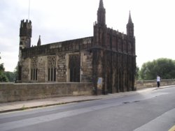
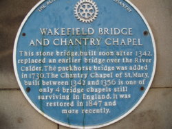
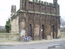
Ings Road, brings more traffic, as it has such attractions to the shoppers, as Sainsburys, & the B&M store
(apparently, the first purpose planned 'bypass' in the country, as a way of allowing drovers/carts to avoid the town, & clogging up its 'Gates; ( Act Of Parliament consent obtained in 1831)
At the far end, where StoneHouses Mill used to be (now PC World/Wickes DIY), it was back onto Lower WestGate, with a quick look at the lovely cruck-framed building on the opposite side (number 166 WestGate), & the (founded in 1826, to treat Cholera) 'House of Recovery'
Not Todays Photographs
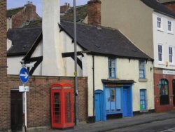
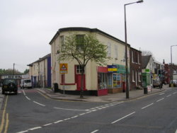
Round St Michaels Church, and onto Dewsbury Road, passing the B*W, Mini & VW dealers.(all where Craven Fawcett was - they produced brick making machinery)
Once at Roundwood, after a constant 'drag' from Wakefield, I turned off, to drop down Queens Drive (before reaching jct40/M1)
At the far end, it was a right turn into Ossett
From here, I was just ;looking for a signpost, as I was going to have a ride along the 'Ossett -Dewsbury Greenway'
http://www.wakefield.gov.uk/Documents/sports-leisure/cycling-walking/ossett-dewsbury-greenway.pdf
One was spotted, but it didn't seem too easily seen, & a U-turn had to be made onto West Wells
Oddly it has a 'Cyclists Dismount' sign at the end, even though it's partially cobbled/stone-slabbed/tarmacked, there's still sufficient room
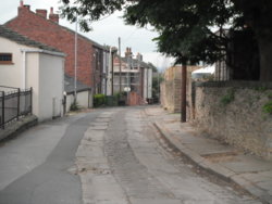
Near the bottom, there was a gate, & steady ride, if surprisingly (& pleasingly!!!) busy pathway, with lots of walkers; dog-walkers/mums with pushchairs/OAPs
This essentially covers the entire route; http://www.lostrailwayswestyorkshire.co.uk/Dewsbury Loop.htm
http://www.wakefield.gov.uk/Documents/sports-leisure/cycling-walking/ossett-dewsbury-greenway.pdf
At the spot where Earlsheaton Station was, a couple of other pathways joined, then it was into the Tunnel
A steady drip came from the roof, on a sunny day, it'd be nice & cool in there, but it could do with better lighting, quite frankly!!
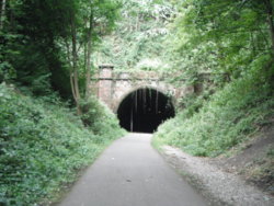
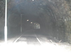
Through the tunnel, shortly it was a view of the old string-girder, over the River Calder, & a divert over it, for a look
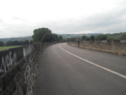
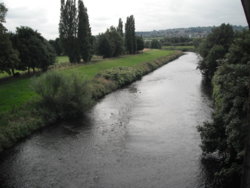
A short ride brought me into Dewsbury, then through Savilletown, towards Thornhill Lees, & the short climb, up to the Coombs (a marvellous twisty stretch of road, with a pub called 'The Alma' - a better road, in the opposite direction!!!)
The Huddersfield Road, was rejoined at Horbury Bridge, opposite the location of the old Toll-House (removed in the 1960s, I think??), & rebuilt in a garden, up in Netherton
Roadworks, by the railway bridge, & old location of (the closed 1970) Horbury & Ossett Station (but, the subway is still there!!)
Back via Horbury, to photograph an old Toll-house, & the 'Hall' (now it can be seen, with foliage removed)
Then, into Wakefield Park, to view the medieval frontage of the Chantry Chapel that is on display there
The 'date'??
All raked out, & looking far better!!!
One more day off, where to, tomorrow???
Weather; overcast, warm, very slight breeze
All photographs taken today, unless captioned otherwise
Not a lot of time today, as I had a 'hot-date', when I returned home................ with a, block-paved, two-car driveway that need de-mossing

Out, past the recently re-modelled 'PineApple Inn', from pub to quite a nice house, with wonderful views
Over Black Road, normally referred to locally (wrongly) as 'Heath Common Road'
As an aside, there is also a Green Lane, & Red Lane, in very close proximity (both are now bridleways, but Green Lane, was possibly a 'corpse road', to Kirkthorpe Church)
Dropping down to the junction with Doncaster Road, we encounter the usual scrum of traffic, as the new Eastern Relief Road, still sees drivers utilising its slip-road to try & gain places for the single-lane working under the two railway bridges, towards Wakefield
Past the now demolished SuperBowl, once the famous Wakefield Theatre Club, & the rugbyists stadium (Wakefield Trinity)
Traffic is at a standstill at Chantry Bridge, as there's quite substantial (& to be long-lasting) roadworks the other side of the railway bridge
As I always do, I turn & look at the lovely 14th century Bridge Chapel
Not Todays Photographs


Ings Road, brings more traffic, as it has such attractions to the shoppers, as Sainsburys, & the B&M store
(apparently, the first purpose planned 'bypass' in the country, as a way of allowing drovers/carts to avoid the town, & clogging up its 'Gates; ( Act Of Parliament consent obtained in 1831)
At the far end, where StoneHouses Mill used to be (now PC World/Wickes DIY), it was back onto Lower WestGate, with a quick look at the lovely cruck-framed building on the opposite side (number 166 WestGate), & the (founded in 1826, to treat Cholera) 'House of Recovery'
Not Todays Photographs


Round St Michaels Church, and onto Dewsbury Road, passing the B*W, Mini & VW dealers.(all where Craven Fawcett was - they produced brick making machinery)
Once at Roundwood, after a constant 'drag' from Wakefield, I turned off, to drop down Queens Drive (before reaching jct40/M1)
At the far end, it was a right turn into Ossett
From here, I was just ;looking for a signpost, as I was going to have a ride along the 'Ossett -Dewsbury Greenway'
http://www.wakefield.gov.uk/Documents/sports-leisure/cycling-walking/ossett-dewsbury-greenway.pdf
One was spotted, but it didn't seem too easily seen, & a U-turn had to be made onto West Wells
Oddly it has a 'Cyclists Dismount' sign at the end, even though it's partially cobbled/stone-slabbed/tarmacked, there's still sufficient room

Near the bottom, there was a gate, & steady ride, if surprisingly (& pleasingly!!!) busy pathway, with lots of walkers; dog-walkers/mums with pushchairs/OAPs
This essentially covers the entire route; http://www.lostrailwayswestyorkshire.co.uk/Dewsbury Loop.htm
http://www.wakefield.gov.uk/Documents/sports-leisure/cycling-walking/ossett-dewsbury-greenway.pdf
At the spot where Earlsheaton Station was, a couple of other pathways joined, then it was into the Tunnel
A steady drip came from the roof, on a sunny day, it'd be nice & cool in there, but it could do with better lighting, quite frankly!!


Through the tunnel, shortly it was a view of the old string-girder, over the River Calder, & a divert over it, for a look


A short ride brought me into Dewsbury, then through Savilletown, towards Thornhill Lees, & the short climb, up to the Coombs (a marvellous twisty stretch of road, with a pub called 'The Alma' - a better road, in the opposite direction!!!)
The Huddersfield Road, was rejoined at Horbury Bridge, opposite the location of the old Toll-House (removed in the 1960s, I think??), & rebuilt in a garden, up in Netherton
Roadworks, by the railway bridge, & old location of (the closed 1970) Horbury & Ossett Station (but, the subway is still there!!)
Back via Horbury, to photograph an old Toll-house, & the 'Hall' (now it can be seen, with foliage removed)
Then, into Wakefield Park, to view the medieval frontage of the Chantry Chapel that is on display there
The 'date'??
All raked out, & looking far better!!!
One more day off, where to, tomorrow???
Last edited:
Supersuperleeds
Legendary Member
- Location
- Leicester
Well that was lucky ( or unlucky ,) just gone to put the bike away after an 80 miler and the back tyres flat as pancake . Small bit of glass discovered ,much easier to change in the shed ( bike workshop) than at the side of the road
I'd have sat and watch you change it at the side of the road

Richard A Thackeray
Legendary Member
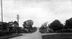
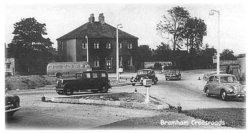
@Old jonhead south on Paradise Way, to the accompaniment of the traffic noise on the rather busy A 1(M), trundle around the roundabout and take the turn for Aberford. It all now becomes predictable, through the village to Cock Beck and turn right.
I take it, that you've seen the cottages at the end, that certainly were there, when it was a 'Cross-Roads'?
The map link should show a 1909 view; http://maps.nls.uk/geo/explore/#zoom=16&lat=53.8565&lon=-1.3434&layers=6&b=1
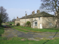
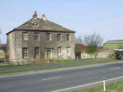
1912 'crosss-roads'
1950s roundabout
2005 (my old 110, creeping out of shot)
@Elybazza61Nice to catch up with some of the guys and gals and a good turnout meant a take-over of the River Terrace cafe in St Ives
View attachment 369308
Eerily co-incidental, that I mention the Bridge Chapel in Wakefield, & you have a photograph of the one in Cambridgeshire
There's another, of the 4, in South Yorkshire, at Rotherham
Last edited:
Gravity Aided
Legendary Member
- Location
- Land of Lincoln
About 93%, quite anticlimactic. I would have had to go to my old Alma mater for totality.Will there be an eclipse up your end today then?
Ian H
Ancient randonneur
- On Sunday, having volunteered to help S check her new event, I set off from home sometime after 7am to meet R and her at the proposed start. On the way I saw a balloon.
It was cold to start with as we rolled through Exeter, noting variations from the planned track. Pretty soon we were past Crediton and on our way to Winkleigh, where D&S Hardware run a cafe as a sideline.
When we emerged, having breakfasted, it was raining.
Our next destination was North Molton via South Molton, along the Taw and Mole valleys. The road began to climb toward N Molton. We had a brief stop for discussion, then onwards.
The road went up for 4km to the top of the moor, then descended to a village with water running across the tarmac in streams. Another climb took us to a crossroads and on to the Exe Valley road, where we did a zig and a zag.
To say the acutely angled turn with a steep gradient sweeping out of sight round the corner of a hill was unpromising might be an understatement. Still, it was on the prepared route, so we had to try it.
The lane levelled off just around the corner—relief. Then came another sharp bend and up it went again, straight into the distance. R and S decided to walk; I rode up, out of the saddle on a 27" gear. S was beginning to get disheartened by the slowness of pace. And, when it wasn't raining, it was pouring down.
Then the tarmac was level again, and we wound through a small valley at a good pace. Eventually we emerged at Williton where the local Spar shop was also a cafe. So we refuelled.
The rain had eased somewhat as we tackled the A39 around the northern edge of the Quantocks. There was a little too much holiday traffic for comfort.
Then came the ascent to Dead Woman's Ditch. R had gone ahead, and when I reached the top he was nowhere in sight. I waited for S in the drizzle and mist.
We descended relatively cautiously and hit another section of main road. Well over halfway now, but the rain resumed.
Turning off towards Evelyn Waugh's old country seat we found R sheltering so that he could recharge his Garmin, its connections having failed the extreme weather test. On we went along sandy lanes to cross the old Barnstaple road, through old towns and villages. The M5 roared behind Sampford Moor, the noise enhanced by the rain.
The rain eased again as we plodded on through villages and towns to the old A38. Through the tatty high street of Cullompton, and on to the old ten mile time-trial course at Budlake. Nearly home.
Through more damp lanes towards the finish. S said the level-crossing had been closed but should be clear again by now. It wasn't, and the barriers that were no a serious barrier to pedestrians or cyclists had been supplemented with a high security fence. So it took a 3 mile detour via a muddy lane to reach the pub.
We finished at 2200. S was totally spent, R said he too was tired, I wondered what state my feet were in after a day's marinading in dirty rainwater.
We had some alcohol to celebrate, then parted company for home. I had a 15km journey, with the obligatory big hill, to reach my house. That made 246km for the day, most of it in heavy rain.
Here's the ride.
Last edited:
@Old jon
I take it, that you've seen the cottages at the end, that certainly were there, when it was a 'Cross-Roads'?
Hmmm, in 1963 a ( very much older ) club member pointed out the cottages and told me their name.
I never managed to take my guitar out there for the lessons from the best . . .
- Location
- Shrewsbury, Shropshire
After a few days off the bike for various reasons I got out with Doug for a ride to up his mileage a bit. He wanted to do around 35 miles so I had just the route in mind, some of which would be new to him.
We started off heading up Lyth Hill and along the rough track to the top before dropping down on the Exfords Green side and heading for Plealey, Pontesbury and Minsterley.
It was quite warm and humid out today and the clouds looked more threatening than I'd expected from the forecast so a waterproof was stuffed into my bag just in case. We got on quite well and made good progress in the still air.
At Pontesbury we were onto the new cycle path to Minsterley, then turned right after the corned beef factory to head through Horsebridge and on the way to Westbury. This is a good bit of road that you can get up some speed on in places, which we did.
At Westbury the good pace continued through Halfway house and on to Prince's Oak. (Had "single file!" shouted at us from a passing car on the way. )
)
We paused at the Church in Melverley then moved on past The Royal Hill and paused again in a gateway just outside Pentre for our packed lunch. Unfortunately, this didn't sit well on Doug's stomach so he struggled a bit when we moved on again. That combined with a couple of short sharp climbs near Great Ness, then again at Montford Bridge conspired to slow us down.
We had an annoying close pass at Bicton. It's a wide straight road and the only vehicle coming the other way was far in the distance so he could have given room. We'd just overtaken a cyclist who was on the pavement so I wonder whether it was a punishment pass to tell us we should have been on there too?
We got slower and made a couple more drink stops but carried on. Near Meole Brace we did overtake another cyclist and I tried my usual "are you going far?" gambit but it was wasted as the chap was Italian and spoke very little English. We managed to lead him astray slightly as he thought we were headed into Shrewsbury and he followed us away from the town for a little while. I think I managed to give the right directions for the town centre - he was certainly heading the right way when we last saw him.
A fraction under 34 miles for the day at 12.2 mph average. Slower than Doug wanted due to him feeling iffy but not a disaster by any means.
Photography was a bit of an afterthought today but here are a few snaps:

Looking moody from the top of Lyth Hill.

Ready to move on.

Melverley Church

A quick stop for refreshment by the church.

An unusual accolade.

One that didn't come out quite as hoped. Looking back along the flat straight road near Pentre.
We started off heading up Lyth Hill and along the rough track to the top before dropping down on the Exfords Green side and heading for Plealey, Pontesbury and Minsterley.
It was quite warm and humid out today and the clouds looked more threatening than I'd expected from the forecast so a waterproof was stuffed into my bag just in case. We got on quite well and made good progress in the still air.
At Pontesbury we were onto the new cycle path to Minsterley, then turned right after the corned beef factory to head through Horsebridge and on the way to Westbury. This is a good bit of road that you can get up some speed on in places, which we did.
At Westbury the good pace continued through Halfway house and on to Prince's Oak. (Had "single file!" shouted at us from a passing car on the way.
 )
)We paused at the Church in Melverley then moved on past The Royal Hill and paused again in a gateway just outside Pentre for our packed lunch. Unfortunately, this didn't sit well on Doug's stomach so he struggled a bit when we moved on again. That combined with a couple of short sharp climbs near Great Ness, then again at Montford Bridge conspired to slow us down.
We had an annoying close pass at Bicton. It's a wide straight road and the only vehicle coming the other way was far in the distance so he could have given room. We'd just overtaken a cyclist who was on the pavement so I wonder whether it was a punishment pass to tell us we should have been on there too?

We got slower and made a couple more drink stops but carried on. Near Meole Brace we did overtake another cyclist and I tried my usual "are you going far?" gambit but it was wasted as the chap was Italian and spoke very little English. We managed to lead him astray slightly as he thought we were headed into Shrewsbury and he followed us away from the town for a little while. I think I managed to give the right directions for the town centre - he was certainly heading the right way when we last saw him.

A fraction under 34 miles for the day at 12.2 mph average. Slower than Doug wanted due to him feeling iffy but not a disaster by any means.
Photography was a bit of an afterthought today but here are a few snaps:
Looking moody from the top of Lyth Hill.
Ready to move on.
Melverley Church
A quick stop for refreshment by the church.
An unusual accolade.
One that didn't come out quite as hoped. Looking back along the flat straight road near Pentre.
Last edited:
gavgav
Legendary Member
A short ride, after work, to keep the legs loose, ready for what I hope will be a long ride over the Bank Holiday Weekend, if the weather plays ball!
It's been muggy but cloudy and quite oppressive today, and the wind was quite odd, alternating between virtually non existent at times to then be quite gusty, suddenly, from nowhere.
Headed through Meole Brace, up to Nobold and then Radbrook, Copthorne, Porthill, leading me down into the Quarry. It was quite busy through the park and became a bit of a slalom course once joining the narrower towpath, where the world and his wife seemed to be walking on the section as far as the railway bridge.
It thinned out as I reached Castlefields and joined the road. Continued through Monkmoor and past the Police Station, joining some suburban lanes I hadn't ridden on before, getting slightly lost! Ended up back mostly where I wanted to be, heading down the cycle paths to Reabrook.
The final route home was along the old railway paths, where I encountered 2 teenagers who struggled to muster a brain cell between them, walking down the middle and therefore in both the cycle lane and walking lane. They turned and saw me about 50 yards away, then as I reached them acted all surprised when they stumbled fully into the cycle path, messing around, as I came up behind them. There was a mostly incomprehensible grunted apology (in teenage language).
12.2 miles at 12.8 mph
It's been muggy but cloudy and quite oppressive today, and the wind was quite odd, alternating between virtually non existent at times to then be quite gusty, suddenly, from nowhere.
Headed through Meole Brace, up to Nobold and then Radbrook, Copthorne, Porthill, leading me down into the Quarry. It was quite busy through the park and became a bit of a slalom course once joining the narrower towpath, where the world and his wife seemed to be walking on the section as far as the railway bridge.
It thinned out as I reached Castlefields and joined the road. Continued through Monkmoor and past the Police Station, joining some suburban lanes I hadn't ridden on before, getting slightly lost! Ended up back mostly where I wanted to be, heading down the cycle paths to Reabrook.
The final route home was along the old railway paths, where I encountered 2 teenagers who struggled to muster a brain cell between them, walking down the middle and therefore in both the cycle lane and walking lane. They turned and saw me about 50 yards away, then as I reached them acted all surprised when they stumbled fully into the cycle path, messing around, as I came up behind them. There was a mostly incomprehensible grunted apology (in teenage language).

12.2 miles at 12.8 mph
welsh dragon
Thanks but no thanks. I think I'll pass.
A short ride, after work, to keep the legs loose, ready for what I hope will be a long ride over the Bank Holiday Weekend, if the weather plays ball!
It's been muggy but cloudy and quite oppressive today, and the wind was quite odd, alternating between virtually non existent at times to then be quite gusty, suddenly, from nowhere.
Headed through Meole Brace, up to Nobold and then Radbrook, Copthorne, Porthill, leading me down into the Quarry. It was quite busy through the park and became a bit of a slalom course once joining the narrower towpath, where the world and his wife seemed to be walking on the section as far as the railway bridge.
It thinned out as I reached Castlefields and joined the road. Continued through Monkmoor and past the Police Station, joining some suburban lanes I hadn't ridden on before, getting slightly lost! Ended up back mostly where I wanted to be, heading down the cycle paths to Reabrook.
The final route home was along the old railway paths, where I encountered 2 teenagers who struggled to muster a brain cell between them, walking down the middle and therefore in both the cycle lane and walking lane. They turned and saw me about 50 yards away, then as I reached them acted all surprised when they stumbled fully into the cycle path, messing around, as I came up behind them. There was a mostly incomprehensible grunted apology (in teenage language).
12.2 miles at 12.8 mph
Your lucky you got a grunt.

gavgav
Legendary Member
It may have been windYour lucky you got a grunt.

Richard A Thackeray
Legendary Member
Bike selected; CGR
Rain was threatening, & it has mudguards (not got the Gran Fondo wet yet)
Weather; overcast, warm, humid, slight breeze
All photographs taken today, unless captioned otherwise
A brief ride, more of an 'Out, Look & Back'
Through Old Snydale, with a grunt of surprise that at 'one up, two down' barn conversion has been sold (£200,000 plus, for something not much bigger than a double garage!)
Into Featherstone, then Purston
Over to Ackworth, past the ever impressive Ackworth Hall (Jacobean era)
Supposedy, once in the private estate of James 1st, & has various Priest Holes
We know the owners
Not Taken Today
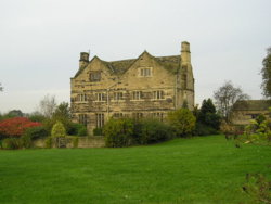
http://www.britishlistedbuildings.c...ed-garden-wall-to-front-ackworth#.WZyV5YWcHIU
Past Ackworth House, supposedly built with money won by prize-fighting!!
By a man, who later became an MP!!
Now split into three, we know 2 of the families
Daughter went to school with children of 1/3rd, I run with the couple in another 1/3rd
http://www.geograph.org.uk/photo/2102769
http://www.britishlistedbuildings.co.uk/101313256-ackworth-house-ackworth#.WZyUxIWcHIU
Down past the lovely old Quaker School, sadly not to be visited any more (founded 1779),as daughter left, for 6th form college
http://www.geograph.org.uk/photo/5377599
Not Taken Today
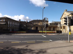
http://www.ackworthschool.com/about/history/
Past Carr Bridge Pavilion, where we meet twice a week (& where I've been earlier this evening)
Up to the Beverly Arms roundabout (where we transfer from the Pontefract - Barnsley road, to the Wakefield - Doncaster road)
Up the hill, to the Badsworth turn off (where there's a ROC/Civil Defence station buried n the field, with an excellent view over the area, for damage to industry around Pontefract/Knottingley, & the 3 big Power Stations)
http://www.geograph.org.uk/photo/228211
After passing a gate-lodge, that was renovated, & now seemingly overgrown, I start mixing a bit, with the big traffic now, as trucks head to/from the industrial estates around South Elmsall, road take the road to Barnsdale Bar, to join the northbound A1, or my direction for the A1 south
Lodge seen here, in better days; http://www.geograph.org.uk/photo/249376
A few miles further on, I drop through the S-bend, into Hampole, & for once disregard the signs to the south-east for Hooton Pagnall
Those who know the village, will probably agree with me, as to what a visual treat it is
I turn off into Hampole village, just after the Manor House, & the 'Doctors House' (some may know its history, if not, read this (& maybe the blue-link, in the '28 Days' article)
https://www.28dayslater.co.uk/ivy-farm-manor-the-doctors-house-hampole-april-2014.t88959
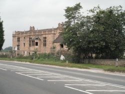
Next it was a shot diversion down Leys Lane, which comes out onto the northbound A1, next to the Little Chef, at Skellow
A brief walk over the footbridge, saw me in Skellow, with my objectives almost in sight
This bridge (not the concrete one!!), but the one carrying the 'GNR' is known as 'Humber Head Bridge' (the railway bridge, also bears the name, on its 'Strike' plate
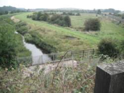
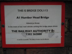
I can't really see it being considered the source of the Humber, so I presume it's a corruption of some other phrase/name around the area??
It's named as such, on the 1900's OS map
If you open this link, preferably on a desk-top, or lap-top, you can see it, & the other reason for my journey
Scroll the blue-dot, & you can overlay modern aerial views
http://maps.nls.uk/geo/explore/#zoom=15&lat=53.5824&lon=-1.2169&layers=10&b=1
As I ride over the bridge, not on the A1!!, the path heads downhill
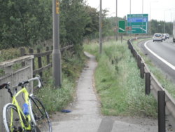
At the bottom, I find...............
Cats-eyes, as this was the southbound corner of the 'GNR' as it headed towards Doncaster
(Open the 'maps NLS' link above, again!)
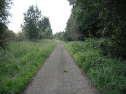
A bit of a poke about didn't reveal any hidden kerbs, or other road markings, but I guess after so many years, they're well-buried?
At the top is RedHouse, once a Coaching establishment, now a farm, it was the northbound carriage, on its side of the road
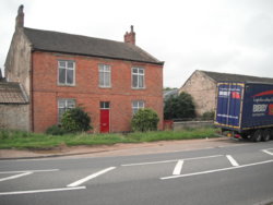
Riding back was slightly easier, with a touch of a tailwind
I took a slightly different route, from Ackworth though, & headed along the Wakefield Road, where there's still reminders too
This plate, at the top of Dicky Sykes Lane
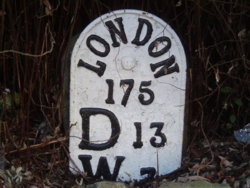
And, the old Bar-House, at Wragby, before the roundabout
http://www.geograph.org.uk/photo/2250225
Nostell Priory is passed, where we ParkRun, & my wife had her office until recently
Then over the bridge, that conceals a weir/lip under it, to keep the lakes at different heights
What the cyclist/runner/driver sees; http://www.geograph.org.uk/photo/2617155
Just about visible, under the bridge; http://www.geograph.org.uk/photo/1608563
http://www.britishlistedbuildings.co.uk/101252808-nostell-bridge-huntwick-with-foulby-and-nostell
A few hundred yards further up, is the area/hamlet known as Foulby, it was here that John Harrison was born/lived
Nostell Priory has one of his earliest clocks
http://www.geograph.org.uk/photo/2250154
http://www.atlasobscura.com/places/john-harrisons-marine-chronometers
A brief journey today, but LOTS of history encountered
Rain was threatening, & it has mudguards (not got the Gran Fondo wet yet)
Weather; overcast, warm, humid, slight breeze
All photographs taken today, unless captioned otherwise
A brief ride, more of an 'Out, Look & Back'
Through Old Snydale, with a grunt of surprise that at 'one up, two down' barn conversion has been sold (£200,000 plus, for something not much bigger than a double garage!)
Into Featherstone, then Purston
Over to Ackworth, past the ever impressive Ackworth Hall (Jacobean era)
Supposedy, once in the private estate of James 1st, & has various Priest Holes
We know the owners
Not Taken Today

http://www.britishlistedbuildings.c...ed-garden-wall-to-front-ackworth#.WZyV5YWcHIU
Past Ackworth House, supposedly built with money won by prize-fighting!!
By a man, who later became an MP!!
Now split into three, we know 2 of the families
Daughter went to school with children of 1/3rd, I run with the couple in another 1/3rd
http://www.geograph.org.uk/photo/2102769
http://www.britishlistedbuildings.co.uk/101313256-ackworth-house-ackworth#.WZyUxIWcHIU
Down past the lovely old Quaker School, sadly not to be visited any more (founded 1779),as daughter left, for 6th form college
http://www.geograph.org.uk/photo/5377599
Not Taken Today

http://www.ackworthschool.com/about/history/
Past Carr Bridge Pavilion, where we meet twice a week (& where I've been earlier this evening)
Up to the Beverly Arms roundabout (where we transfer from the Pontefract - Barnsley road, to the Wakefield - Doncaster road)
Up the hill, to the Badsworth turn off (where there's a ROC/Civil Defence station buried n the field, with an excellent view over the area, for damage to industry around Pontefract/Knottingley, & the 3 big Power Stations)
http://www.geograph.org.uk/photo/228211
After passing a gate-lodge, that was renovated, & now seemingly overgrown, I start mixing a bit, with the big traffic now, as trucks head to/from the industrial estates around South Elmsall, road take the road to Barnsdale Bar, to join the northbound A1, or my direction for the A1 south
Lodge seen here, in better days; http://www.geograph.org.uk/photo/249376
A few miles further on, I drop through the S-bend, into Hampole, & for once disregard the signs to the south-east for Hooton Pagnall
Those who know the village, will probably agree with me, as to what a visual treat it is

I turn off into Hampole village, just after the Manor House, & the 'Doctors House' (some may know its history, if not, read this (& maybe the blue-link, in the '28 Days' article)
https://www.28dayslater.co.uk/ivy-farm-manor-the-doctors-house-hampole-april-2014.t88959

Next it was a shot diversion down Leys Lane, which comes out onto the northbound A1, next to the Little Chef, at Skellow
A brief walk over the footbridge, saw me in Skellow, with my objectives almost in sight
This bridge (not the concrete one!!), but the one carrying the 'GNR' is known as 'Humber Head Bridge' (the railway bridge, also bears the name, on its 'Strike' plate


I can't really see it being considered the source of the Humber, so I presume it's a corruption of some other phrase/name around the area??
It's named as such, on the 1900's OS map
If you open this link, preferably on a desk-top, or lap-top, you can see it, & the other reason for my journey
Scroll the blue-dot, & you can overlay modern aerial views
http://maps.nls.uk/geo/explore/#zoom=15&lat=53.5824&lon=-1.2169&layers=10&b=1
As I ride over the bridge, not on the A1!!, the path heads downhill

At the bottom, I find...............
Cats-eyes, as this was the southbound corner of the 'GNR' as it headed towards Doncaster
(Open the 'maps NLS' link above, again!)

A bit of a poke about didn't reveal any hidden kerbs, or other road markings, but I guess after so many years, they're well-buried?
At the top is RedHouse, once a Coaching establishment, now a farm, it was the northbound carriage, on its side of the road

Riding back was slightly easier, with a touch of a tailwind
I took a slightly different route, from Ackworth though, & headed along the Wakefield Road, where there's still reminders too
This plate, at the top of Dicky Sykes Lane

And, the old Bar-House, at Wragby, before the roundabout
http://www.geograph.org.uk/photo/2250225
Nostell Priory is passed, where we ParkRun, & my wife had her office until recently
Then over the bridge, that conceals a weir/lip under it, to keep the lakes at different heights
What the cyclist/runner/driver sees; http://www.geograph.org.uk/photo/2617155
Just about visible, under the bridge; http://www.geograph.org.uk/photo/1608563
http://www.britishlistedbuildings.co.uk/101252808-nostell-bridge-huntwick-with-foulby-and-nostell
A few hundred yards further up, is the area/hamlet known as Foulby, it was here that John Harrison was born/lived
Nostell Priory has one of his earliest clocks
http://www.geograph.org.uk/photo/2250154
http://www.atlasobscura.com/places/john-harrisons-marine-chronometers
A brief journey today, but LOTS of history encountered
Last edited:
