21/6/26
Recumbent Ride
Midsummer’s Day Ride on the Rans.
After my last ride I took my own advice and set off early.
My intention was to do what I set out to do last time but failed due to timing.
So, out of the back gate on the Rans at 09:40 to head for Nantwich via Darnhall-Wettenhall-Cholmondeston. A slight headwind but certainly not as strong as last time, so I made better time.
A few cyclists about, it being Sunday.
Steady trundling through Nantwich on to the Audlem road, down the dip at Hatherton to grind up the other side. Levelling off and rolling at a better speed through the village before turning left on to Park Road. Despite less of a headwind, this road still looked as if it was downhill despite having to ride it in low gear.
Left at the next crossroads to stop at Dagfields craft and antiques centre for a swift leak break. Then out to turn left on Lodge Lane, left again on Hunsterson Road, and after a bit of up and down and weaving about through some woods which were teeming with squirrels, left at a T junction. Illogically, according to the map the left turn to Bridgmere is a continuation of Hunsterson Road, while the right turn, not to Bridgemere, is Bridgemere Lane. Despite it being gradually uphill it seemed easier today without that strong headwind which there was when I rode it a few days ago.
I reached the turning on the right down Dingle Lane to Bridgemere ford, passed the Road Closed sign and the cones
and wheeled the bike on to the raised walkway. There seemed to be less water today, and it looked clearer. I reached the other side and rode up the hill. A few hundred yards further on there was a Mercedes saloon car parked slap bang in the middle of the narrow lane, not to one side as you might expect. I wheeled the bike past on the verge and carried on. I’d established on my previous ride that this lane runs parallel to the A51 for a few miles before coming out opposite Bridgemere Garden Centre.
However, once rolling in the direction of Woore on the A51 something that I hadn’t established became apparent. After riding round a bend in the road a quite steep climb for about a mile hemmed in by steep hedgebanks appeared. There was nowhere to turn in to let the following traffic get by until I was nearly in Woore so they all had to follow me at 4-5mph. I wondered if the A525 to Audlem had any similar stretches. Even this one leading to Woore didn’t stand out on the map. There is a similar, shorter bit of road not far from where I live. I’m OK riding it in a downhill direction but I choose an alternative route to return on.
I’d intended to photograph the Shropshire boundary sign outside Woore but I’d had other things on my mind just then.
Woore is a pretty village despite the traffic and runs into the next one of Irelands Cross as a continuation. The road crosses into Staffordshire before the next village of Pipe Gate but if I turned for Knighton before leaving Irelands Cross the boundary would be closer and it would get me off the A51.
As I approached the junction cars persistently overtook me even though I was rolling downhill at a good speed. I was considering turning round further on then coming back to turn when one such overtook me at the junction itself and the inevitable happened as a car turned left from the junction on the right and they ended up stopped bumper to bumper blocking traffic. I took the opportunity to stick my arm out and turn off. So many seemingly angry drivers in a hurry. Someone let off a long beep behind me as I headed for Knighton and I wondered if an irate driver might appear in my mirror (‘cos it’s always the cyclist’s fault, isn’t it) but nothing appeared.
I arrived at Knighton in need of a break so I got off the road at a disused railway bridge and had a snack and a drink. The cutting on one side had been turned into a children’s play area with signs stating firearms prohibited. I wonder what led to that? Unauthorised rabbit shooting? The track looked as if it went to Irelands Cross. The bridge itself had been reinforced with extra brick pillars. The cutting on the other side had been filled in and was now part of a farmer’s field. I meant to take a photo but was distracted by working out an alternative route to Audlem.
I sat on a well manicured bank by the path to the cutting and after finishing my refreshments had a look at my map. I could see that there were no alternative routes to Audlem but the A 525. I could retrace my route back to Dingle Lane downhill on the A51, back through Bridgemere ford, along Hunsterson Road, Bridgemere Lane, then turn left on the A529 to reach Audlem from the North. It was about the same distance, on known quieter roads and mostly downhill to boot. Even though I prefer to do a circular ride, in this instance backtracking seemed the better option.
As the day was warming up I took off my gilet, zipped it up and slipped it over the seat back.
I got my things together and got back on the road. I photographed the Staffordshire and Shropshire boundary signs
and got going to Irelands Cross. I arrived at the A51, turned left and rode up the fairly gentle gradient towards Woore. Once in Woore the gradient steepened but was still manageable. I passed the turning on the left for the Audlem road. A couple of cyclists turned into it. Should I go too? A tractor came to the junction, filling it so I carried straight on. The tractors seemed to be switching to reeking slurry tankers instead of the hay wagons today.
I reached the top of the hill and eased off pedalling. It really was some hill, and my speed rapidly increased. The Cheshire boundary sign flashed past with no chance of photographing it. Further on the slope eased but I was still freewheeling when I reached Dingle Lane. There hadn’t been much traffic in this direction and not a vehicle had overtaken me. Nevertheless, it seems that regardless of the time of day, the A51 experience is pretty unpleasant.
I gratefully turned left into Dingle Lane and alternatively freewheeled and pedalled easily until I got near to the ford. The Mercedes had gone, but I noticed that someone had put a couple of extra traffic cones at the approach to the ford from this direction. I managed to avoid getting stung this time by nettles but as earlier, there were some black flies hovering about which buzzed loudly and I had a feeling that I’d got a couple of bites on my elbows.
As I climbed up towards Hunsterson Road a dog started barking in one of the gardens nearby and it set off others in the vicinity. None came out on the road but I was still relieved to turn left at the end of the lane and get going back the way I’d come.
This time it was going to be a straight run until I reached a T junction with a major road so no likelihood of getting lost. Although there were a couple of uphill stretches it was going to be a few miles of mostly downhill or easy pedalling.
Soon I was at an acute T junction with the A529 getting speed up down a dip before coming into Hankelow. Up the other side, on the level then down another dip before climbing back up to come into Audlem.
By the time I got to the centre of the village at a T junction with the A525 it was lunch time so I was looking round for somewhere to pick up something to eat.
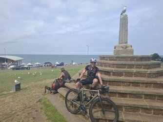
After picking up something from a local shop I sat on one of the benches under a shady canopy in front of the Parish Church of St James the Great. The day was heating up, and the shade was welcome.
Passers by were very polite in this well kept Cheshire village compared with the vibe on the Shropshire/Staffs border. I’d taken a trundle through the streets in the direction of Woore just to absorb some of the atmosphere and when I turned back a driver stopped and flashed me to go ahead. I’ve got used to this kind of thing in the area where I live but I suspect it’s not the experience of the majority of cyclists around the country.
I packed up my things and after a look at my map set off west on the A525.
After crossing the canal bridge I went left on the A529 Market Drayton road, Green Lane, then steeply downhill for a quarter of a mile before the road levelled out and reared up again for another quarter of a mile. It was steeper than I remembered from coming this way several years ago. I’d wanted to take a photo of the tall narrow old railway bridge over Mill Lane, which leads from the summit of this road to the A 525.
I reached the summit and turned right into Mill Lane. It’s very narrow and straight, and as there was a car coming in the far distance I pulled in to a gateway. Once they passed I let off the brakes and zoomed downhill cooling off nicely after the previous climb. The road widened out at the bottom with some houses on the right. Then came the bridge.
The line from Wellington to Nantwich via Market Drayton once ran here, joining the existing Crewe to Shrewsbury line at Nantwich. There’s a lot of railway infrastructure around here, bridge abutments, old cuttings and embankments as the terrain is far from flat. I took some photos then pressed on to the A 525.
There are some roadworks going on at the moment and I had to wait at the junction until traffic cleared when the lights changed. Then left up a short hill, after half a mile right into Coole Lane.
A quarter of a mile later, left into what I hoped was Coole Back Lane, with warnings about loose chippings, resurfacing and whatnot. I didn’t come across any of those hazards, just the occasional vehicle but it was becoming increasingly hot.
The countryside was slightly rolling and very green. Quite enjoyable riding apart from the heat.
I came to a T junction and followed the sign for Aston to the right. Cycling through the picturesque village, I came to the A 530 and was flashed to cross by an oncoming motorist Looks like he just wanted me to go so he could turn in.
Onward, following signs to Wrenbury. Mysteriously, there was a sign with no placename but an arrow saying cyclists only, to the right. Perhaps it leads to a great pit full of cyclists, wheels, arms, legs everywhere.
I followed the signs to Wrenbury, passing the station and was soon on the main road through the village. I stopped in the shade at a bench opposite the primary school for a drink before carrying on through the village.
I came to the Llangollen canal with Road Closed signs beyond. I decided to carry on as being a Sunday it was probable that there wasn’t any work going on. For the first few miles there were plenty of holes in the road with barriers to them but nothing to stop anyone getting through.
I carried on in the direction of the A49 and Cholmondeley. There was very little traffic even after I came to the end of the Road Closed section and after a few uphills I came to the A49. Straight across into the woodland surrounding Cholmondeley Castle. There were many huge old scots pines casting shade and the sound of the wind in the tops was very relaxing. I was on NCN 45 now and the occasional cyclist went past.
I passed signs and entrances for Cholmondeley Castle before continuing in the direction of Bickerton. It was 4 O’clock now and I was considering whether to turn back soon. It had clouded over, so the sun was less intense. I decided to press on to Harthill and see what the time was by then.
There were more downhills than I remembered (which would be uphills on the way back). I swept downhill into Bickerton and turned right at a T junction. I was soon at a crossroads on the A534 and went across in a gap in the traffic on to Long Lane. Slightly uphill to start with, then a gentle downhill to a T junction at Harthill Lane to turn right to start the steep climb up to Harthill. Interesting to compare this bike with previous recumbent bikes. The Linear with a 20” front wheel and neutral underseat steering was definitely more steady on a slow uphill like this but this bike had no trouble in getting up there. It needed a bit more concentration, and a bit more road, but it got up there without any great difficulty.
As I came up to the crest the dour shape of the mausoleum in the churchyard of All Saints’ Church appeared, then the rest of the church. I wondered how it must be to live a life in the knowledge that a family mausoleum with a ledge pre booked for you awaits. Breathing heavily, I looked at the air vent on the wall, and considered that the occupants had long given up on their need for air. It was a bit unsettling. I leaned the bike against the churchyard wall and took some photos.
Should I turn round and go back the way I’d come? It was just before 5pm. I knew there was a steep fast downhill if I carried on, then another climb at Oakhurst Farm before the long downhill to Tattenhall. The route via Huxley and Tiverton would actually be shorter than back tracking via Wrenbury and Nantwich.
So, on I went. I didn’t need to turn a pedal as the bike rolled forward and gathered speed on Bolesworth Road. As I came to the next climb at Oakhurst Farm I went over the top with the same relative ease as at Harthill and started the freewheel to Tattenhall. The miles to Tattenhall soon disappeared as I turned right to the centre then right again to the Chester-Huxley road. After a short hill, left alongside a park to stop at a bench under a tree while I drank some water.
On what felt like the home stretch now, I got going again towards Chester. Leaving Tattenhall, I crossed the bridge across a railway line then the Shropshire Union canal. It was mostly downhill from here to the uphill turn off towards Huxley. I had a glimpse of Beeston Castle across the fields to the right with the hot air giving the illusion that it was not far away but by the time I saw it next there were trees in the way so I didn’t take a photo. There were roadworks and traffic lights at the top of the hill in Huxley but I got through before turning right.
For some reason today’s ride between Huxley and Tiverton seemed easier than usual despite being the same uphill road. Steady rolling brought me to the sign for Tiverton and Brassey Green and not long afterwards the downhill to the A49. After a brief break I followed a path uphill alongside the A49 under some shady trees to hop on to the road at the traffic lights at Four Lane Ends.
The A49 goes left at the lights and the lane to Eaton goes straight on. Rolling at the green light to get up speed to tackle the first of three climbs. Plodding over the top, then as the road dipped gaining speed to rush the next climb. Slow rolling to the top of the next one then fairly level to get some speed up, downhill then rushing the next one. This was steep but then eased off to a more gradual slope into Eaton. Increasing speed into Eaton, round a sharp right hander then a right turn down a steep hill on Hickhurst Lane to get up some speed as I went out of Eaton and up another peak before relaxing to enjoy several miles of freewheeling and easy pedalling after the last few miles of effort. Hickhurst Lane continues for several miles. Left at a T junction with Winsford Road, in to Darnhall with its traffic lit bridge and steep climb out. A steady trundle for a few miles through the lanes before arriving at my back gate.
Counties visited -Shropshire, Staffordshire (started in Cheshire). A bit more time, a few more miles, could have included Flintshire. Perhaps next time, Flintshire and Merseyside. After the recent mechanical tweaks, a smooth and stress free ride.
Distance 63.4 miles. Max Speed 32.0 mph. Average Speed 7.8 mph. According to Cateye Velo 7
Ascent 1862 ft. According to Bikehike. A bit less Ascent might have given a higher Average, perhaps.


 .
.