gavgav
Legendary Member
Winter weather has meant walking for the last few days, on my Annual Leave, but a thaw overnight enabled a ride out with Doug, today.
Much milder than recently and only a fairly gentle South Westerly breeze, which I was cycling into as far as the meet up point. We headed up Lyth Hill, where the car park was quite busy with people having a walk.
View towards the Stretton Hills

We had a very short section on the A49, which was still long enough for 2 unnecessary close passes from vans....before enjoying the wind assisted downhill run into Condover. From there we climbed up to Wheathall and along the sandy lane, to the bottom of Ryton. Hardly ever see a soul along there, but today saw 7 people walking and 1 runner.
The road to Longnor was a muddy and wet mess, but at least the 1 flood had just about parted in the middle, to save any danger of getting wet feet. From Longnor we enjoyed the wind behind us to Frodesley, but had to negotiate roadworks on what appears to be a collapsing bridge over the brook! They’ve just created a ramp of tarmac, for now, to presumably attempt to strengthen it, but the “weak structure” sign suggests that will be a full scale replacement needed at some stage soon.
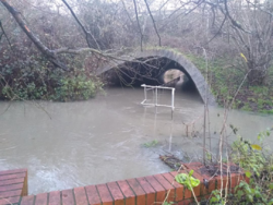
The downhill sections to Acton Burnell and Pitchford were good, but the fast section into the dip was tempered by a flood at the bottom. We then climbed up to Cantlop, before enjoying the mostly downhill section to Betton Abbots and parted ways by my estate.
20.4 miles at a leisurely 11.2mph avg and good to catch up with Doug.
Much milder than recently and only a fairly gentle South Westerly breeze, which I was cycling into as far as the meet up point. We headed up Lyth Hill, where the car park was quite busy with people having a walk.
View towards the Stretton Hills
We had a very short section on the A49, which was still long enough for 2 unnecessary close passes from vans....before enjoying the wind assisted downhill run into Condover. From there we climbed up to Wheathall and along the sandy lane, to the bottom of Ryton. Hardly ever see a soul along there, but today saw 7 people walking and 1 runner.
The road to Longnor was a muddy and wet mess, but at least the 1 flood had just about parted in the middle, to save any danger of getting wet feet. From Longnor we enjoyed the wind behind us to Frodesley, but had to negotiate roadworks on what appears to be a collapsing bridge over the brook! They’ve just created a ramp of tarmac, for now, to presumably attempt to strengthen it, but the “weak structure” sign suggests that will be a full scale replacement needed at some stage soon.
The downhill sections to Acton Burnell and Pitchford were good, but the fast section into the dip was tempered by a flood at the bottom. We then climbed up to Cantlop, before enjoying the mostly downhill section to Betton Abbots and parted ways by my estate.
20.4 miles at a leisurely 11.2mph avg and good to catch up with Doug.


 and a choice of getting very wet feet or falling off. I chose the wet feet option, walking the bike to the verge and then wading through a mixture of water and mud until I got to the other end.
 . Not fancying another soaking, I turned left and hoped the bigger Withington to Upton Magna road would be better, which it was, with just 1 smaller flood to negotiate.
 ) so I took the chance to get out. Just the regular Longnor-Acton Burnell-Harnage-Cross Houses route so not imaginative but it does allow for easy racking up of miles.
 Turning past Concord College there was another flood on the way to Cound Moor. I got through it alright but got more water into the boots. At least I haven't completely dunked them as I've done in the past.